Escalation in North-West Syria: Civilian Areas Hit in Renewed Attacks
With all eyes turned towards events in Israel and Gaza over the past two months, a significant escalation in the long running conflict in Syria has failed to gain front-page attention.
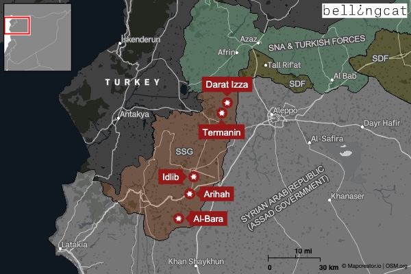
More than 15 cities, towns and villages across North-West Syria — including in Idlib province, known as the last rebel stronghold — have been targeted with shelling.
Bellingcat analysed footage and images of recent shelling and identified the use of incendiary weapons, cluster munitions and Grad rockets in close proximity or directly impacting civilian infrastructure including mosques, schools and camps for Internally Displaced Persons (IDPs).
Since the initial four day period, further shelling has been carried out across the country by different groups, leading UN official Paulo Pinheiro to describe it as: “the largest escalation of hostilities in Syria in four years.”
What Happened?
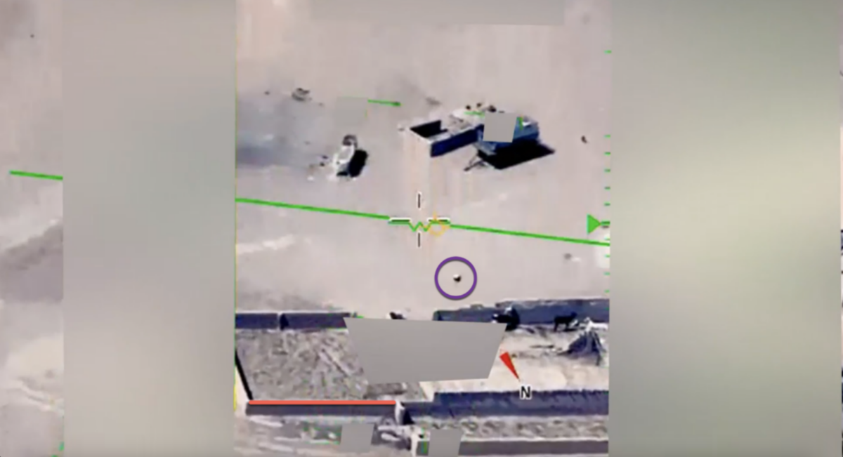
The initial shelling was reportedly carried out in response to a drone strike on a Syrian government military academy in Homs on October 5 that killed at least 80 people.
On October 5 at around noon local time, a drone attack struck a graduation ceremony at the Homs Military Academy, here: 34.752382, 36.687726.
No group immediately claimed responsibility for the attack. Syria’s Defence Minister reportedly attended the graduation but left minutes before the attack.
Syria’s defence ministry stated that it would respond “with full force” to the attack. Later the same day the government forces carried out heavy bombing of opposition-held areas in North-West Syria.
The shelling of Idlib province and the countryside of Aleppo continued for several consecutive days.
Despite media reports that shelling in North-West Syria was a response to the attack on the military academy, we couldn’t independently verify who was responsible for the shelling outlined below.
Use of Incendiary Weapons in Darat Izza
Between October 6 and October 7, videos emerged on social media showing incendiary weapons and other artillery alongside claims it was being dropped on Darat Izza, a town located about 25km west of Aleppo.
Bellingcat’s preliminary analysis suggests that 122mm 9M22S Grad Rockets were used to shell the town of Darat Izza in early October.
The earliest footage we found was posted on X (formerly Twitter) at 9:10 pm local time on October 6, alongside the claim that artillery strikes were taking place in Darat Izza, Termanin and Towama.
While earlier posts mentioned artillery fire, later posts showed explosions near the ground accompanied by a rain of flares, likely activated after the impact of rockets, as seen in the gif below.
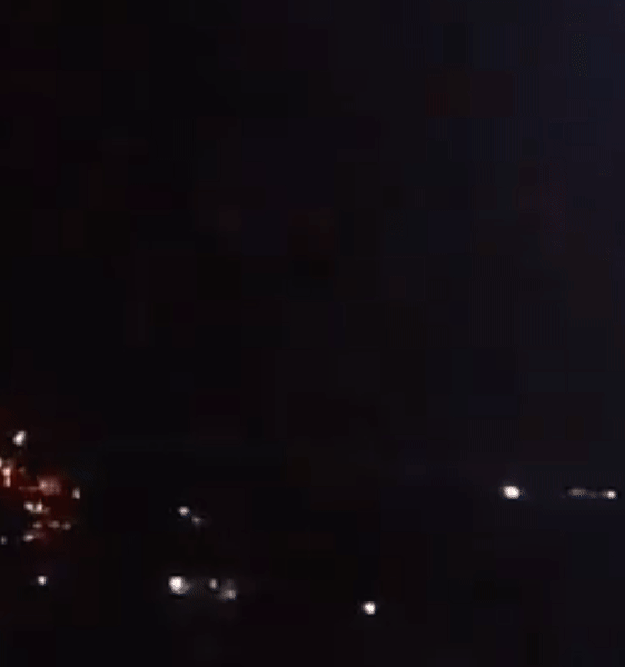
The series of videos from October 6 were filmed at night. With no further information on the location, we looked at the urban landscape features revealed by the explosions’ flashes and cross referenced them with other open source information to match it to Darat Izza.
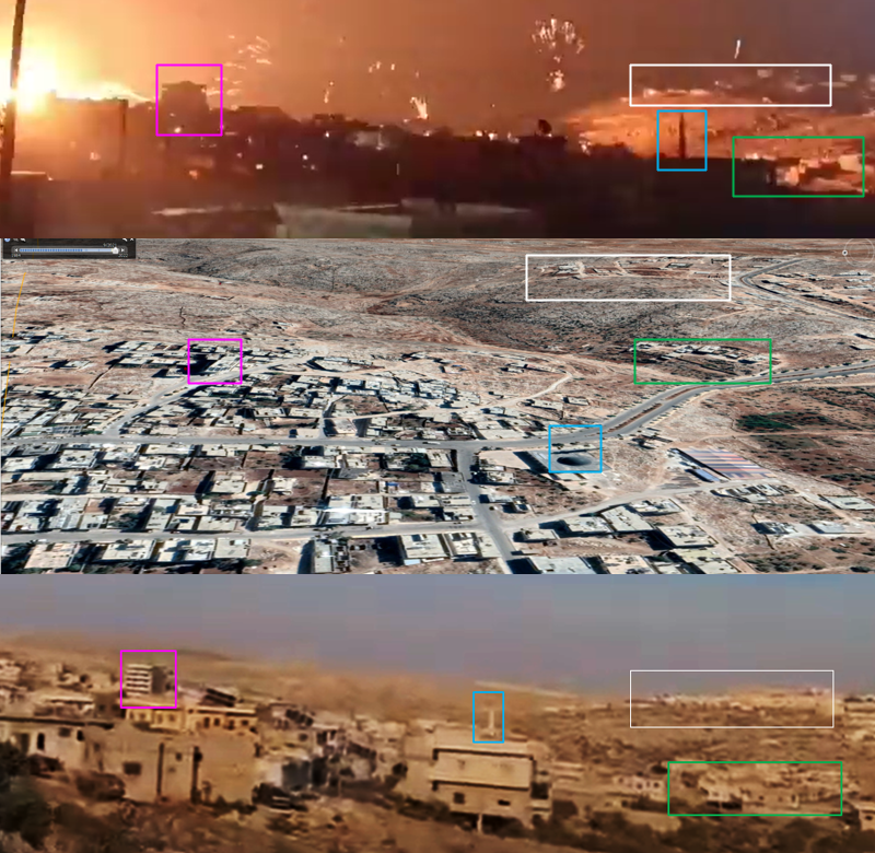
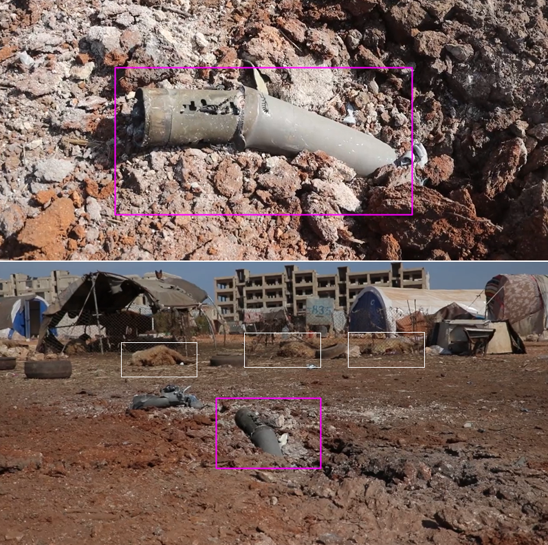
Based on the approximate location of explosions and flares seen in the videos, we determined that the respective cameras were pointing towards southwest Darat Izza and that the explosions likely took place in a valley located in a sector in proximity to an IDP camp, here: 36.280114, 36.861183 (we’ll return to this location later). By October 8, rocket remnants and damage to civilian infrastructure was also reported in that area by The White Helmets — a volunteer civil defence and humanitarian organisation operating in Syria.
The White Helmets said that 9M22S Grad rockets were used in Darat Izza during the early October attack and claimed the rockets were packed with ML-5 submunitions filled with thermite mixture – a flammable material designed to cause fires. We analysed footage captured by The White Helmets after the early October shelling, showing remnants of a possible 9M22S Grad Rocket here, 36.274441, 36.855304.
The Unusual Features of the Incendiary Weapon
Human Rights Watch describes incendiary weapons as weapons that contain flammable substances that ignite, they can be dropped from the air or fired from the ground in rockets or artillery shells. Incendiary weapons often start fires and can inflict severe injuries.
The use of incendiary weapons in Syria has been well documented. Typically, an incendiary weapon explodes in the air and then thermite submunitions are dispersed downwards, falling like rain over a particular area. You can see an example of this here:
However, in the early October attack on Darat Izza not all the explosions seem to occur in the air. Additionally, the incendiary elements seem to be projected upwards.
Here’s a reminder of how it looked:
We spoke to Petro Pyatakov, a retired colonel of the Armed Forces of Ukraine and former Deputy Head of the Faculty of Missile Forces and Artillery of the Academy of Ground Forces who told us: explosions, followed by a hail of flares – as seen in the footage from Darat Izza – is consistent with incendiary weapons. He added that the explosions observed on October 6 could be caused by the explosion of a 122mm 9M22S Grad rocket either in the air or upon impacting the surface — depending on how the rocket was set to detonate before it was launched.
There seems to be limited footage or other examples from Syria showing weapons projecting incendiary elements upwards after the point of explosion. Further analysis is needed to identify the exact type of weapon and incendiary elements used in Darat Izza on October 6.
Additional Evidence from Darat Izza
North-West Syria is already home to more than two million IDPs and at least 120,000 more were displaced in the October shelling according to the UN Office for Coordination of Humanitarian Affairs.
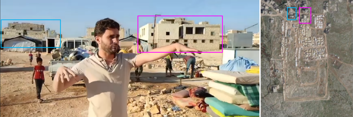
On October 7 – the day after footage of incendiary weapons was posted online and we geolocated it near an IDP camp in Darat Izza- Abdulkafi Alhamdo, a teacher, activist and reporter, posted a video on Facebook reporting a “burning and cluster bomb” attack had taken place near an IDP camp in Darat Izza. We located the impacted IDP camp where Alhamdo was filming to the same place we had geolocated the night before, at these coordinates: 36.280114, 36.861183. According to Alhamdo, although the attack did not cause damage to the camp, it did force the IDPs to leave the camp in fear.
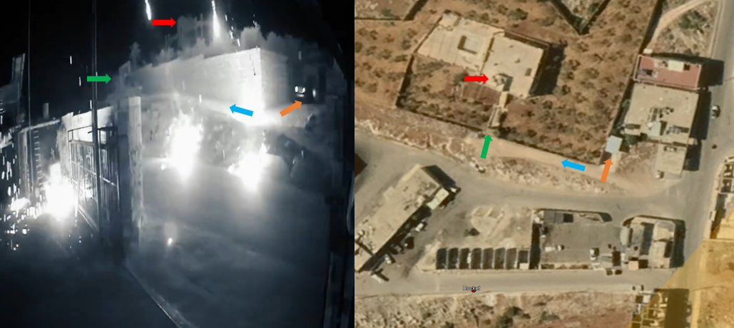
Separately, CCTV footage posted by The White Helmets allegedly filmed the night of October 7, showed what appear to be incendiary flares scattered on the roofs of houses. We geolocated these houses to a sector in the south of Darat Izza at coordinates: 36.274918, 36.851466.
This humanitarian organisation also posted a drone video on October 8 showing damage to buildings and vehicles in Darat Izza. The video also features at least two munition remnants encrusted in the road, here: 36.274441, 36.855304 and here: 36.274934, 36.852089. At least one ordinance appears to be consistent with a 9М22S Grad rocket, mentioned above but further analysis is required to confirm this.
For comparison, here is another example of a 9M22S Grad rocket, from Ukraine.
We located residential areas including a mosque, a school and the IDP camp within a 1,000 metre radius to the rocket remnant.
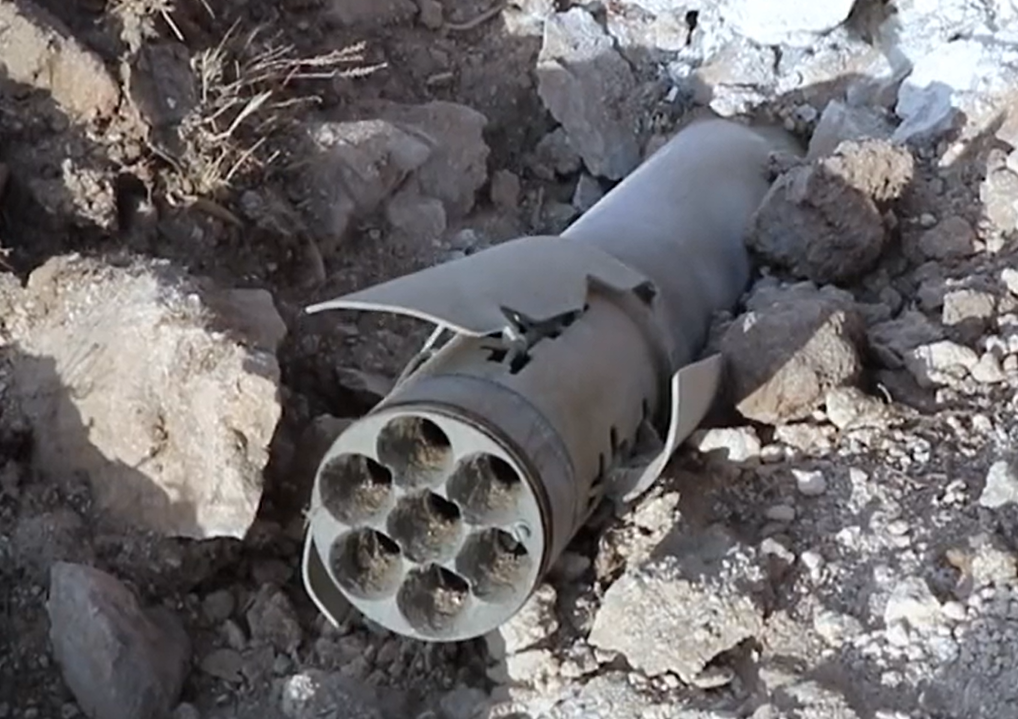
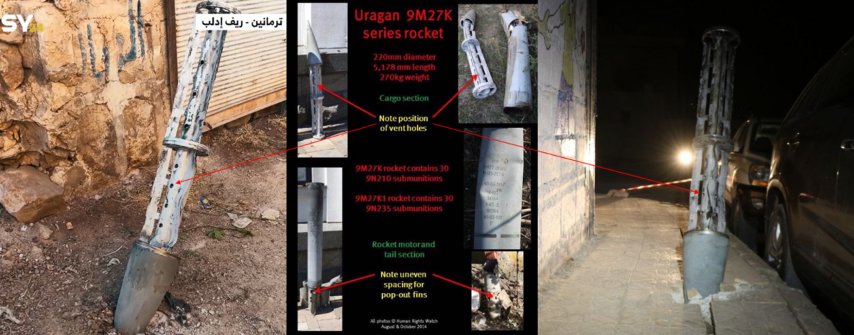
Use of Cluster Munitions in Termanin
Based on Bellingcat’s analysis it appears that several different kinds of weapons, including at least two cluster munitions, hit the small town of Termanin – located 30km due west of Aleppo- over a period of a few days in early October.
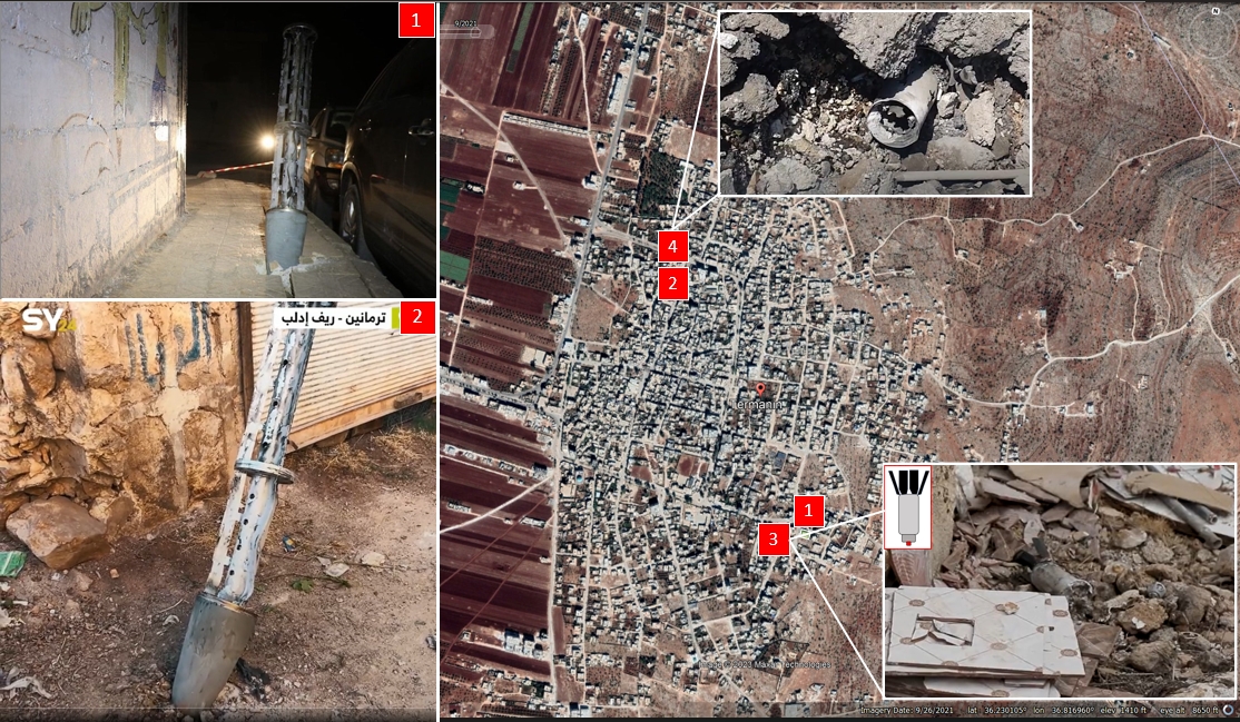
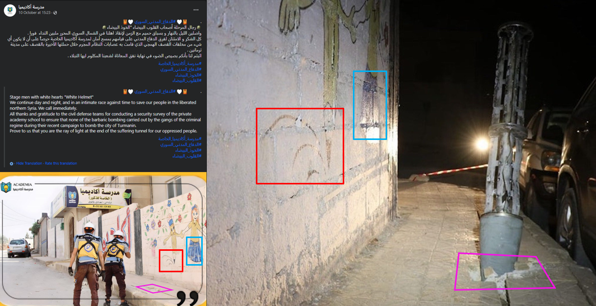
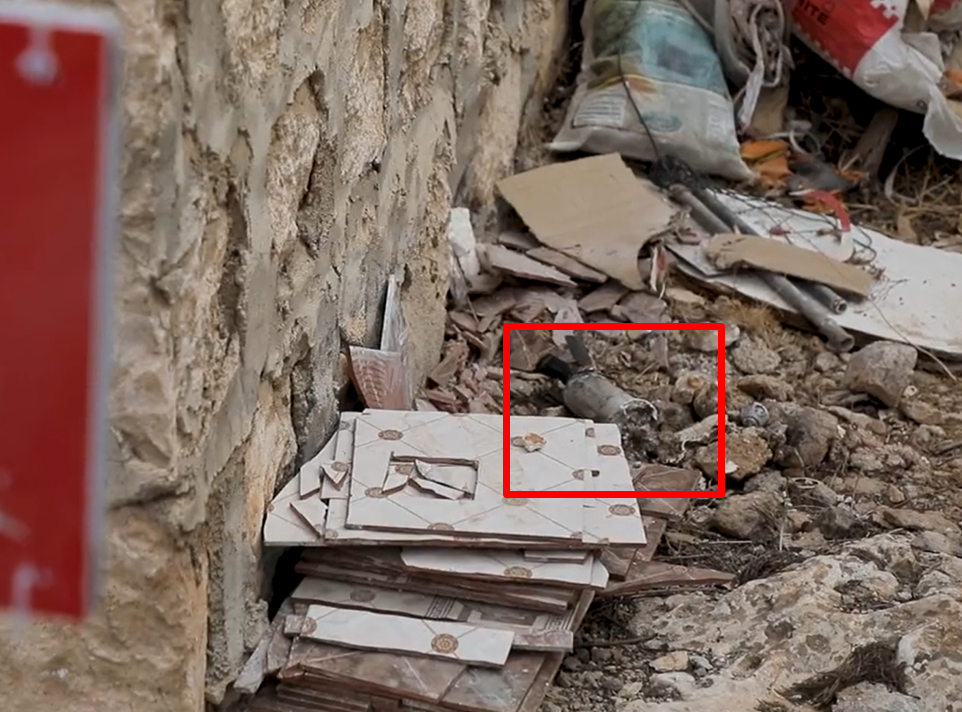
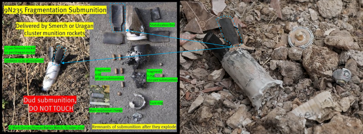
We geolocated an image of a 9M27K cluster munition cargo section posted on X next to a school in the town of Termanin at coordinates 36.226206, 36.818707. In addition to the cluster munition cargo section, we also identified and geolocated an 9N235 submunition within a 100 metre radius of the same school at 36.226054, 36.818162.
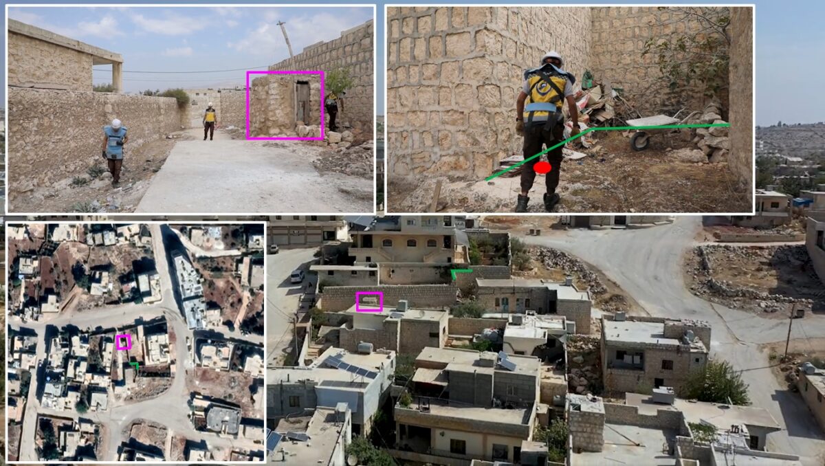
The image of the 9N235 submunition seen in the White Helmets’ video appears to be consistent with the reference tool provided by Mark Hiznay, Associate Arms Director at Human Rights Watch (HRW) and corresponds to 9N235 submunition which can be delivered by Uragan or Smerch cluster rockets.
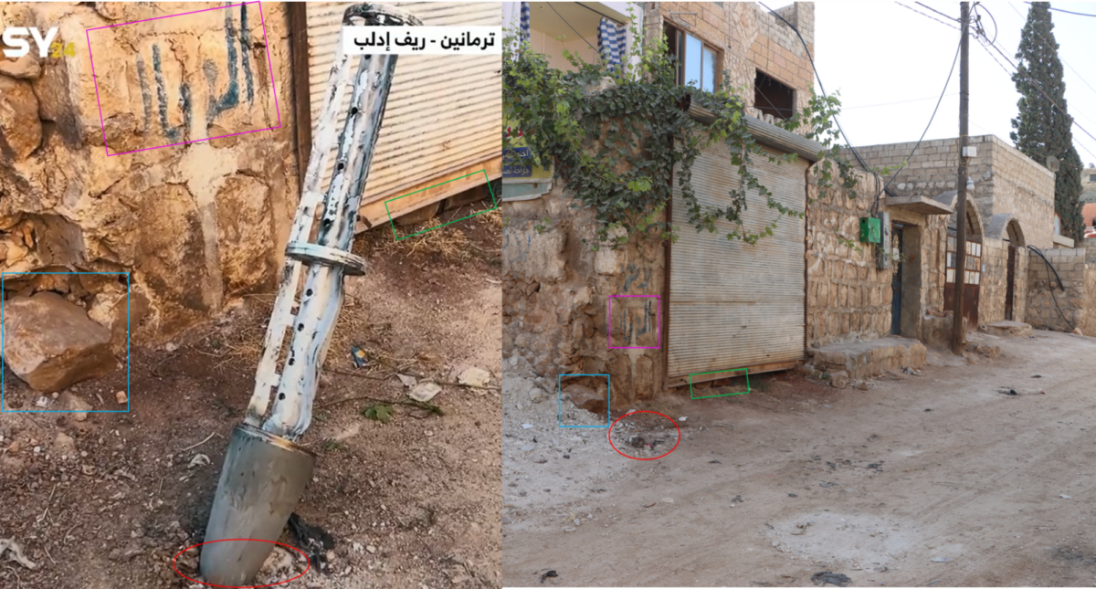
In addition, we also identified another 9M27K cluster munition cargo section in a video posted on X on October 7. However, given that the video provides very limited view of the surroundings, it was not possible to geolocate this munition remnant based on this information alone.
Comparing the cargo section from the video posted on X with imagery provided by The White Helmets, we geolocated the additional cluster munition cargo section to 36.231684, 36.813705, close to a post office according to information on Google Maps.
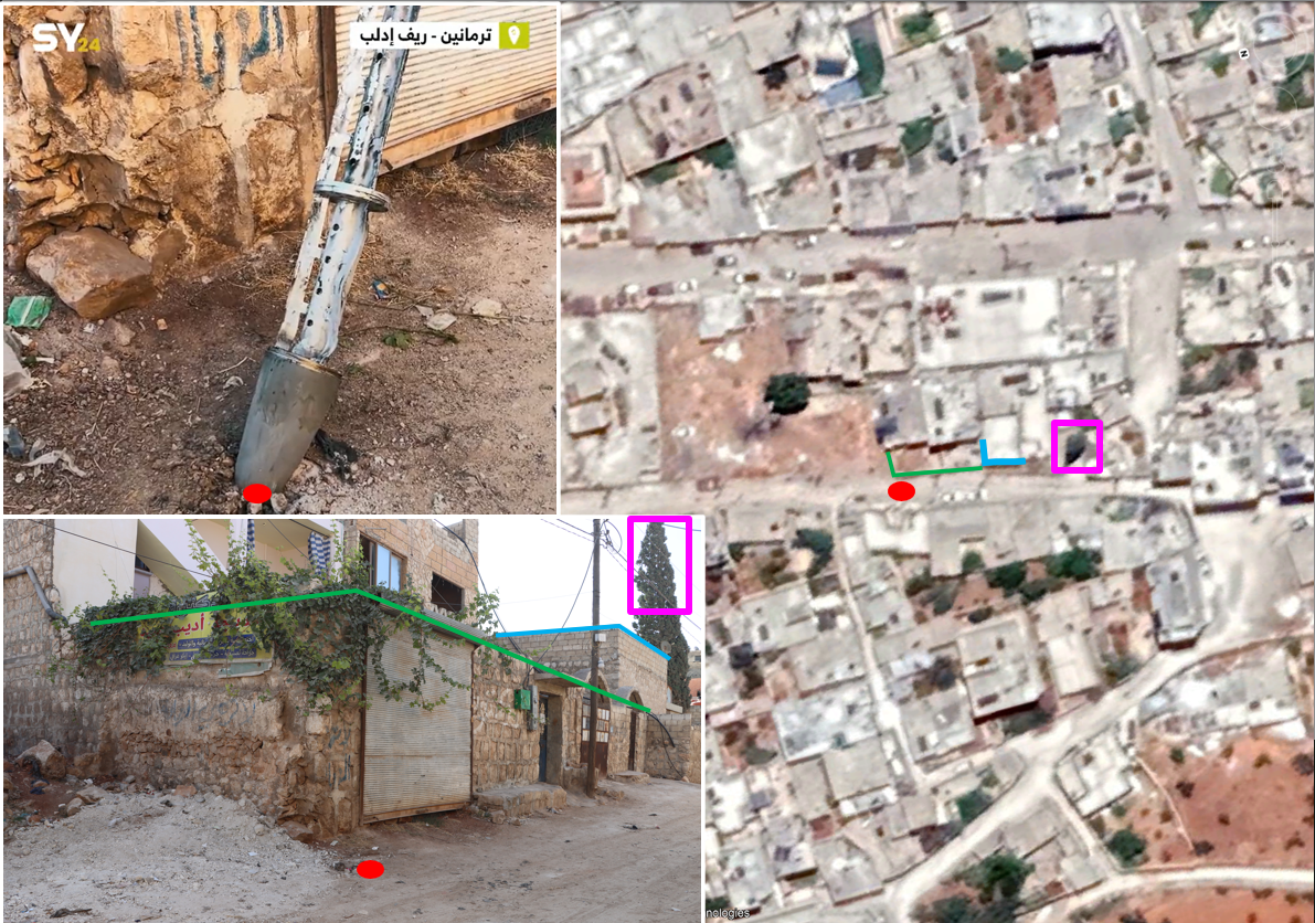
According to a report from The White Helmets, one more cluster munition remnant landed at coordinates 36.232028, 36.818756. However, there are no images or videos available to confirm this.
Both of the geolocated cluster munition cargo sections seem to be consistent with the cargo section of the 9M27K cluster munition, as outlined below — using a reference tool shared by Mark Hiznay. The 9M27K rocket has a range of between 10km and 35km.
In addition to identifying the use of cluster munitions and incendiary weapons, we were also able to identify additional incidents of the shelling of civilian infrastructure other towns and cities.
This included the shelling of an IDP camp in Idlib and a residential area and mosque in Ariha.
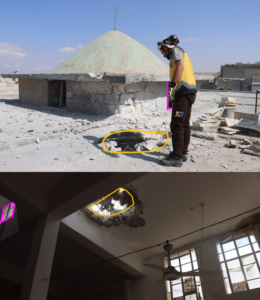
IDP Camp Hit in Idlib
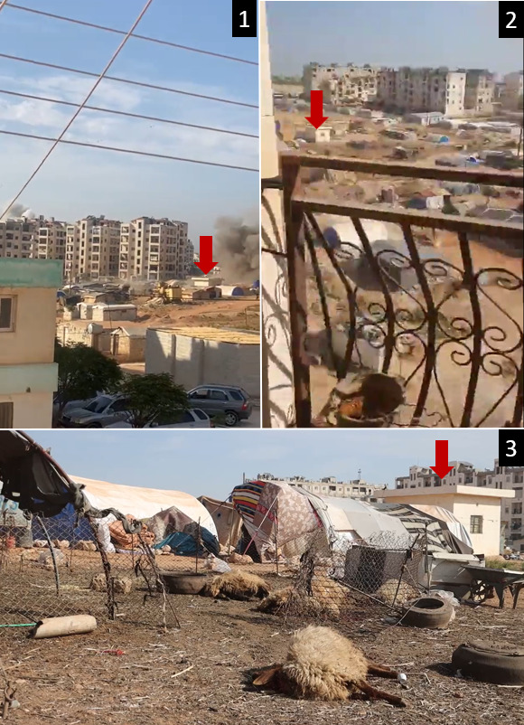
Footage posted on X on October 8 showed large clouds of white smoke rising above the camp in broad daylight as residents can be seen running and grabbing their belongings.
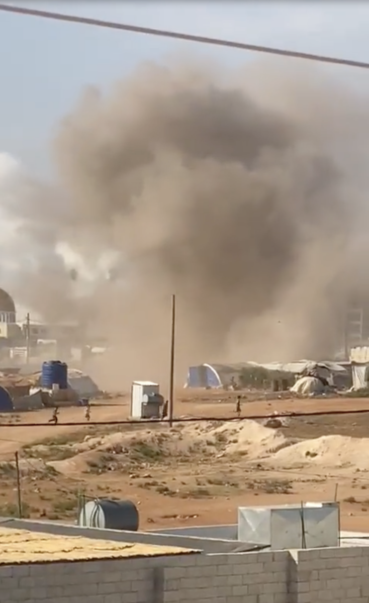
Bellingcat verified that at least two of these videos were filmed on the northern outskirts of Idlib, a sector with residential buildings, university facilities, schools as well as an IDP camp with people living in tents scattered over an area of approximately 1.5 square kilometres. We also found images of a shell remnant inside the camp.
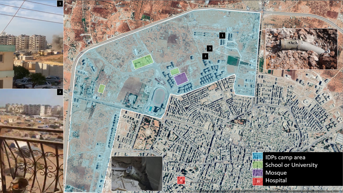
We examined a series of videos. In video 1 explosions are heard and smoke is seen rising from behind buildings and near a mosque, in video 2 people run and clouds of dust move across the camp. In video 3, posted by The White Helmets, the alleged aftermath of the attack is shown. Several dead animals can be seen near what appears to be a Grad rocket remnant.
Comparing the three videos, we verified they were all filmed in a sector occupied by the IDP camp at coordinates 35.942382, 36.630046.
This is not the first time IDP camps in Idlib and the surrounding areas have been shelled. In November last year, the UN noted that shelling had killed civilians and damaged tents.
School Damaged in Al-Bara
The town of Al-Bara — located less than 30km south of Idlib — was also allegedly shelled on October 5 damaging a school.
Bellingcat geolocated imagery from social media showing damage to the school, here 35.683940, 36.540628. There was no recent Google Earth imagery available of the area, so we were not able to identify the damage in the satellite imagery but we were able to use it to help geolocate the site.
Residential Areas Hit in Ariha
The October 5 bombardment of Ariha — a town located about 15km south of the city of Idlib — was filmed from a number of angles. Footage and images of the shelling and its aftermath circulated on social media in the days after the attack.
Bellingcat geolocated five videos from that day, showing the shelling of Ariha from different angles. With this footage we were able to establish residential areas of Ariha were shelled.
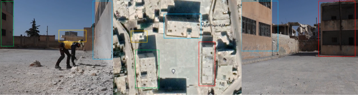
We geolocated one of the damaged buildings to 35.811865, 36.604708, which matched the area that was shelled the day before. In a photo of the damaged building we can see a washing line on a balcony with clothes hanging from it. Available open source visual evidence indicates this was a residential building.
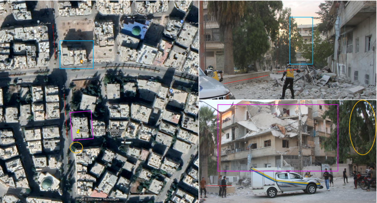
Further shelling was reported on October 7, two days after the initial attack. We identified additional damage to residential buildings, including a mosque, located here: 35.812983, 36.613567.
We were able to geolocate damaged buildings by matching features in footage posted on social media by The White Helmets with Google Earth satellite imagery. The most recent Google Earth imagery of the area was from October last year, so we were not able to identify the damage in the imagery but we were able to use it to help geolocate the site.
Despite ample evidence of shelling in North-West Syria and the damage it caused, it has received little media coverage.
In fact, a recent investigation by Bellingcat on misinformation circulating about Israel and Gaza found that footage of previous strikes on Ariha had been misrepresented as depicting strikes on Gaza.
The death toll from the early October shelling varies, the UN Office for the Coordination of Humanitarian Affairs reported that more than 70 people have been killed in North-West Syria since the escalation on October 5, more than a third of them children.
At least 349 people have been injured and more than 120,000 people have been newly displaced.
Since the shelling of early October, the situation in Syria has continued to deteriorate with further shelling, by a variety of groups across the country. Meanwhile, humanitarian groups have warned about the increasing hardships facing more than two million internally displaced people in North-West Syria this winter.
Bellingcat is a non-profit and the ability to carry out our work is dependent on the kind support of individual donors. If you would like to support our work, you can do so here. You can also subscribe to our Patreon channel here. Subscribe to our Newsletter and follow us on Instagram here, X here and Mastodon here.