Russian Tanks in Millervo Train Station
Translations:
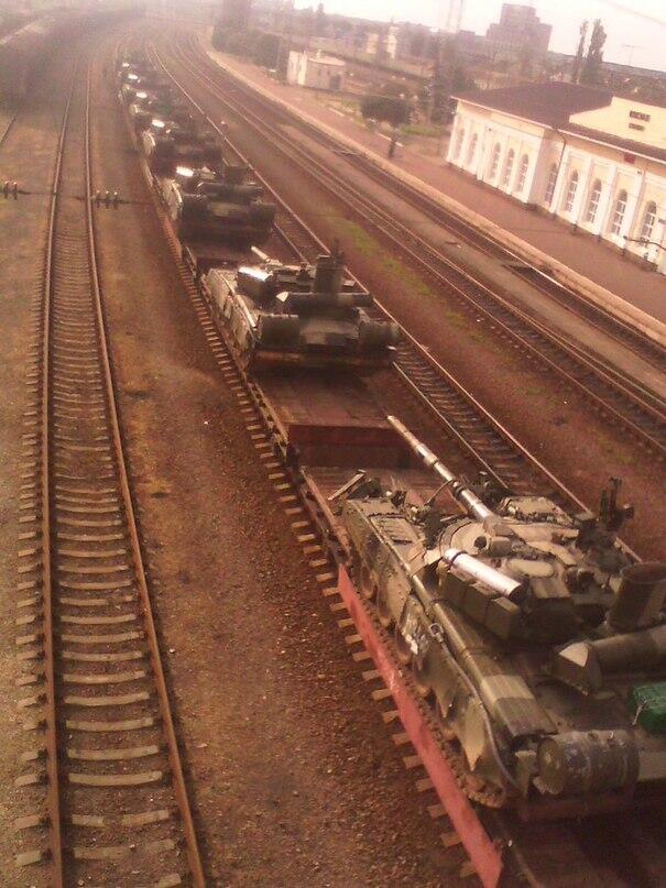
On June 20th 2014 photographs were posted by the Twitter account @AndrijUKR claiming to show Russian armoured vehicles being transported by train through Millerovo, Russia, near the border with Ukraine. This was presented by some as part of a body of evidence that the Russian military were beginning to invade Ukraine, and the debate began over the authenticity of these images.
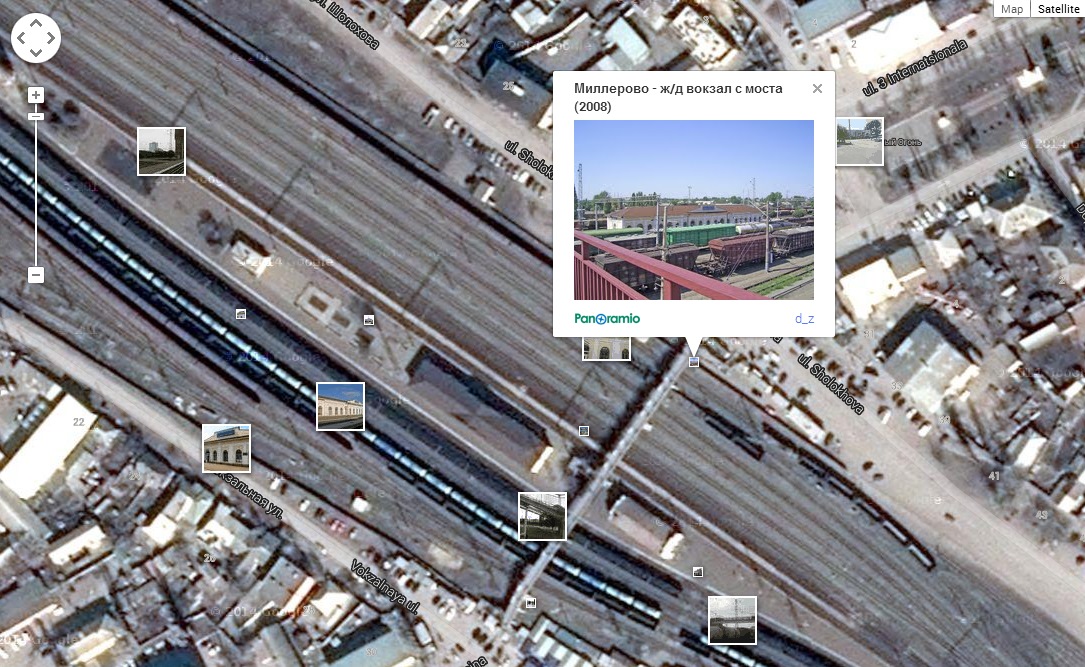
One site that become part of that debate was the Ukraine@war blog, which presented the tweet and attached photographs as evidence of Russian invasion in the post “Open Russian invasion into Ukraine has begun”. In particular it presented the following image which it claimed showed the same station in the tweeted photographs in a photograph taken from Panoramio

[Source]
This image created its own discussion, with some people first noting the sign on the station was different, but that was countered with claims the photo actually showed the other side of the station, and therefore a different sign. Others claimed the station design was reused across Russia, so it could be anywhere.
Obviously this would have been an interesting set of photographs if they could be authenticated, but it’s clear there are questions that still needed to be answered. First of all, is the station featured in the photographs really Millerovo station?
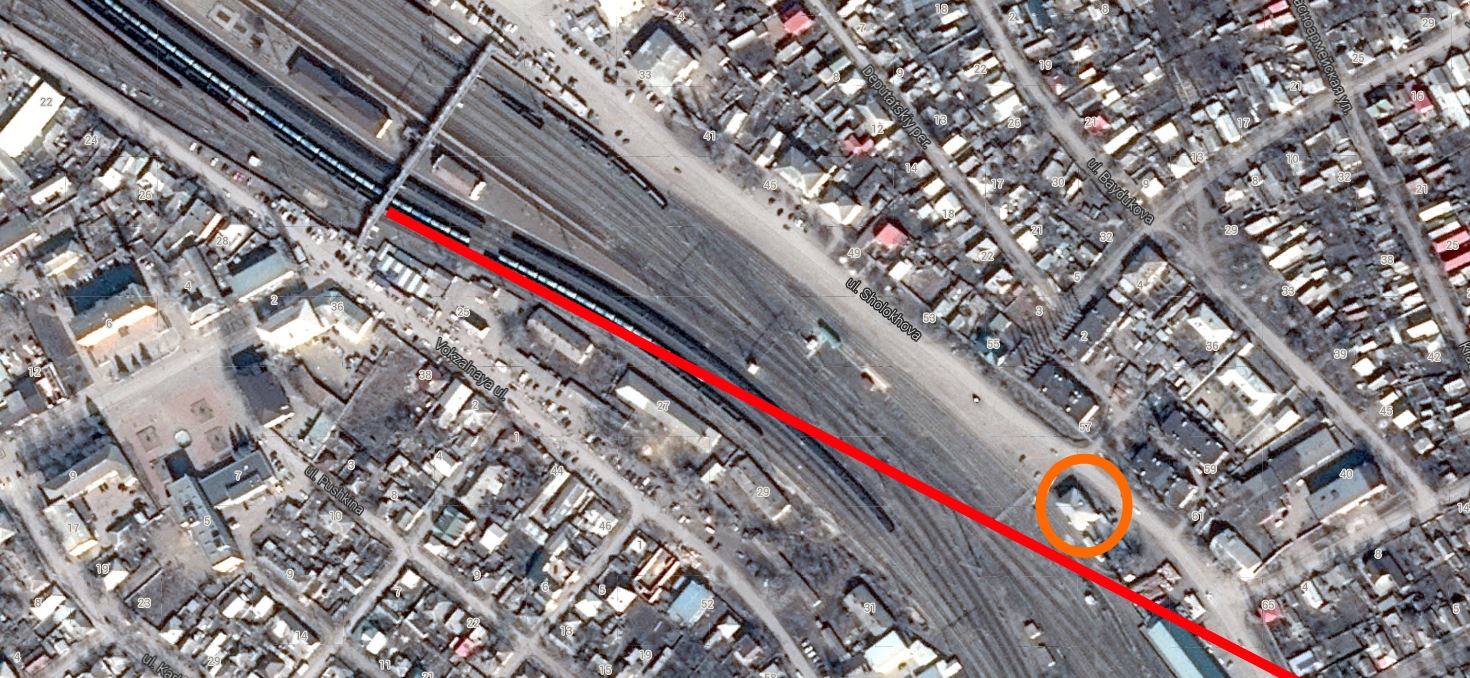
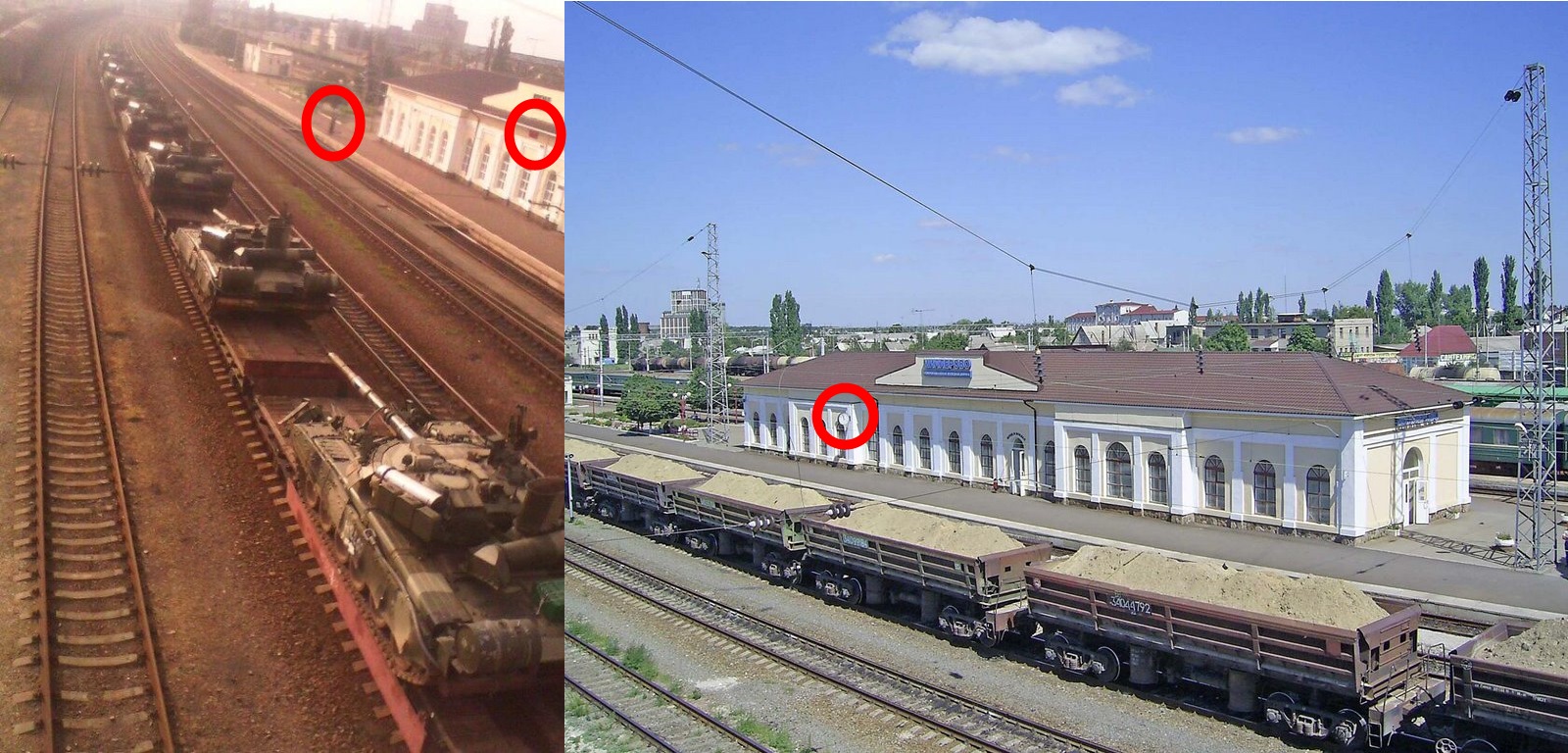
To begin with the station can be easily found on Panoramio, a site which combines Google Earth with photographs that have been linked to specific locations, a useful tool in those countries where Google Street View hasn’t been used widely. Millerovo can be located quickly, as can the train station, and the photograph used of the Ukraine@war blog showing the train station. The photograph has been tagged to a specific location, north of the station, on a bridge
It can be quickly established the photograph must have been taken facing west, showing the north side of the station, assuming the position of the camera is correctly presented on Panoramio.
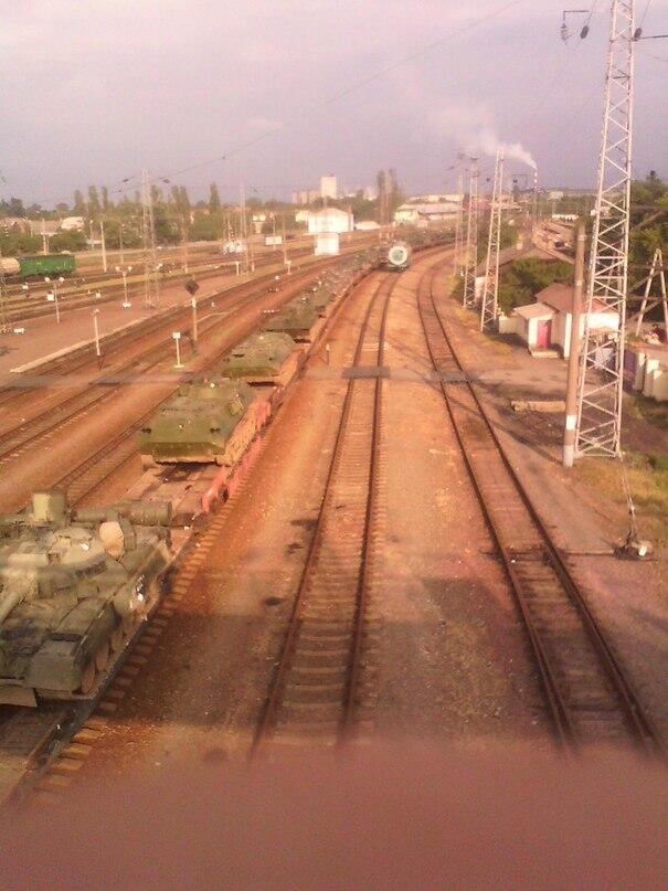
Next we have the photographs from the @AndrijUKR Twitter account. This first photograph shows the camera position above the track, with the station on the right
From this we can say it’s reasonable that the camera is on the bridge, facing northwest, showing the south side of the station. This would support the claim made by some that the Twitter photographs shows the station from the opposite side of the Panoramio photograph, but is there more we can see that would support that theory?
In the below image I’ve highlight the position the Twitter photographs were taken from in red on the map, and the position the Panoramio photograph was taken from in green.
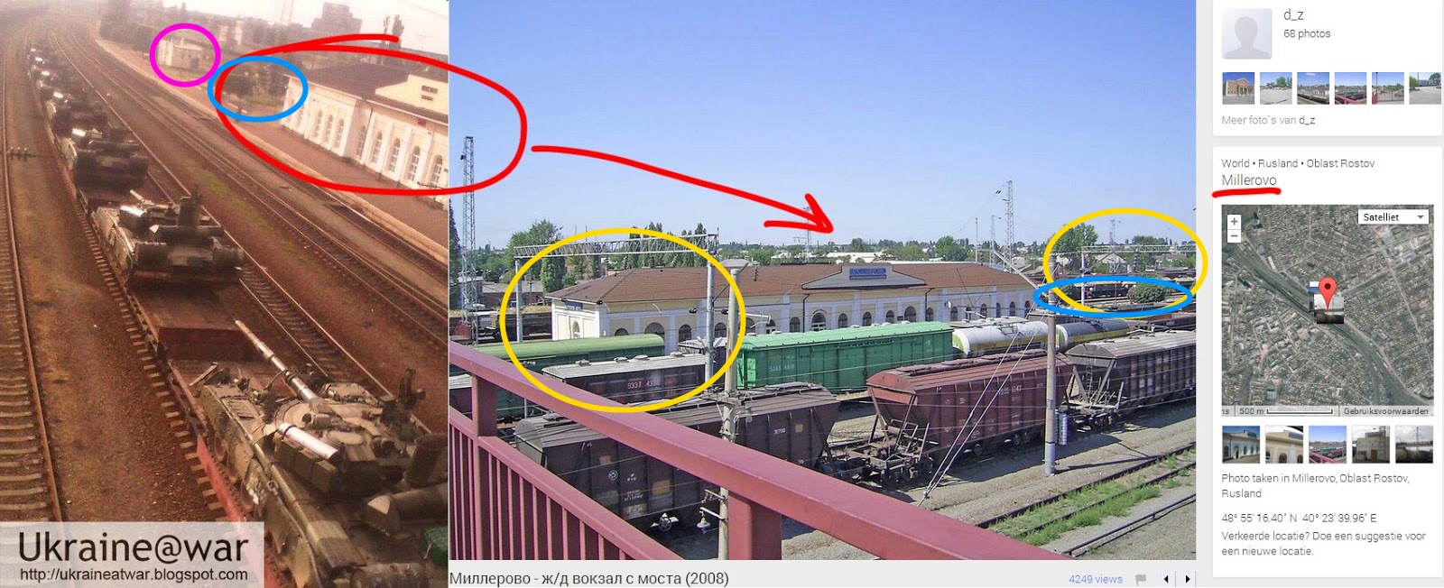
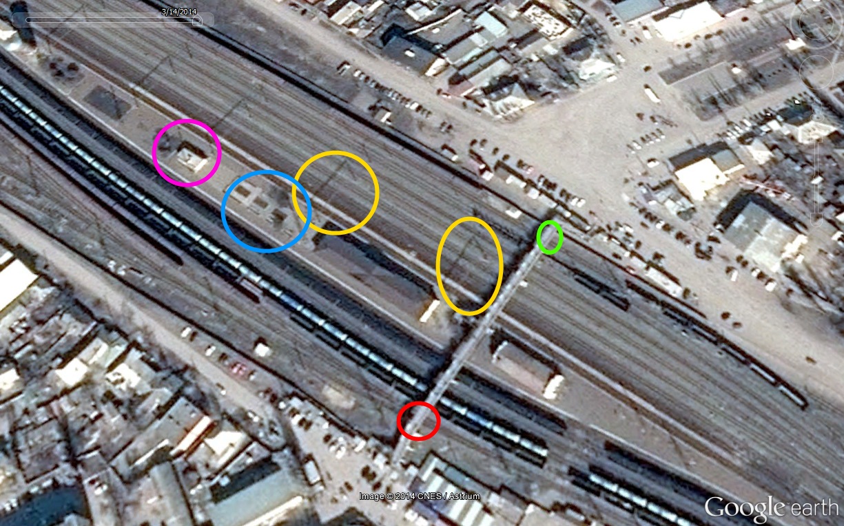
The yellow circles show structures visible above the tracks on the north side of the station, visible on satellite map imagery as being in the same position. The blue circle shows a small park area just northwest of the station, visible in both photographs, with the purple circle highlighting a small building northwest of that, visible in the Twitter photograph.
In this next photograph from Twitter we have what appears to be the view southeast.
By comparing the photograph to satellite map imagery it’s possible to investigate the assumptions the photograph would be taken near the same location as the other photograph.
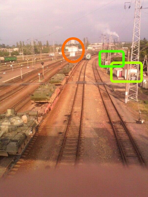
There’s a number of features in the photograph that can be matched to the satellite maps. 6 tracks are visible in the photograph and satellite map imagery, and it’s possible to establish the exact position of the camera between the two right hand tracks in the camera. You can also see the camera is point between the tracks, so we can draw a straight line on the satellite map between the tracks, and on the north side of that line we can see the end of a small building that’s also visible in the photograph, marked in orange
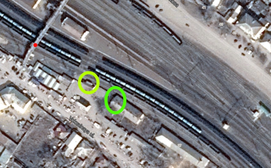
It’s also possible to see a couple of small buildings on the right hand side of the track, one small building with a small structure on its north side, and the end of the structure behind that clearly visible in the photograph
It’s even possible to make out the shadows of the pylons visible in the photograph on the satellite map, with their position matching in both the photograph and satellite map imagery.
It seems extremely likely that these photographs were taken at Millerovo station, but there is a second question the original images raised. The sign on one side of the station doesn’t match that on the other, so we have to ask, why? First of all, can we find images of that side of the station? Panoramio again comes into play, and we can begin to examine all the other photographs taken in the area. This first set of images shows the front stage of the station between 2008 and 2012
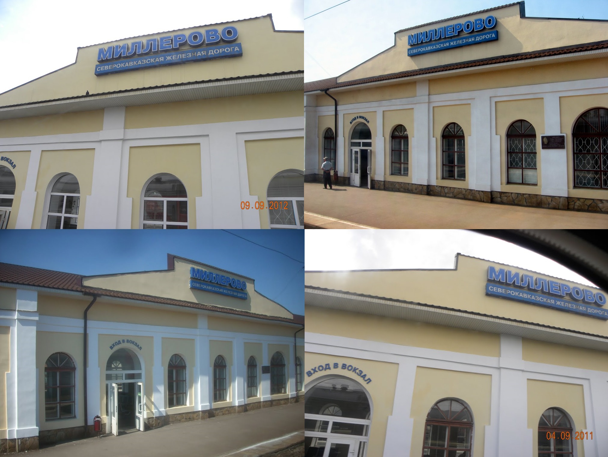
The features in this photograph match very strongly with the photograph we’ve already established was taken from the bridge on the north side of the station. We can see the doorway with the writing above it is in the correct position, the plague is in the right place, and the drainpipes are where they should be
[Source]
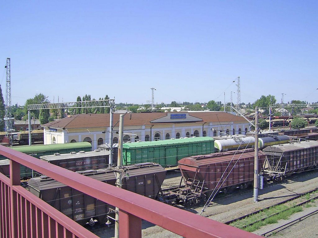
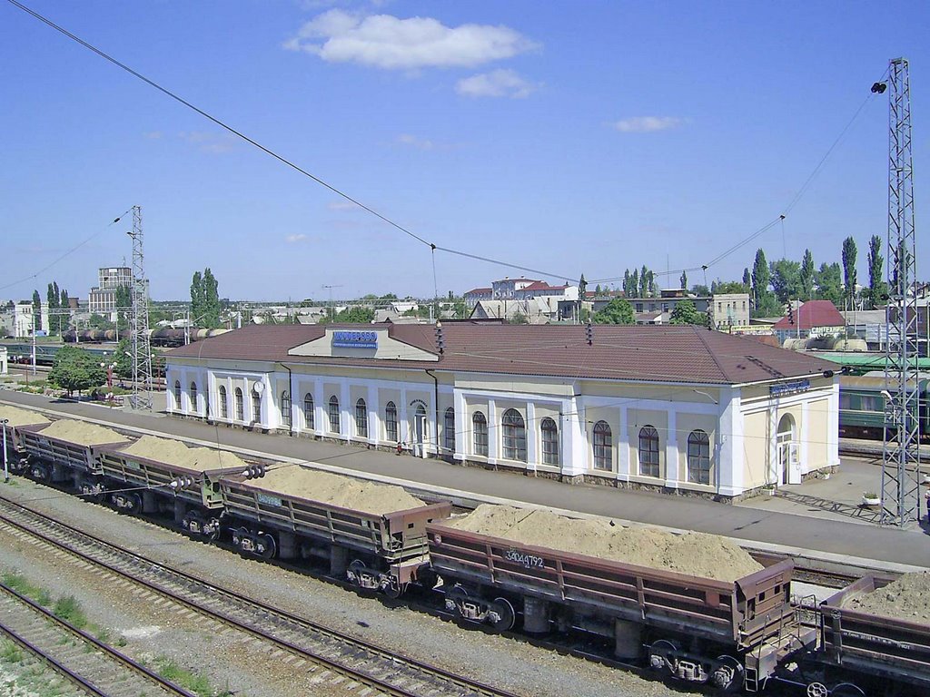
As for the other side of the station Panoramio only has one image, but it clearly shows the sign doesn’t match the sign in the Twitter photograph, and Google searching for “Millerovo station” in Russia brings up other results showing the same sign.
[Source]
There’s also some other features that don’t match, the station clock isn’t visible in the Twitter photo, but a small sign is, as well as what appears to be a post on the station platform
What this may suggest is there’s been a renovation of the station in the last several years, and it would seem strange if the sign is changed to something that didn’t match the other side of the station, and the clock removed, so it’s a real possibility that the photographs from Twitter were in fact taken at least 7 years ago.