
Retracing a UK Street 100 Years On
When an amateur restorer discovered slides showing street scenes from early 20th century Middleton – located near Manchester in the UK- he was keen to find out where exactly they were taken.
With the help of local historians, he was able to track down the location of some of the photos. But is there another way to identify where these historical photos were taken?
Using historical Ordnance Survey (OS) maps we were able to independently locate a number of the images. Here’s a quick guide to how we did it.
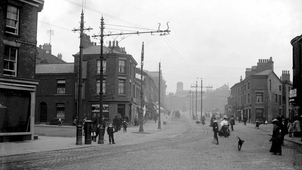
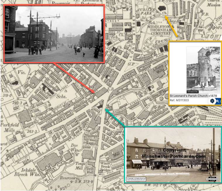
This historical photo holds the first clue, a street sign with the name ‘Manchester Old Road’ can be seen on the left-hand side of the image.
The first search we did on Google Maps for Manchester Old Road, revealed the street is still there. However, using Google Street View and walking down the street we couldn’t find an area that matched the photo. And that’s when we looked for older reference material.
We then searched Google for (“Manchester Old Road” Middleton 1900 maps) and found a relevant page on StreetList.co.uk, a tool for navigating and exploring geographical information in the UK. It included details about the street and an ordnance survey map from the 1900s with Manchester Old Road highlighted. The map was highly detailed and showed the layout of Middleton, on the northern edge of Manchester, in the 1900s.
The Ordnance Survey and other National Mapping Agencies
With historical ordnance surveys, you are able to scroll through detailed street maps that are more than 100 years old.
In the UK the Ordnance Survey (OS) is the national mapping agency. Beginning in the mid-1700s the agency has created detailed maps of the UK, and many of these historical maps are still available via national libraries and archives. Many other countries also have a version of the Ordnance Survey, a list of them can be found here.
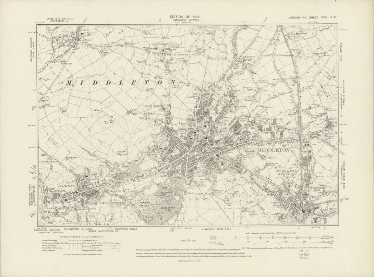
We found the National Library of Scotland provides many high-quality historical maps that you can view and explore without payment or subscription. After initial searches, we found the following high-quality map of Middleton from 1910.
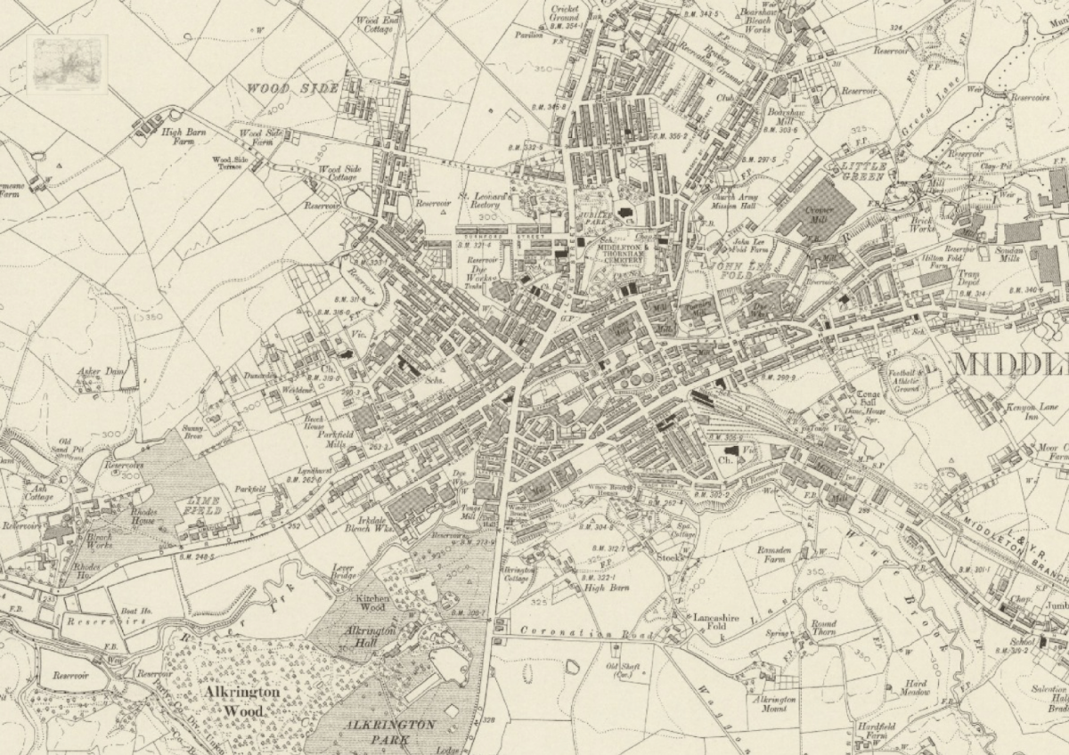
We browsed through a number of these ordnance survey maps; they ranged from one-inch maps- providing a useful overview of wide areas to 50- and 120-inch maps providing the most detailed views of rural and urban areas.
The 25-inch map of Middleton from 1922, shows a tramway running down Manchester Old Road, which can also be seen in some of the historical photos.
Geolocating the Images
In addition to finding the ordnance survey, we were able to find historical postcards of the area to help geolocate the original photos.
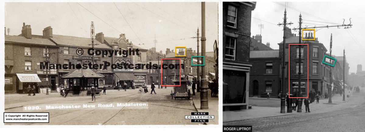
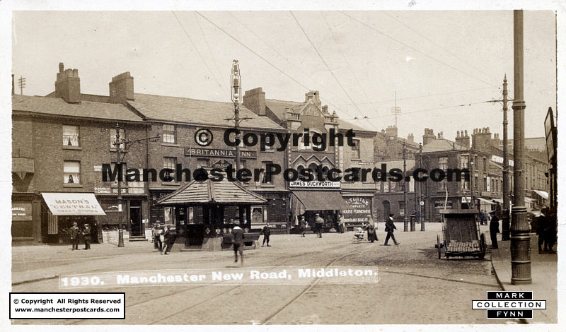
This postcard has a label with the location ‘Manchester New Road, Middleton’ and on the right-hand side, we can see the same storefront (red square), sign (green square) and chimney (yellow square) as in the source picture.
Looking at the map from 1910, we can see there was a big intersection where the ‘Manchester Old Road’ and the ‘Manchester New Road’ came together in Middleton, and it lines up perfectly with a church seen in the background on the map and in the following postcard.
Here’s another example of an historical photo we geolocated further down the road, by examining the ordnance survey, other postcards of the area and Street View.
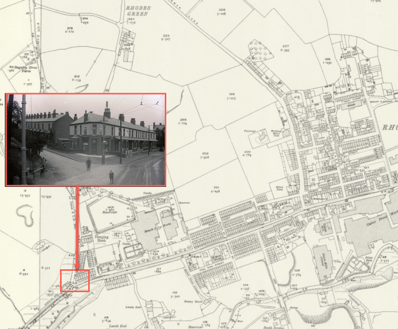
By combining the ordnance survey with the historical photos and postcards we geolocated where the historical photos were taken and gained an approximation of how the street would look at the time.
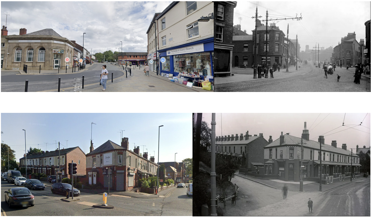
Comparing with Modern-Day Street View
We can now compare the historical photos of Middleton with modern-day street view images, and see how much has changed.
You can read more from Bellingcat about using open source to investigate historical images and mysteries here or via the history tab.
With thanks to Roger Liptrot for sharing information about the historical photos he found of Middleton, UK and for digitising the images from the original glass slides.
Bellingcat is a non-profit and the ability to carry out our work is dependent on the kind support of individual donors. If you would like to support our work, you can do so here. You can also subscribe to our Patreon channel here. Subscribe to our Newsletter and follow us on Instagram here, X here and Mastodon here.
