We Tasked a Satellite Based on Your Suggestions. Here are the Results
Satellite imagery is increasingly used by open source researchers and newsrooms around the world to analyse and understand what is happening, during a conflict, a natural disaster or even a new development project.
Bellingcat has the ability to take a snapshot of anywhere in the world using our Planet satellite account.
Through our subscription to Planet Labs, we have access to a satellites that can capture 50cm resolution imagery of anywhere on Earth within a few days of a tasking request.
Last month we asked you where you wanted us to look and why it’s important for research.
And here are the results.
There were so many good suggestions; we narrowed it down by selecting requests for areas that aren’t well covered and tried to select requests that had a high chance of successfully producing high quality images (not areas that are completely covered by cloud or jungle).
To our knowledge, these are the latest publicly available satellite images of these areas.
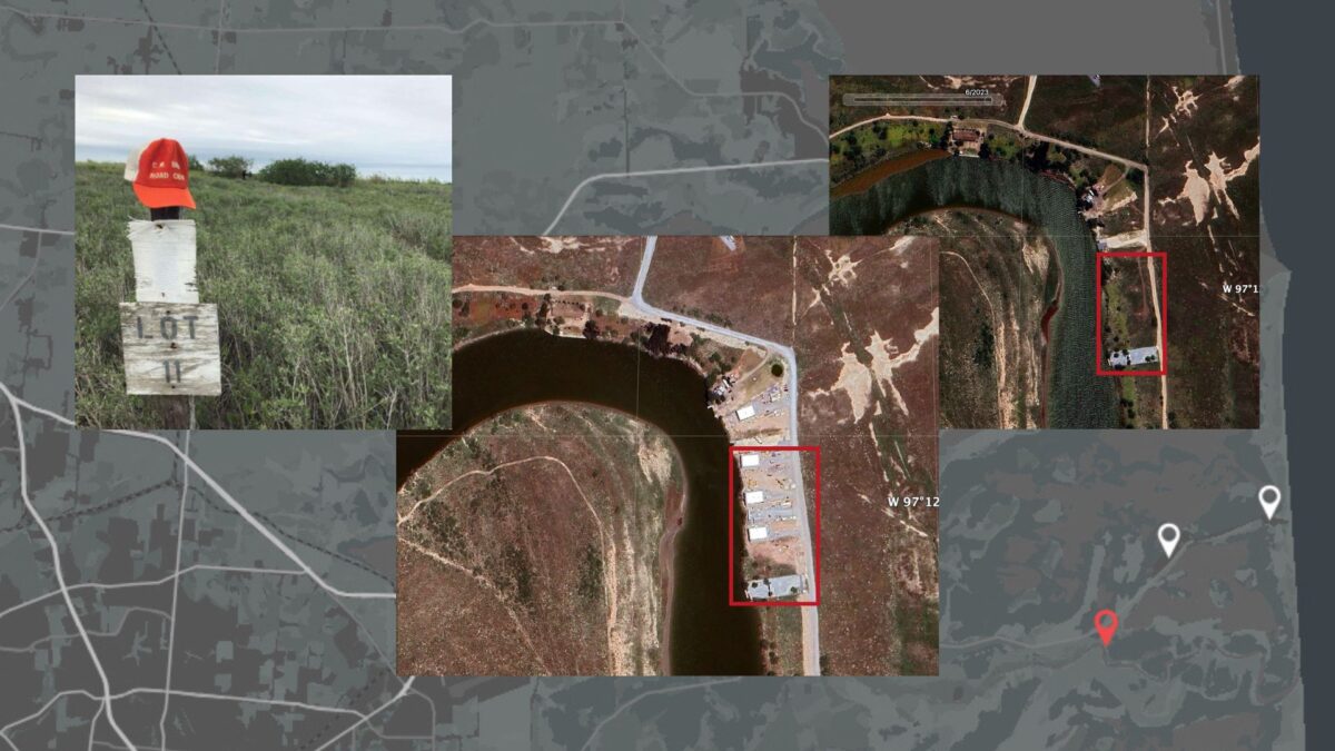
Intrenchment Creek Park, also known as, Cop City: Atlanta, Georgia, USA (33.694458, -84.332762) – Suggestion via Bluesky
Intrenchment Creek Park is the site of a proposed $90-million police and firefighter training centre that according to reports would include a shooting range, a driving course to practise chases, and a “burn building” for firefighters to work on putting out fires. A “mock village” featuring a fake home, convenience store, and nightclub would also be built for authorities to rehearse raids. Activists – some of whom who camped for months at the site – were cleared from the area earlier this year after an executive order was issued making it illegal to enter the area.
This satellite image was taken on 19 September, 2023 and gives a clear image of the area.
Sino-Indian Border, Base near China’s Shigatse Peace Airport (29.314558, 89.321937) – Suggestion via Discord
The base is located near the Shigatse Peace Airport in a valley approximately 155km north of the China-India border. According to this report by ChinaPower the airport and surrounding infrastructure has been significantly expanded in recent years.
Our satellite image taken on 17 September, 2023 shows additions to the area not seen in earlier satellite imagery.
Votkinsk Machine Building Plant: Russia (57.040290, 53.984870) – Suggestion via Mastodon
The Votkinsk plant, which makes Iskander, Yar and Bulava missiles and has been ramping up production.
An explosion was reported at the plant on August 4, reportedly at workshop number 95. The structure of the workshop was reportedly damaged but it did not collapse. At first viewing this is not visible in the satellite imagery, but merits a closer look.
Our satellite image was taken on 17 September, 2023.
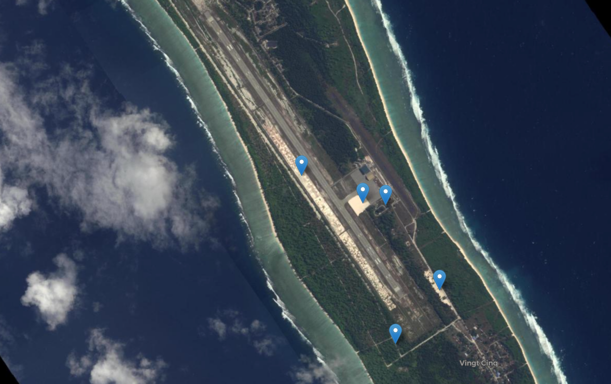
Mischief Reef, Disputed Area: South China Sea (9.919159, 115.519635) – Suggestion via Twitter
The Chinese occupied Island in the disputed area of the South China Sea, has been the subject of a major dredging operation and has been built up as a Chinese military base, with satellite images from 2016 showing the building up.
Our Satellite image taken on 16 September, 2023, shows a completed airfield runway.
Burevestnik Launch Pad: Novaya Zemlya, Russia (73.115450, 53.272410)- Suggestion via Discord
Located on the Novaya Zemlya archipelago, a reported launch site for Russia’s nuclear-powered cruise missile. There have been recent reports of increased activity near the site.
Our Satellite image was taken on 20 September, 2023.
Bellingcat is a non-profit and the ability to carry out our work is dependent on the kind support of individual donors. If you would like to support our work, you can do so here. You can also subscribe to our Patreon channel here. Subscribe to our Newsletter and follow us on Twitter here and Mastodon here.