How To Track Desert Locust Swarms
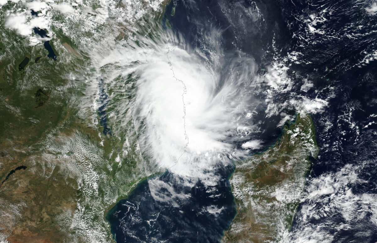
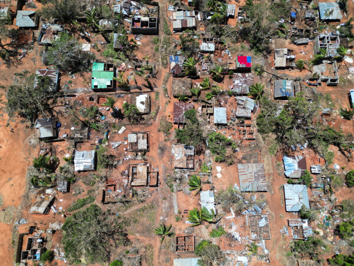
Billions of desert locusts are swarming across East Africa, multiplying in numbers over several months of favorable rain and breeding conditions, creating what the UN Food and Agriculture Organization (FAO) called an “unprecedented threat to food security,” and the worst locust upsurge in East Africa in seventy years.
“We do have a chance to nip this problem in the bud, but that’s not what we’re doing at the moment. We’re running out of time,” said Mark Lowcock, UN undersecretary-general for Humanitarian Affairs and Emergency Relief.
Recognizing the urgent need for informed control operations, and locust tracking, the UN has published several comprehensive datasets and open source tools. In particular, there are four crucial aspects to analyzing the locust insurgency: movement, weather and climate, containment efforts for locust breeding, and agricultural impact.
In this guide, we will take a deep dive into the public data and tools that will allow individual investigators to understand and monitor a rapidly evolving international six-legged crisis.
Tracking Locust Movement
The best resource to track the locust development is Locust Hub, a centralized data source organized by the United Nations FAO. The portal offers a geographic and time sensitive visualization of both hopper groups and swarms. The data is concatenated from reports to the FAO from affected countries.
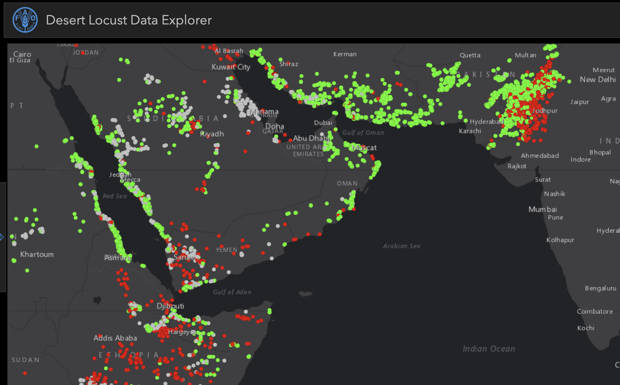
The desert locust data explorer on Locust Hub displaying all reports of desert locusts since June 5th 2018, screenshot taken on June 5th 2020
Green dots represent the presence of hopper groups, which are immature desert locusts that have not yet developed wings, and are much easier for pesticides to eliminate. Red dots represent adult swarms — far more destructive locust groups that can fly and travel longer distances.
We can navigate the map of desert locusts by dragging our mouse and zooming into specific areas by double clicking, or using the zoom buttons on the bottom-right of the user interface. Clicking on the left bar opens a menu that allows filtering the dataset over specific time periods and locust types.
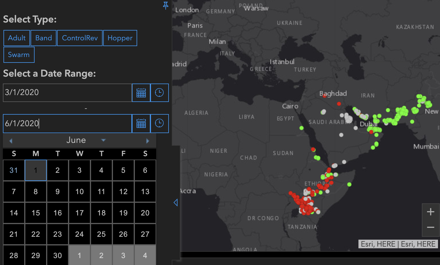
In the above example, we filter the map to display recent locust sightings between 03/01/2020 (March 1st), and 06/01/2020 (June 1st). Notably, locust cases in the past three months are heavily concentrated around two bodies of water: the Gulf of Oman and Lake Turkana, near Ethiopia, Kenya, and Uganda.
In an effort to scale up data collection, the FAO is calling for people in affected regions to report locust sightings through an app, eLocust3m, which is available on both Android and IOS.
In eLocust3m, users enable location tracking in order to submit a report, which includes relevant details on the locust swarm and photo evidence. All frontline countries affected by desert locusts have a National Locust Control Centre, where the reports are initially received.
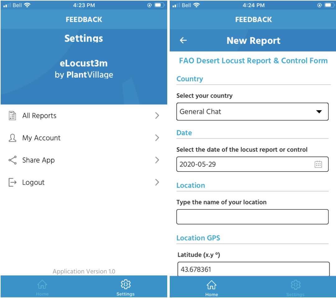
Data from each country is then collated into a single file and sent daily to FAO Headquarters in Rome, where the reports are validated. The FAO also trains groups of local users to maintain consistent updates on locust presence.
Analysis & A Second Peak
Since 1985, the United Nations has also maintained data on desert locusts; this dataset includes 45 years of information on swarms, hoppers, solitary locusts, and ecology and soil conditions of affected regions, all available for download.
We demonstrate the type of analysis that can be performed by plotting out all reports of locust swarms and hopper groups over the past six months. In this example, we use the hopper and swarm datasets, and basic Python code.
https://etedward.github.io/LocustPlot/ (please click on this link for an interactive version of the graph below)
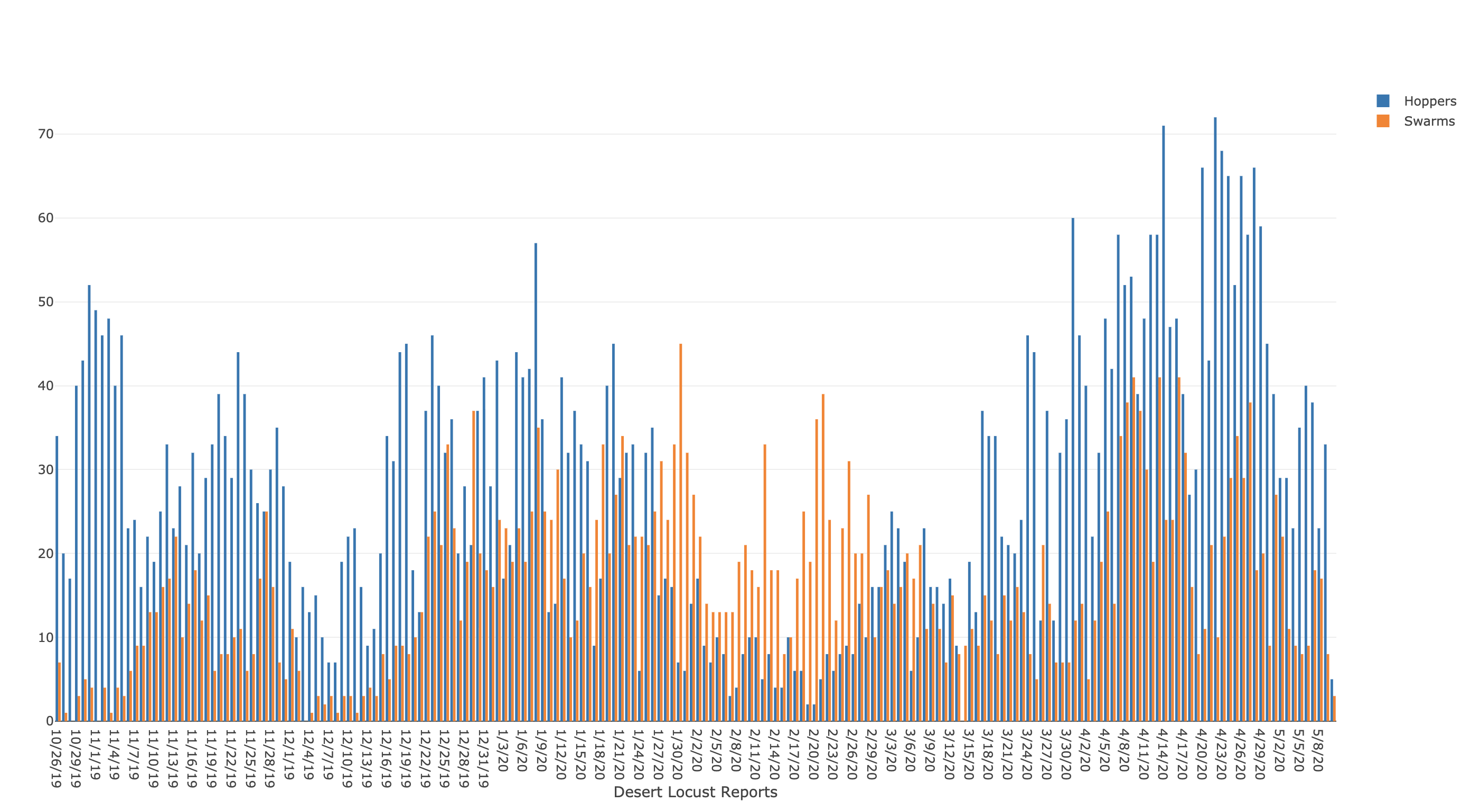
In the plot, a major spike in locust numbers occurred this year in late January, which reflected international coverage from major news outlets, and motivated more than 50 million dollars worth of pesticide and aid packages to East Africa.
The visualization also shows that we are in the midst of a second major spike of desert locusts that started in early May, with the number of hopper groups surpassing 150% of January’s peak. This drastic increase notes an alarming implication if all the hoppers are allowed to mature into adult locusts.
Adult locusts are nearly impossible to track and eliminate because they can fly 50 to 150 kilometers in a single day. Instead, local experts target locust eggs and hoppers, because without wings, they are less mobile and easier to control.
This graph does not account for the size of each locust swarm. On average, each successive generation of locusts breeds twenty-fold, meaning the impact of a locust group in June could be much more severe than a locust group in January.
Recognizing the urgency of eliminating these hopper groups, the World Bank approved a 500 million-dollar aid package to countries in Africa and the Middle East on May 21, 2020.
To provide accountability and monitor the success of control operations, Locust Hub also provides a weekly tracker on the number of swarms, hoppers, locust control operations, as well as how the number changes weekly.
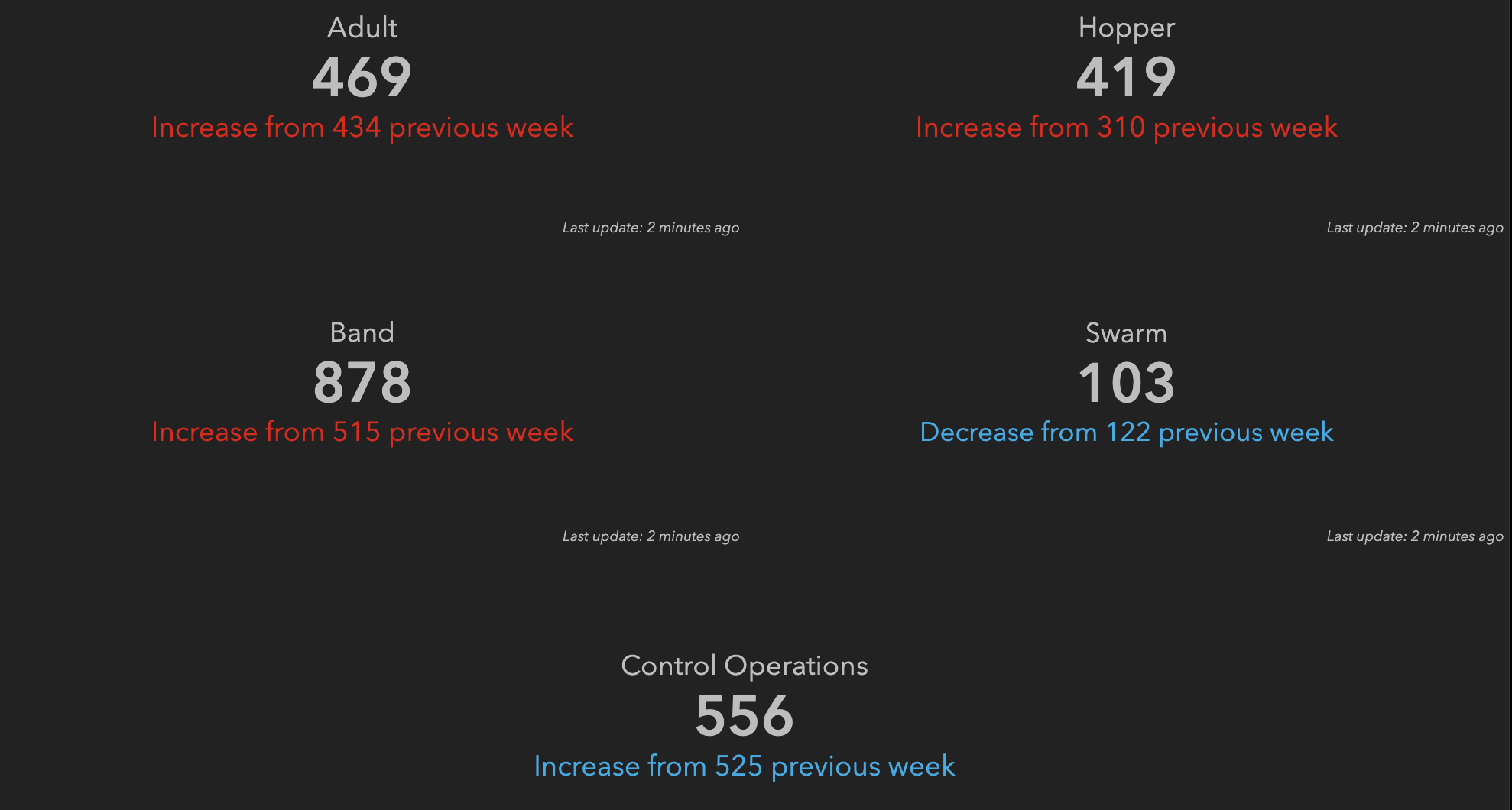
Weekly changes in locust data displayed in the desert locust explorer. Screenshot taken June 1st 2020
Predicting Future Movement
Our tools, as of now, have been good at showing us what has already happened, which is to say that locust numbers spiked in January in Ethiopia, Somalia, and Kenya; by February, swarms were ravaging crops in the Middle East; by April, the swarms had migrated as far east as Rajasthan, India.
To predict the future movement of desert locusts, however, we need to consider other data sources.
According to FAO scientists, several complex factors influence the movement of locust groups including atmospheric pressure, temperature, wind, rain, access to breeding grounds, and nearby food sources. Wind, in particular, is a valuable indicator of a locust swarm’s future flight path.
We use windfinder.com to access a map of wind speeds in the region.
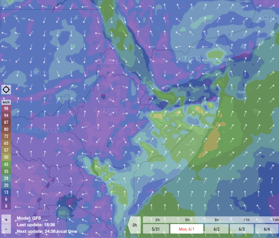
Wind speeds in the Horn of Africa, screenshot taken on June 1st 2020
In the above map, wind speed is indicated by color, where purple represents gentle breezes less than 6 km/h, and green represents strong winds ranging from 35 to 43 km/h. The direction of the winds are indicated by the white arrows.
Winds in landlocked Africa, in places such as Uganda, South Sudan, and Ethiopia, remain relatively calm, with low speeds. By contrast, much stronger winds are generated by the Arabian Sea along the Somalian coast. This weather pattern is largely responsible for introducing desert locusts into the Middle East, allowing swarms to cross over the Red Sea when strong gusts of wind are present.
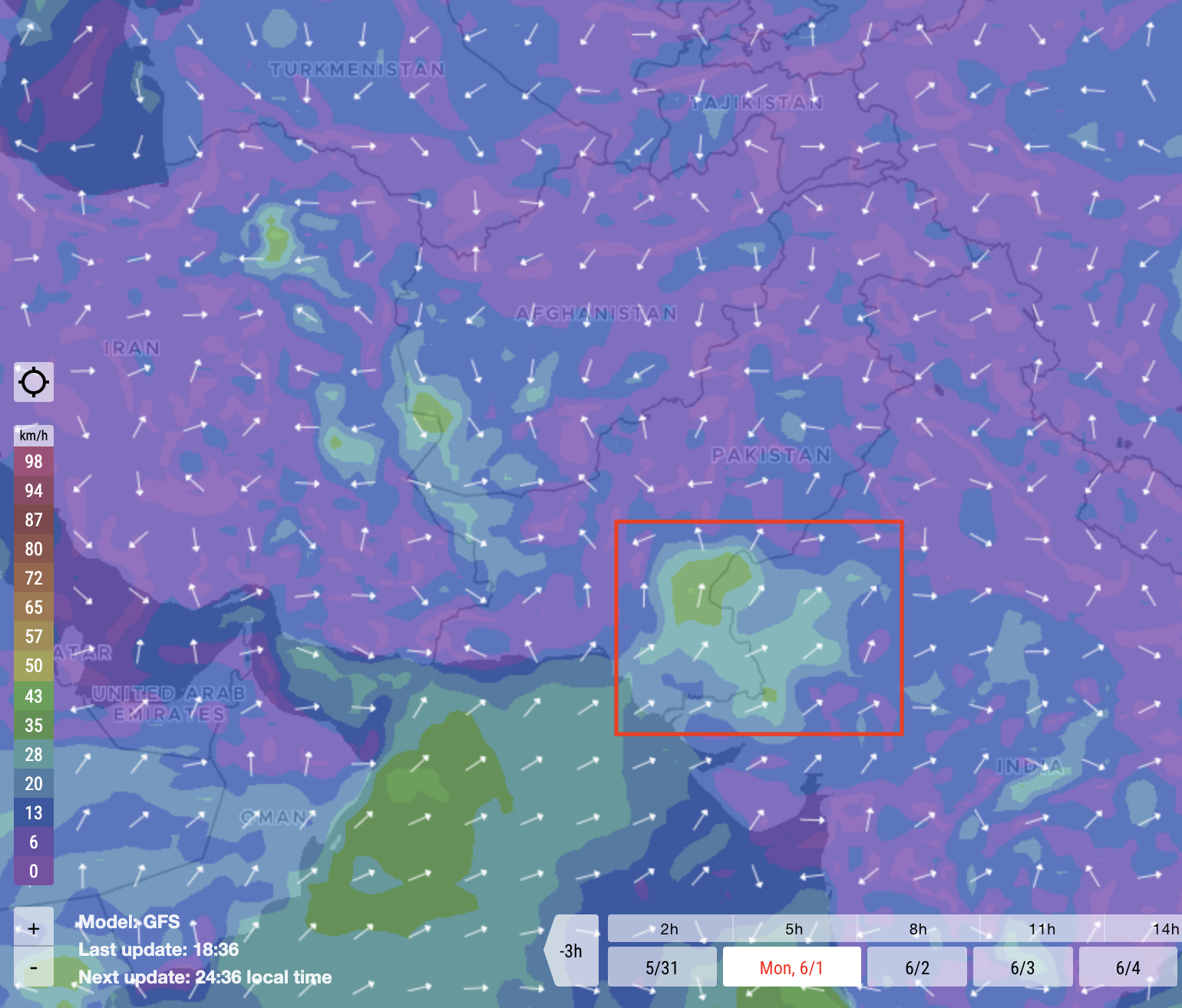
Wind speeds in Middle East and South Asia on June 1st 2020
Strong winds are also present farther east, blowing towards India.
Millions of locusts have already entered Rajasthan, India, in April. While the desert locust tracker shows that in past years locusts usually stop at Rajasthan, heavy winds have carried swarms into seven of India’s heartland states.
This is particularly notable along the Pakistan-India border where high concentrations of mature swarms currently reside.
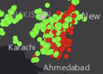
Screenshot of desert locust explorer in Locust Hub showing high concentrations of locusts along India-Pakistan border, taken May 29, 2020
With current winds directed North East towards New Delhi, and high numbers of locusts along the Pakistani-India border, there is a major concern of swarms entering the Indian capital. Indian news reflects this concern, with New Delhi already bracing for an encounter with the pests.
Weather & Rain
Locusts thrive after periods of heavy rainfall. Rainfall moistens soil, and nurtures plants, forming ideal breeding conditions; according to NASA’s chief scientist for SERVIR, regions of sandy moist soil are directly correlated with increased locust activity.
There are many public tools to monitor rainfall, including Windfinder.com, which offers accumulated precipitation data for the past week. However, for a comprehensive timeline, we use NASA’s Worldview, which displays rainfall and soil moisture data for the past twenty years.
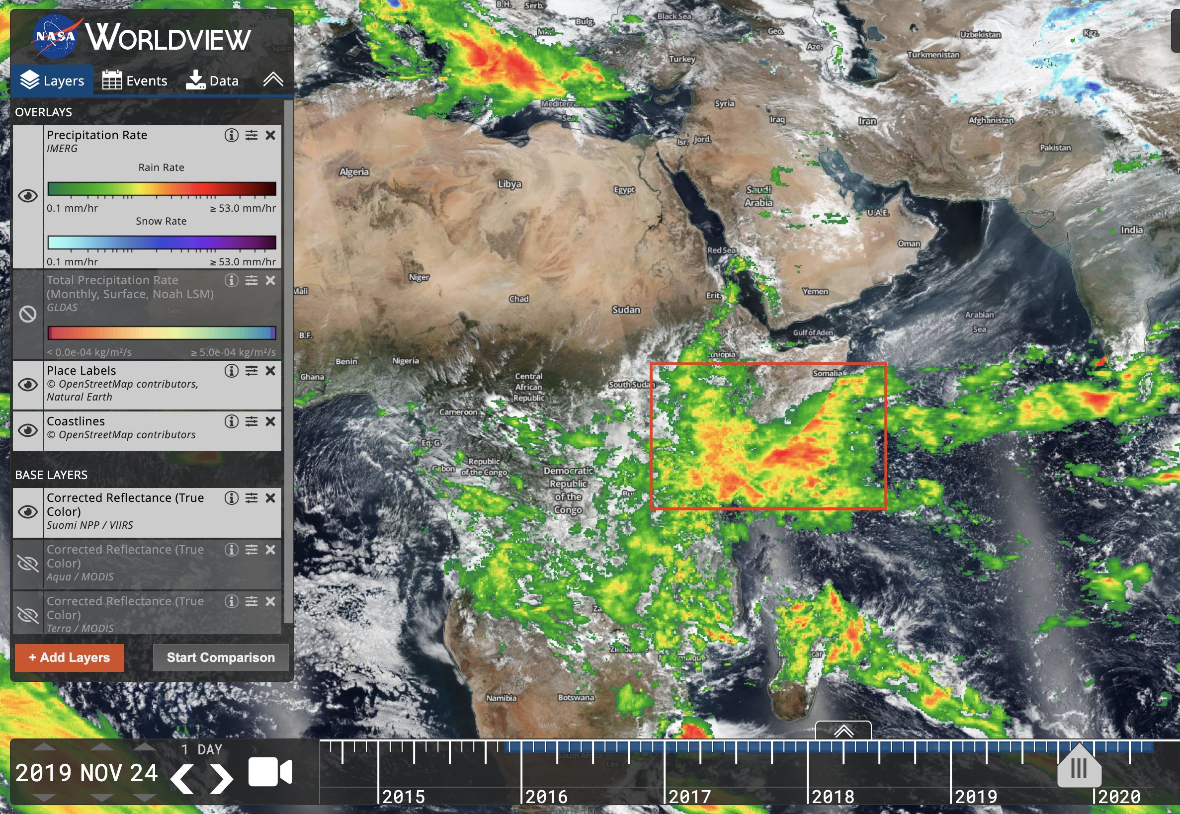
Day of intense rainfall in the Horn of Africa (Nov 24, 2019) displayed on NASA Worldview
Data sources can be added to Woldview in the layers tab; in this case, we add “precipitation rate” data. Precipitation intensity is indicated by color from green to red representing 0.1mm/hr to 53.0mm/hr of rainfall.
At the bottom of Worldview, there is a “video camera” button that allows us to view the progress of storm clouds and rain over time. Throughout 2018 and 2019, more than eight cyclones formed in the Indian Ocean, causing abnormally high levels of rainfall in East Africa.
“There is a link between climate change and the unprecedented locust crisis plaguing Ethiopia and East Africa. Warmer seas mean more cyclones generating the perfect breeding ground for locusts. Today the swarms are as big as major cities and it is getting worse by the day.” — Antonio Guterres, UN Secretary General
Between October and December 2019, the “Horn of Africa” received four times its average rainfall. This period of heavy rain directly correlates with successful locust breeding, and a spike in hopper populations in January.
Although Africa’s short rain season has ended, monsoon season in India is starting. From June to September, humid southwest storm clouds, starting in south India, will sweep across the country, potentially sparking another spike in locust breeding.
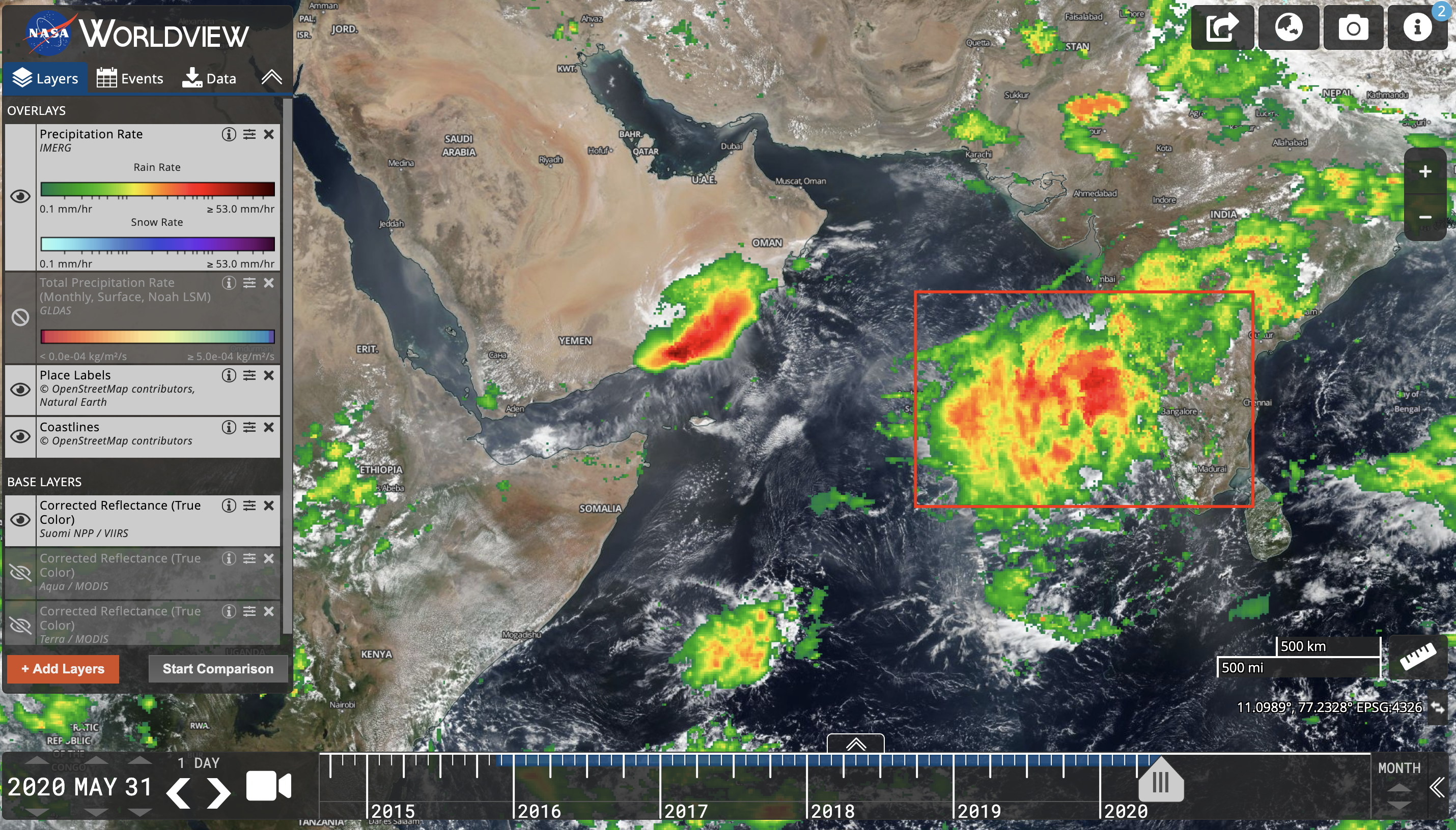
Large storm clouds moving upwards into India at the start of Monsoon season, data displayed for May 31, 2020
Monitoring rainfall data and the movement of storm clouds will be critical in local efforts to analyze and contain the growth of locust groups.
In particular, areas that encounter high levels of precipitation in the upcoming weeks, especially near mature locust swarms, must be monitored and prioritized in control operations to stop locust breeding.
Agricultural Reports
Agricultural data is vital to our understanding of the impact of this crisis — on an estimated 25 million East Africans who will suffer food shortages in 2020, according to the UN. Secondly, agricultural data is also crucial in tracking locust movement and informing pesticide application, based on changes in cropland and greenery in the region.
We use a locust modeling tool developed by Gro-Intelligence, an agricultural analytics startup, that measures hectares of cropland impacted by locust swarms.
The model is based on NDVI levels in each region obtained from NASA satellite data. NDVI stands for Normalized Difference Vegetation Index, and is an indicator of plant greenness and vegetation health based on infrared scans.
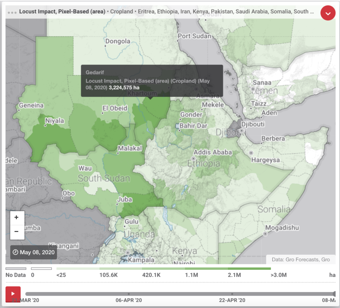
The darker areas represent lower than expected NDVI levels, indicating locust impact. The total impacted area has increased dramatically in the past six months; damages in the most severely affected region, Gedarif, South Sudan, have exceeded 3 million hectares.
The model does not account for factors aside from locusts, such as climate change and farming practices, that may also shift NDVI levels from historical averages. In consideration, agricultural impact data should be used as a supplement, and not a replacement for on-the-ground reports of locust presence.
Gro-Intelligence updates their data approximately twice a month; we can display impact charts in two time periods side by side, and scan for changes. This is a useful trick to identify locust presence and movement, where areas that have become “darker” represent presence of locusts within that time slot.
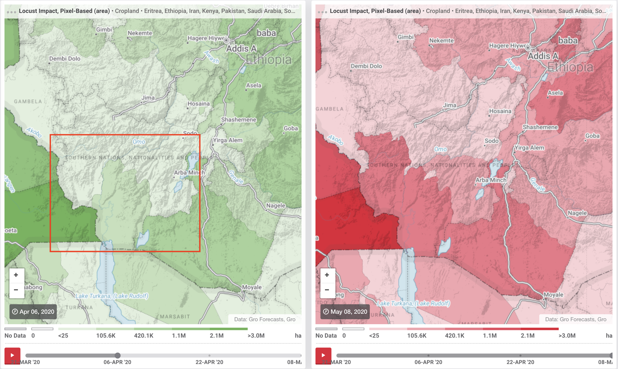
In the above example, the same crop map for two time periods (April 6th in the left, and May 8th in the right) are displayed for Southern Ethiopia. During the month, several changes have occurred in NDVI levels in the region; the most striking is around the highlighted area of Omo, Ethiopia above Lake Turkana. When we further examine the data for the highlighted area, 188,600 ha of cropland was impacted in Southern Omo by April 6th, compared to 717,575 ha by May 8th.
In comparison, the changes in adjacent regions are much more moderate. Thus we have identified an area with a high concentration of locust activity.
Video Correlation
For almost every major city that a locust swarm passes through, there will be individuals posting videos of locust sightings. Many of the initial videos and media related to locust activity were uploaded to Twitter. These posts are relevant in both confirming locust presence, and documenting the visual and human impact of locust swarms.
One particular place of interest is Jaipur, a sprawling city of four million and the capital of Rajasthan state of India. Jaipur is located only 241 km from New Delhi, and has been reported as one of the hardest hit by locusts.
We can use the geocode search feature of Twitter to locate tweets geotagged to its longitude and latitude. The input, in The twitter search bar, to display all tweets geotagged within 100km of Jaipur that contain the word locust, is “locust geocode: 26.885147,75.650472, 100km.”
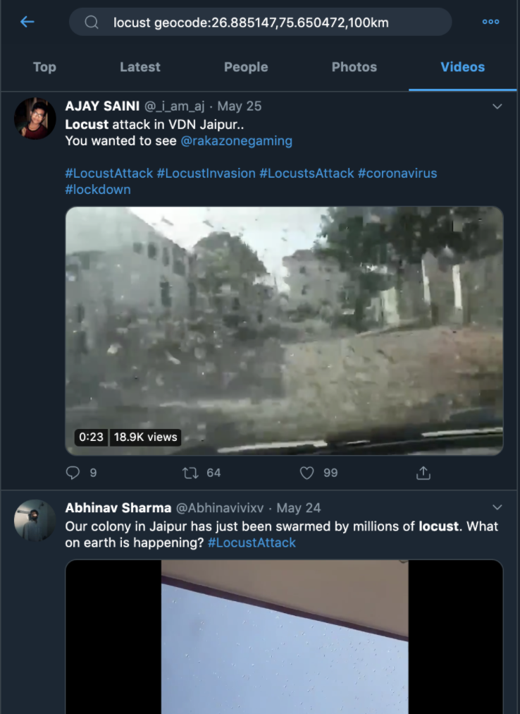
Filtering to only videos, there are dozens of first hand sightings of locusts in the region. The earliest video is dated to May 10th near Ajmer Shariff, a shrine 100 km outside of Jaipur (archive link):
Today at 5:15 pm in Ajmer Sharif city a huge wave of huge white feather creatures which looks like desert locust stormed the sky….
May all be well n blessed… Dua's from Ajmer Sharif pic.twitter.com/0NXz8DMBNT— Haji Syed Salman Chishty-Gaddi Nashin-AjmerSharif (@sufimusafir) May 10, 2020
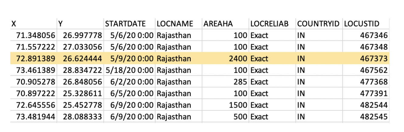
In the United Nations dataset, we can also search for specific locations through filtering the “LOCNAME” tab to display only data in the Rajasthan region. The May 10th video corresponds to a May 9th report of the largest locust group sighted in Rajasthan, with a size 24 times larger than earlier swarms.
There are two previous locust reports on May 6 which were not reflected in the Twitter search as their locations were more than 100km outside of Jaipur; when we expand our search area, videos dated to May 7th are picked up, which reflect the earlier groups.
The one day offset between UN reports and Twitter posts may be the cumulative result of time zone differences, delays in sightings, or the delay between capturing a video and posting it on Twitter:
Locust(Tiddi) at baytu Barmer pic.twitter.com/l3qFM5Rwu6
— Robin (@Robin03190042) May 7, 2020
(archive link to tweet above)
In this example, we were able to correlate the first-hand video sightings of a locust swarm with UN reports through pinpointing the date and location. Correlation is key to verifying data, and increases our understanding of a locust swarm through combining information (ie. images, swarm size, agricultural impact) unique to each method of locust tracking.
Conclusion
Locusts have been historically difficult to track because of their unpredictable movements, and the fact that their movements occur across borders. However, a coordinated and informed control effort is vital for local responders and NGOs in mitigating this crisis. Understanding the data is crucial in controlling this outbreak through predicting swarm movements, identifying areas of locust breeding, and directing pesticide and control operations.
We strongly encourage you to personally check out the data, and have listed all of the featured tools below.
Locust Hub: https://locust-hub-hqfao.hub.arcgis.com/
Swarm Dataset: https://locust-hub-hqfao.hub.arcgis.com/datasets/swarms-1?showData=true
Windspeed: https://www.windfinder.com/
Weather and Rainfall: https://worldview.earthdata.nasa.gov/
Agricultural Impact: https://app.gro-intelligence.com/displays/WdK0QlkqK
The author would like to thank Johanna Wild for her help with this piece.