Azerbaijan Pushes into Nakhichevan Borderlands
Translations:
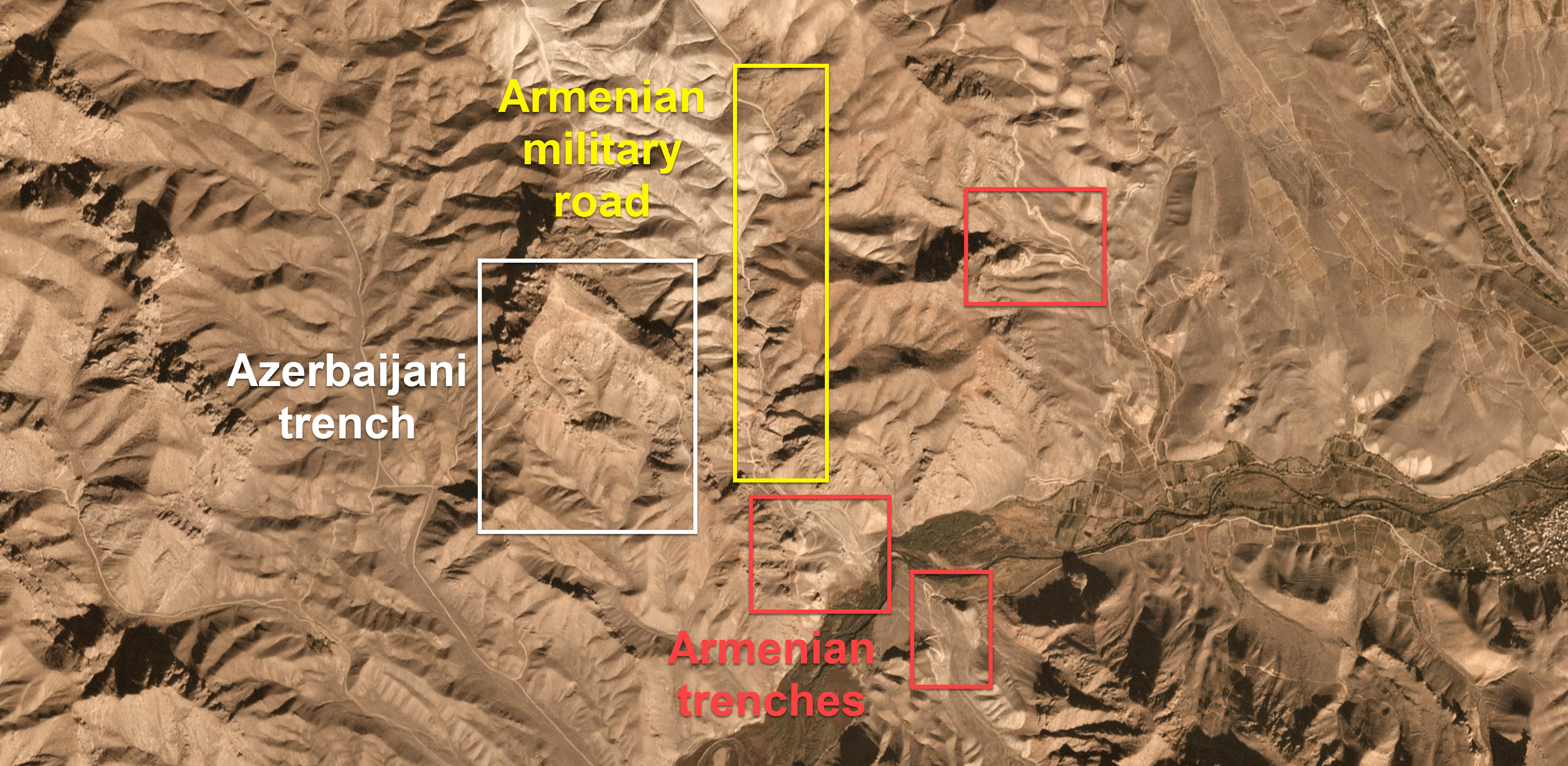
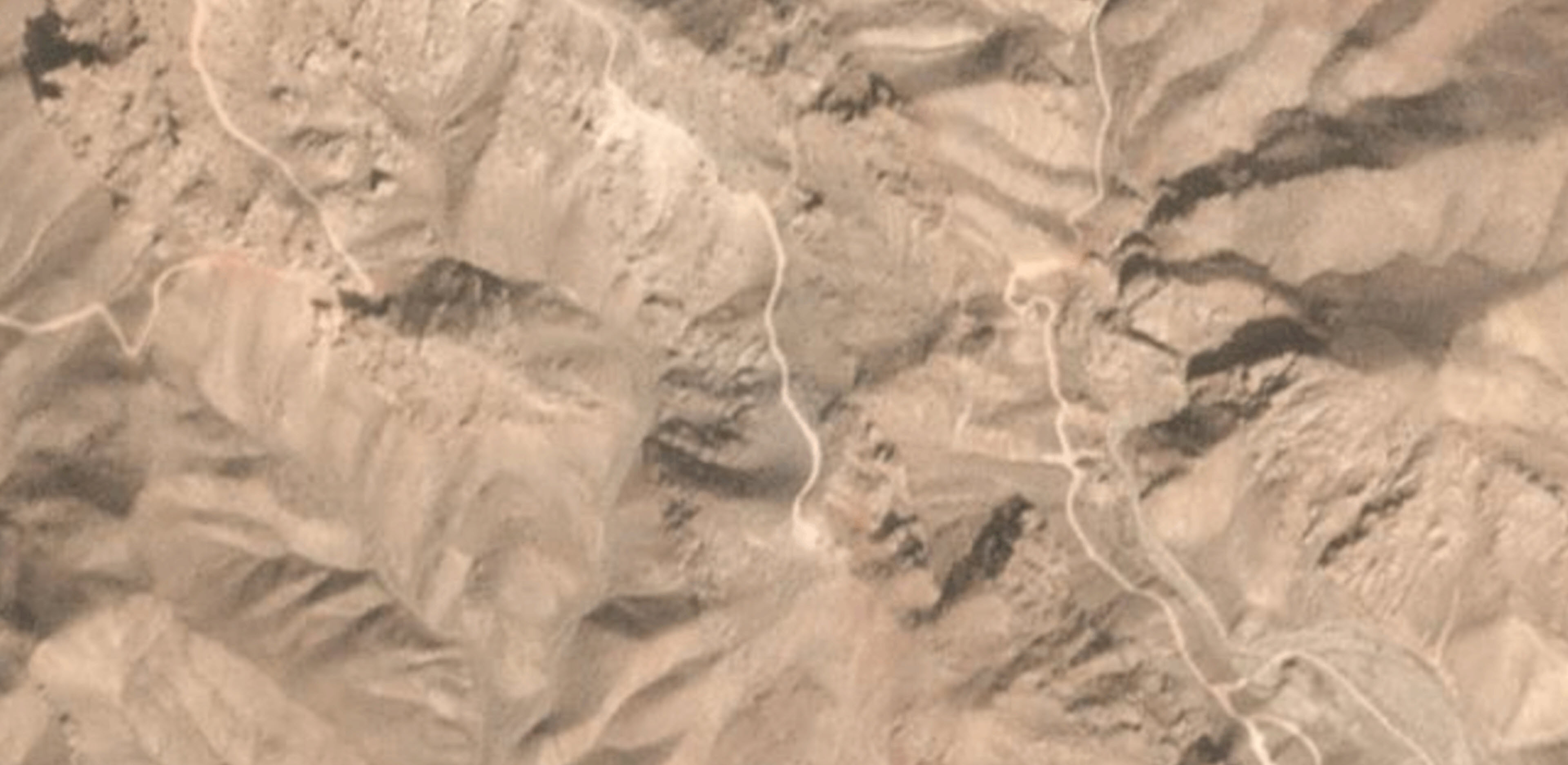
This Azerbaijani trench (white) is the latest in the engineering works completed by the Azerbaijani military. These latest actions have led to the strategic height coming under the control of Azerbaijan during autumn of this year. Imagery courtesy of Planet Labs, 28 October 2018. Click the image for full size.
Recent satellite imagery from Planet Labs shows ongoing engineering works by the Azerbaijani armed forces on the Nakhichevan border into what was once considered neutral territory.
Azerbaijani attempts to sidle up closer to the Armenian frontline since the 1994 ceasefire have primarily taken place on the Nagorno-Karabakh border, reducing the point of contact to fewer than a few hundred meters in most areas.
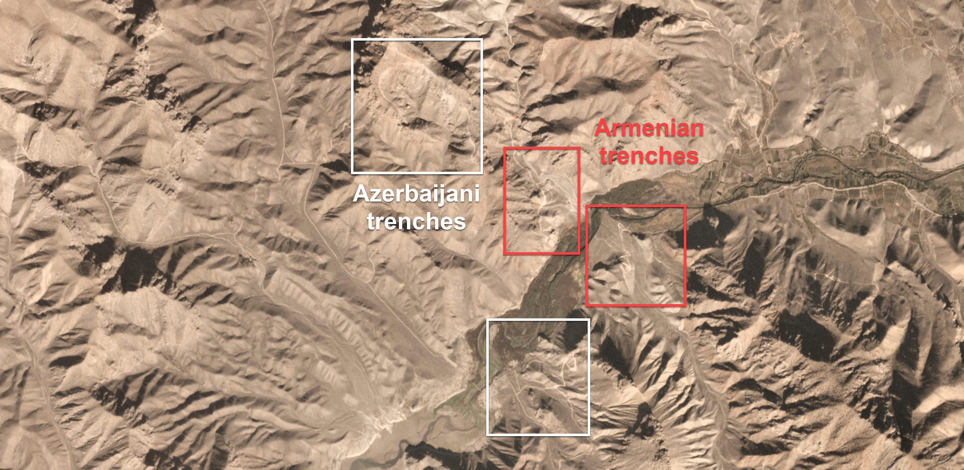
The east-most Armenian trench is likely unmanned. Imagery courtesy of Planet Labs, 31 October 2018. Click the image for full size.
These moves along the border of Nakhichevan, one of which is detailed in the above imagery and in other reports, have been the largest takeover of territory since the end of the war. Armenia has also used similar tactics with its push into new heights in 2012 and in 2014/2015, but recent imagery provided by Planet Labs indicates that Azerbaijan is now in more favourable positions than Armenia following the last ten years of jockeying for positions in the region.
Azerbaijan’s goal of improving its position in the region, including new engineering work of constructing roads, and pushing closer to Armenian trenches has the potential to diverge into a new conflict on a second front. Bellingcat has previously reported on Azerbaijan increasing its military presence in the Nakhichevan Autonomous Republic.
Hayk Khachikyan, an analyst from Razm.info, earlier this year noted three sections of engineering works pushing into the neutral territory in his analysis “What is Happening in Nakhichevan?” According to Khachikyan, Azerbaijan’s expansion into new strategic heights in the border area was “only a push into neutral ground.” Although the terrain entered is not considered a part of Armenia, it may have larger consequences due to the fact that major Armenian roads are now under threat of a possible direct attack.
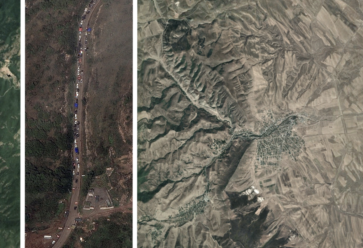
New satellite imagery from Planet Labs provides insight into Azerbaijan’s capture of favourable positions along the border of Nakhichevan. Below, a number of Azerbaijani positions and engineering works are visible, and will be highlighted further in this article.
Imagery courtesy of Planet Labs, 31 October 2018. Click the image for full size.
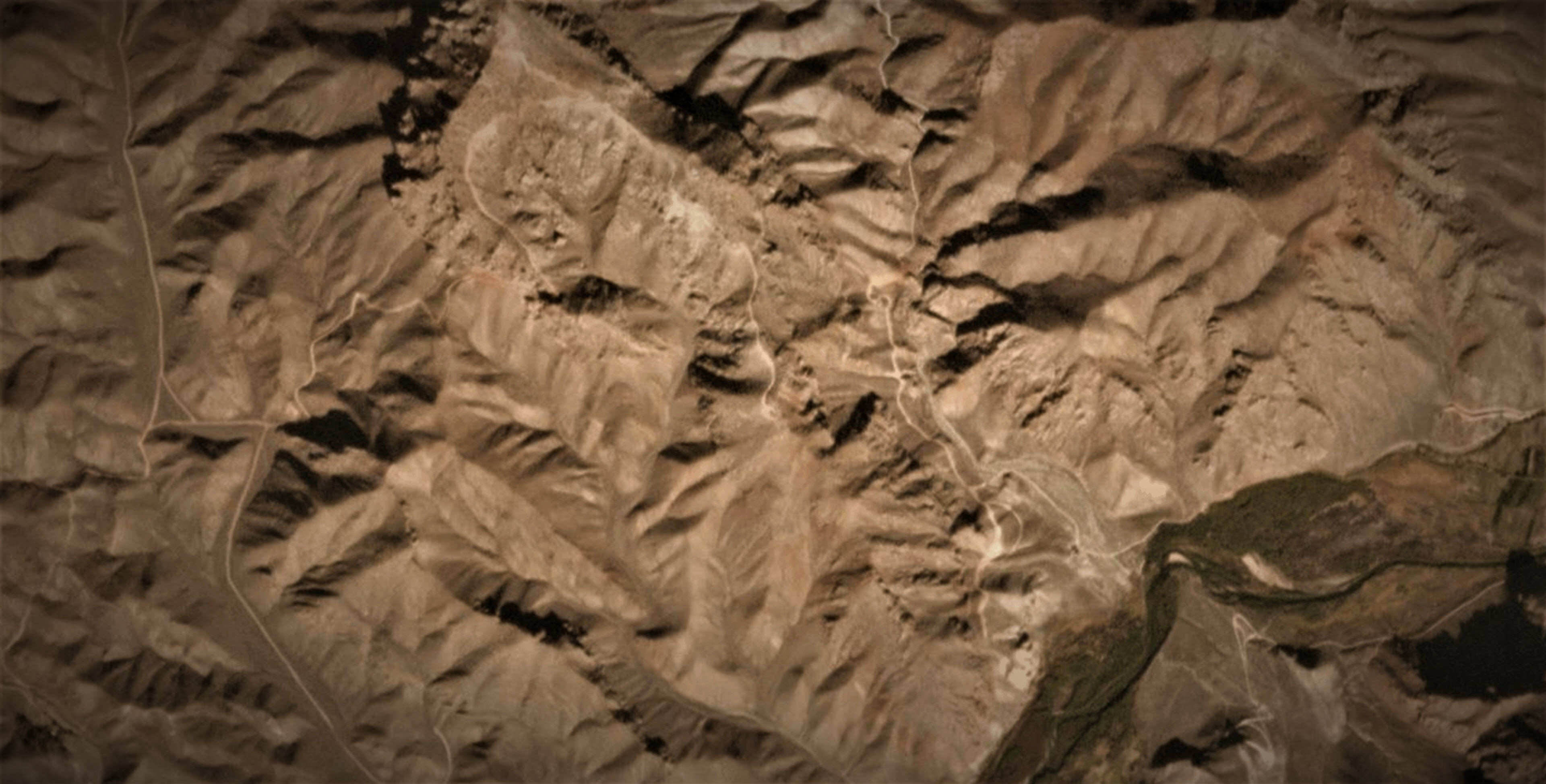
When considering satellite imagery since May 2018 and Khachikyan’s analysis, it becomes clear how Azerbaijan has shifted even closer to the unofficial demarcation line on the same roads that were being built around May of this year. The mountain northwest of the Arpa River, which now connects to the roads mentioned in Khachikyan’s article, was not fully taken by Azerbaijani forces in May 2018; however, fresh satellite imagery from Planet Labs showing new roads suggests that the mountain is now under Azerbaijan control.
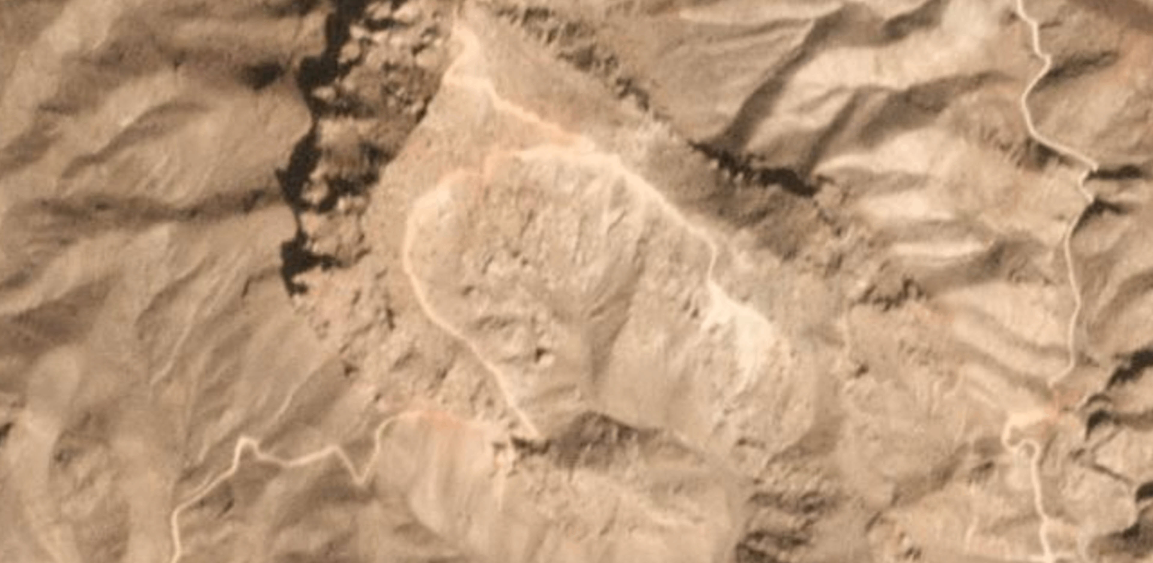
Over the summer and early autumn of this year, Azerbaijan has moved troops into these new positions along the mountain which oversees the Armenian first line of defence in the area and a vital Armenian military road (highlighted in yellow in the first satellite image in this article). Satellite imagery of the region suggests that this height that has minor tactical significance, came under Azerbaijani control some time in August or September 2018. Additionally, a new trench was constructed by Azerbaijan, as seen in the time-lapse imagery below, and has roads leading towards the Armenian side.
Azerbaijani trench on 19 May and 30 September 2018 (©2018 Planet Labs, Inc. cc-by-sa 4.0)
Satellite imagery reveals Azerbaijan has constructed new roads towards unmanned strategic points along the mountains, leading towards the frontline and Armenian positions.
Azerbaijani road construction in newly-established position on 15 and 20 October 2018 (©2018 Planet Labs, Inc. cc-by-sa 4.0)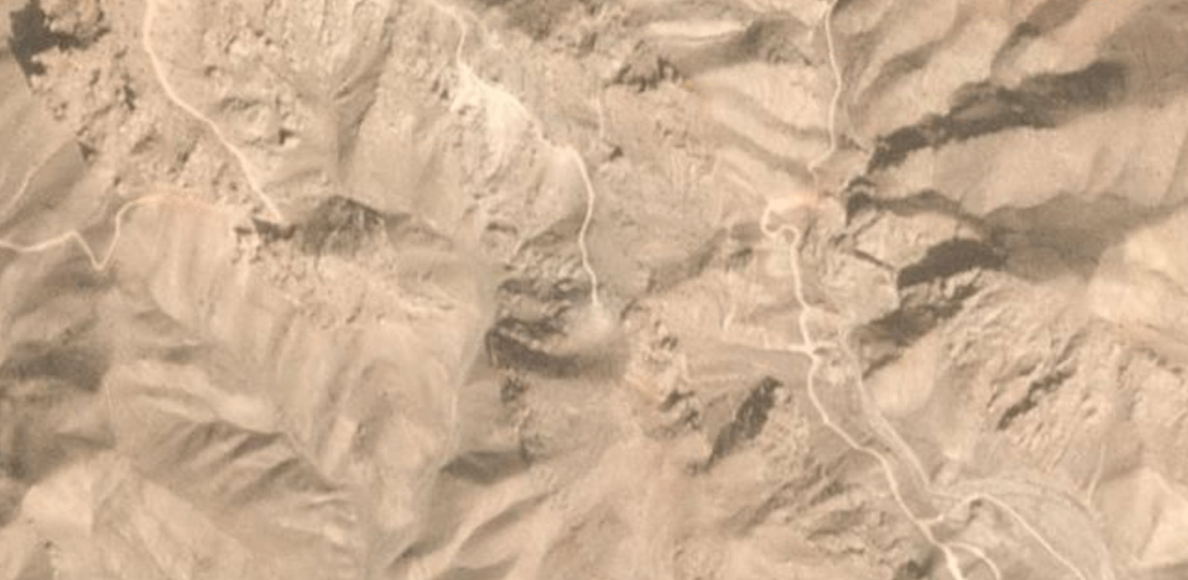
With this in mind, and taking into consideration the mountain terrain with opposing trenches, there will likely be continuing construction of new trenches and roads, and possibly lead towards Armenian manned posts to the south of the imagery provided in this article. Such a move could push Armenia off its first implemented line of defence (the bottom-right zoomed area in the satellite image below) due to increased vulnerability. In fact, one such post may have already been abandoned due to new Azerbaijani maneuvers (the eastern trench highlighted in red in the second satellite image in this post). Such a turn of events would constitute a new threat in which a seized, neutral territory could pose a threat to Armenian infrastructure and settlements — while also raising the question of Azerbaijan’s future plans with the militarization of the borderlands.
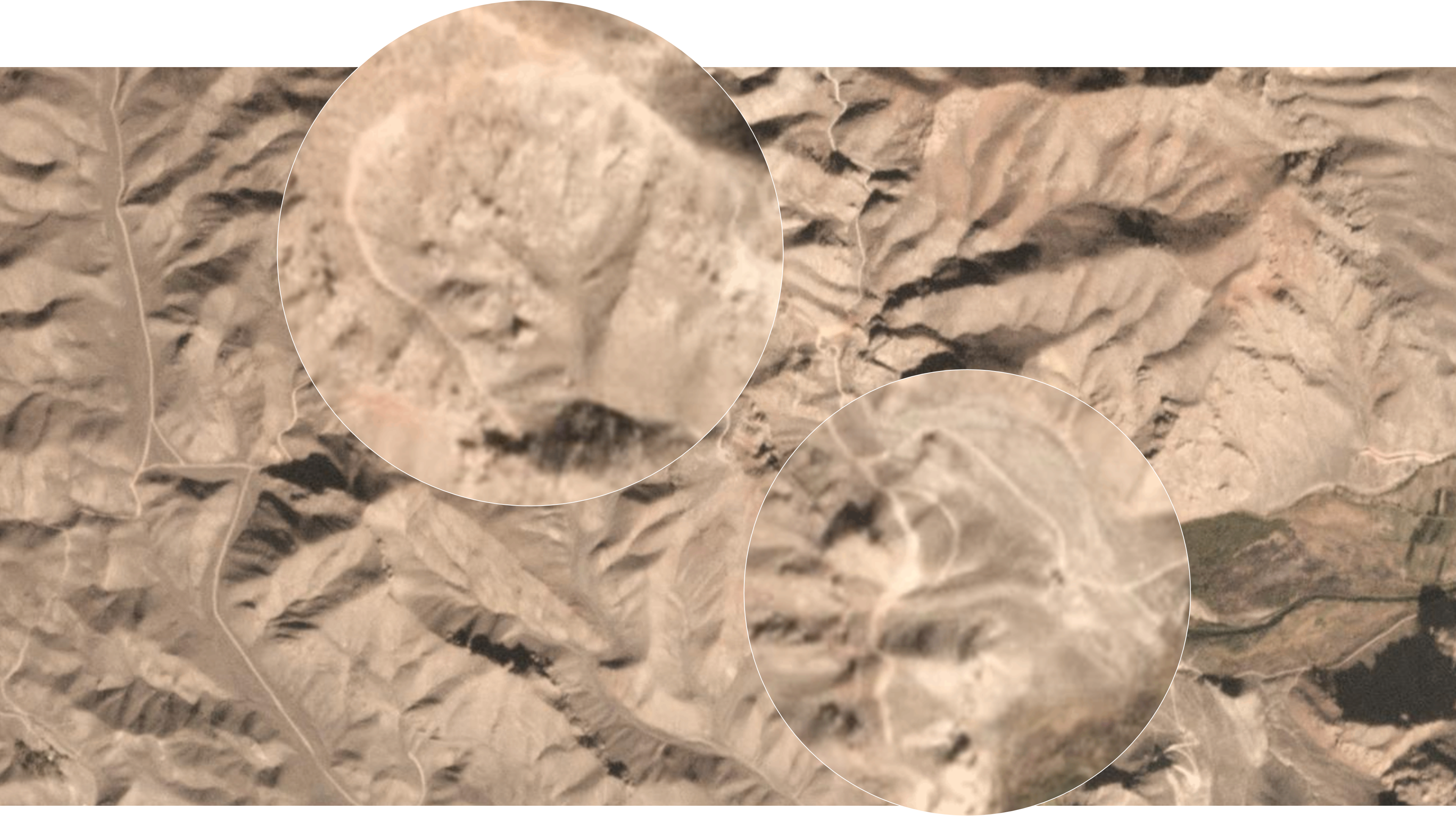
In between the zoomed-in trenches is a new road, which has been trickling down the mountain towards the Armenian trench (bottom-right zoomed area). The Armenian trench at the bottom of the mountain has been made more vulnerable in the last couple of months due to recent activity from Azerbaijan, with a chance that Armenian will abandon this position in the near future. This trench holds strategic value due to the fact that it connects to a military road that runs from Armenia. Imagery courtesy of Planet Labs, 31 October 2018. Click the image for full size.
While both nations have made moves into the border areas of Nakhichevan, Azerbaijan’s recent moves in the ongoing jockeying for advantageous territory could thaw the frozen conflict between the two Caucasian states.