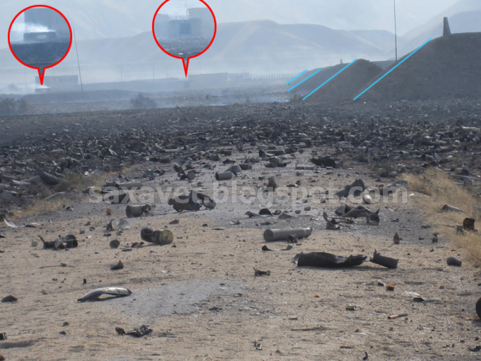
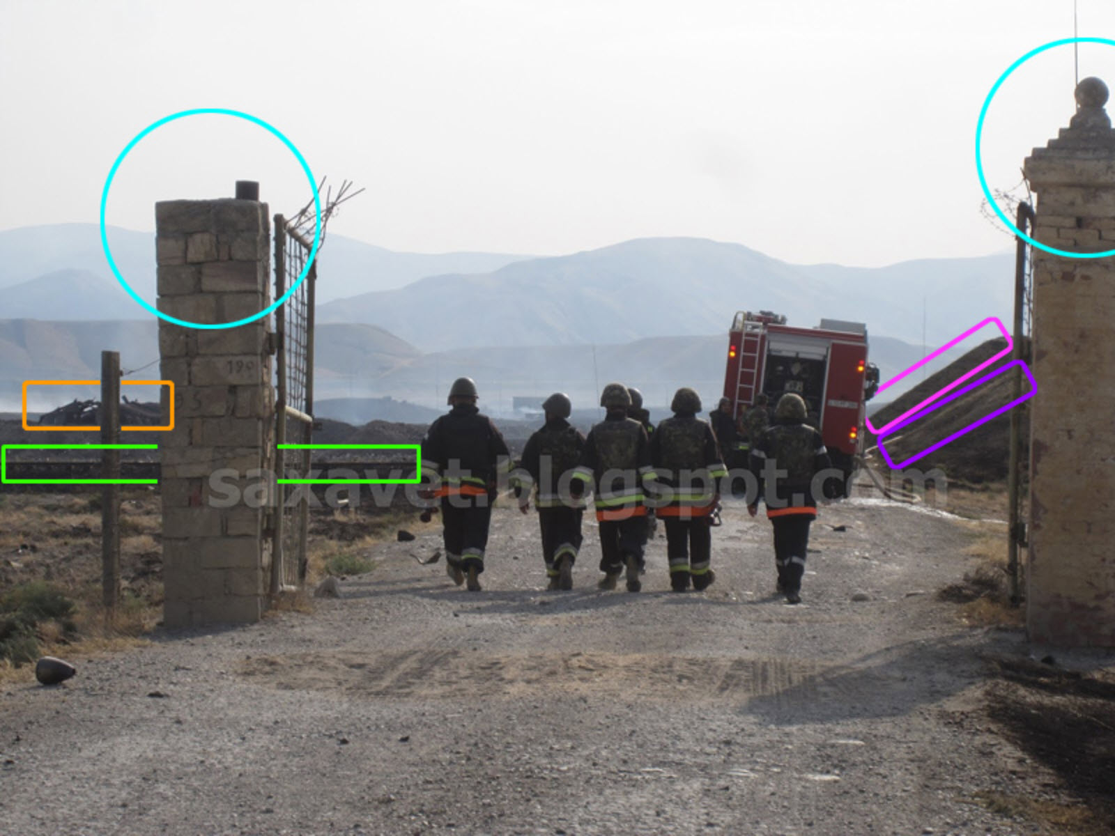
Measurements from imagery indicate that craters are between 25 and 35 meters wide. Superficial damage on the surface suggests that the underground storage units are likely undamaged. What is interesting, however, is that a closer look at historical imagery reveals many above-ground storage facilities, which now have been mostly destroyed. Also, cross-matching the craters identified on imagery and the location of storage units corroborates the damage of above-ground storage. Furthermore, pictures that have emerged online show fields of exploded artillery shells, confirming the existence of above-ground munition storage units and the extensive fallout.
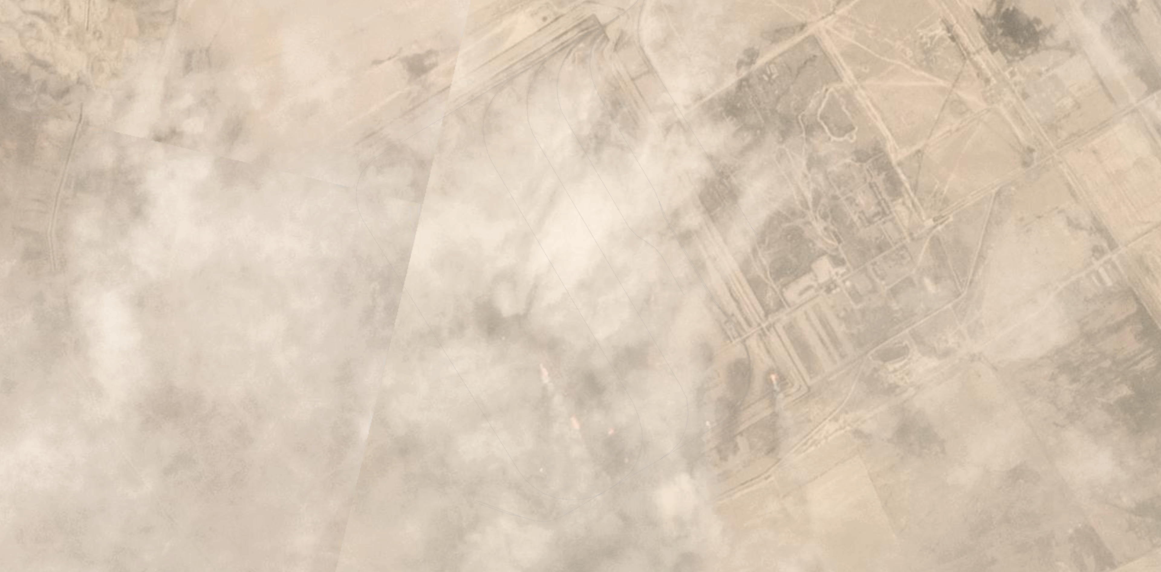
We can see the impact of the explosion by viewing the munitions installation before (August 23), during (August 27), and after (August 28) the explosion in the composite below, with all images provided by Planet Labs.
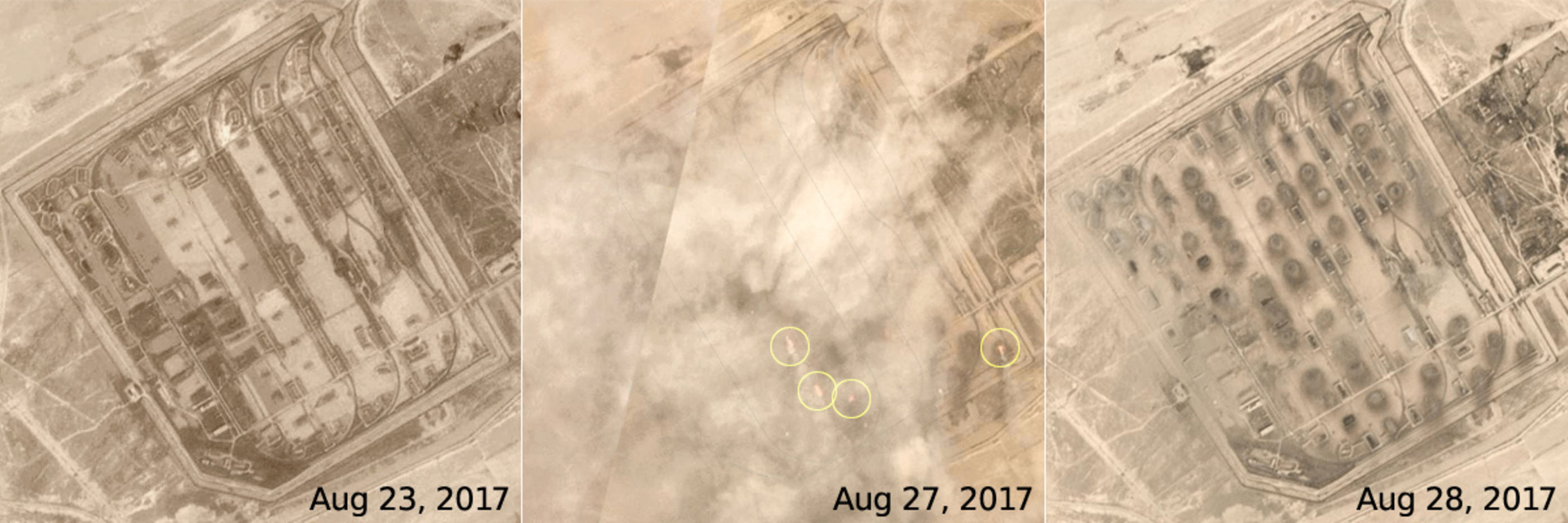
©2017 Planet Labs, Inc. cc-by-sa 4.0
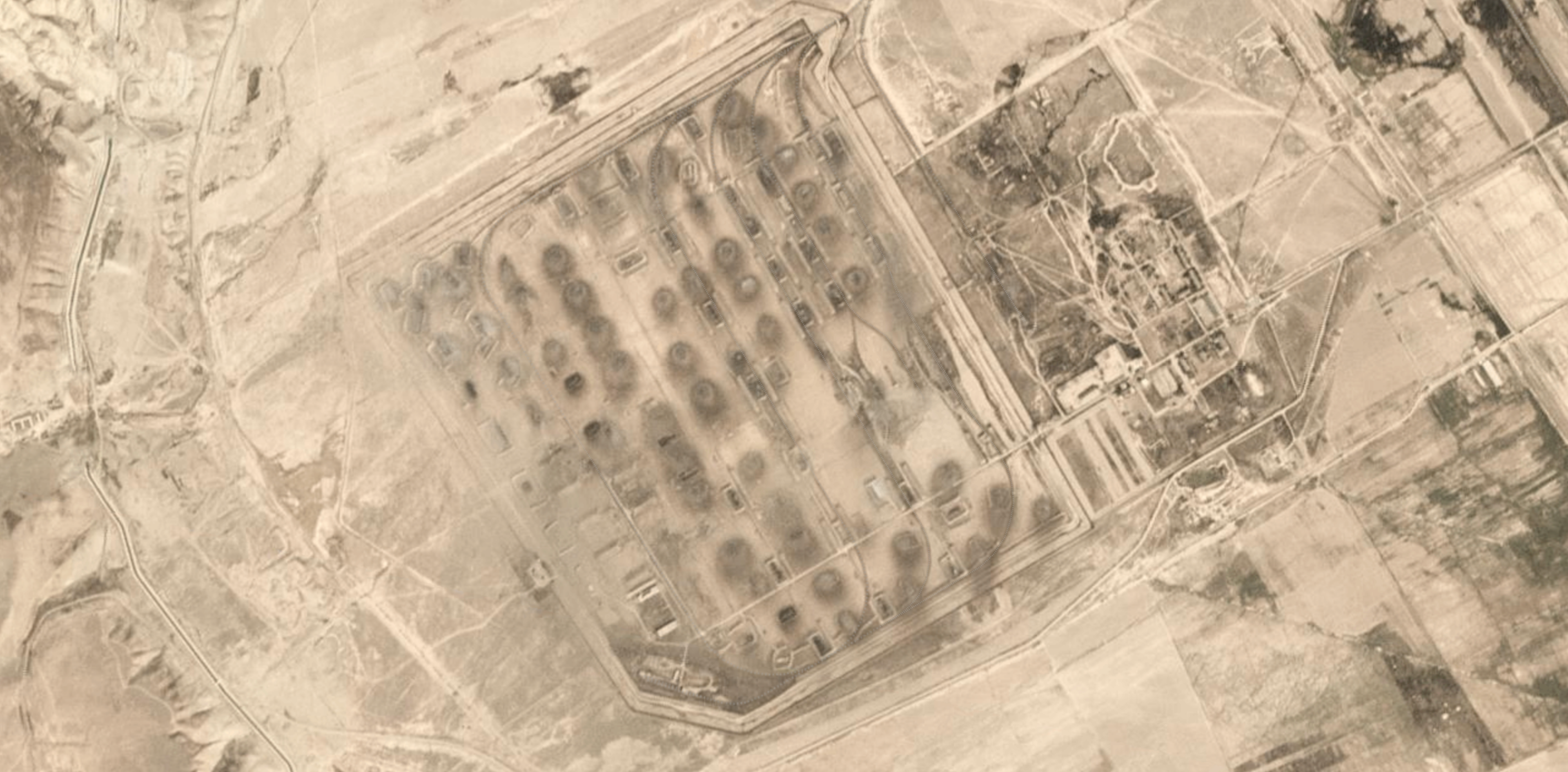
Yellow circles on the August 27th photograph mark the visible seats of fire. There are other smaller “hot spots”, but it is hard to tell whether these are fires too. Most of the area is covered with heavy smoke. A closer look at the August 27th imagery shows how the fires were still burning at the time when the image was captured.
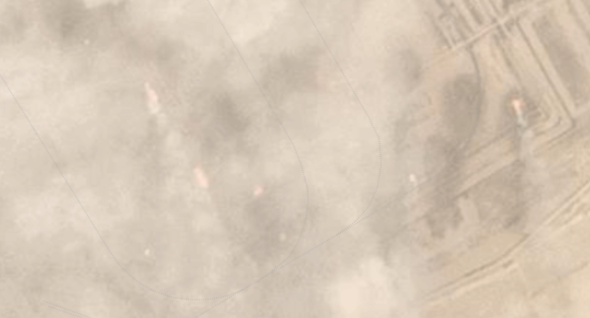
August 27, 2017. ©2017 Planet Labs, Inc. cc-by-sa 4.0
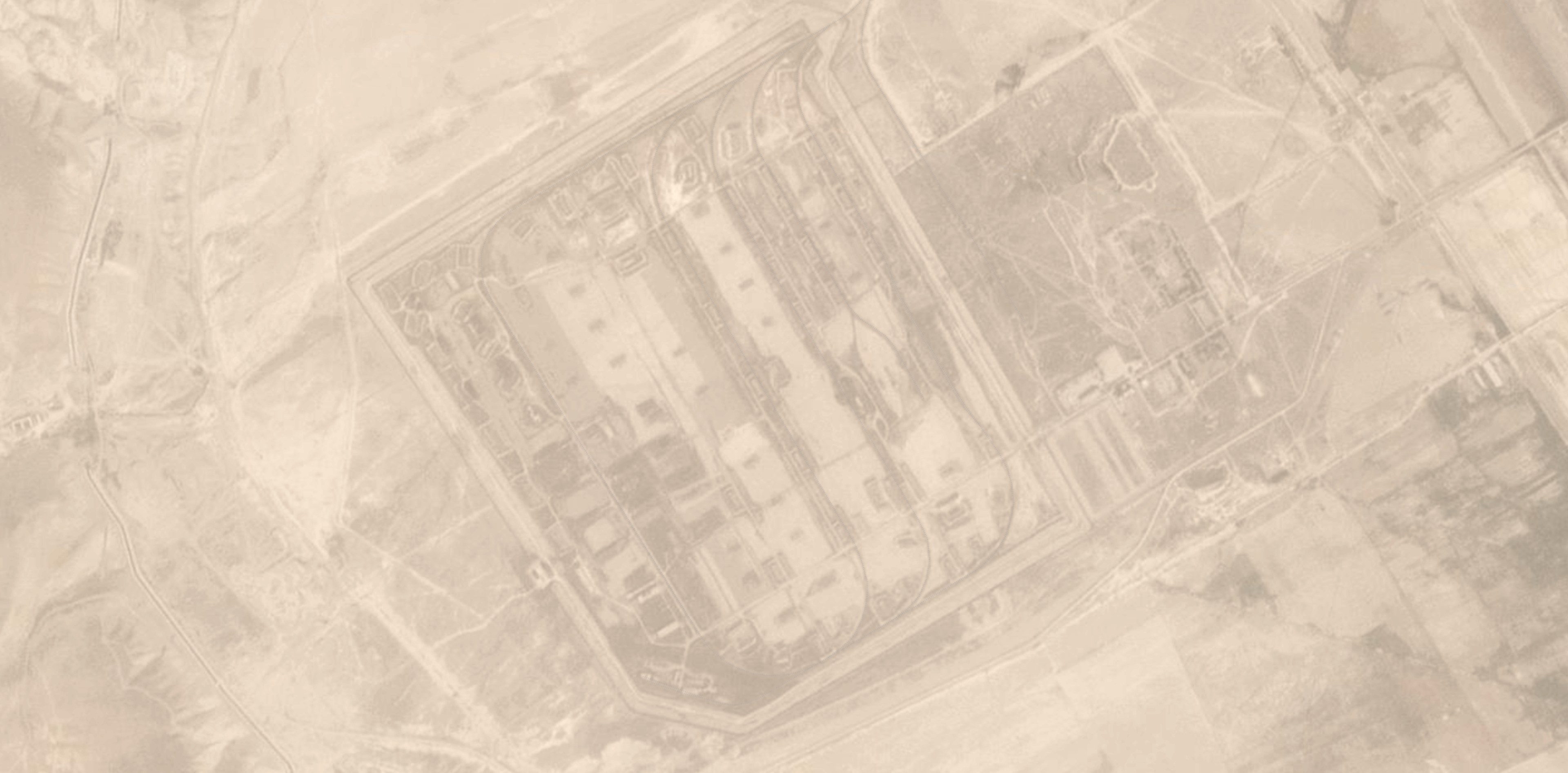
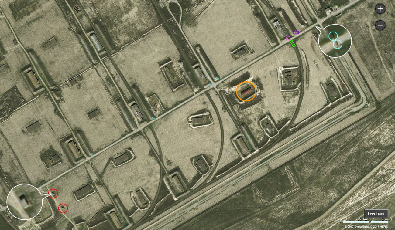
Below, we see imagery accessible on Google Earth from May 26, 2016, with craters (red circles) identified from the August 28, 2017 Planet imagery and seats of fire (full yellow circles with red outlines) identified from the August 27, 2017 Planet imagery. The three black circles show the objects that definitely had suffered from heavy fire, but have no visible craters. Also, underground installations are marked with green rectangles, and the carload system is marked with yellow lines. We used Bing’s imagery to identify these areas, as it has the highest resolution imagery available for this area.
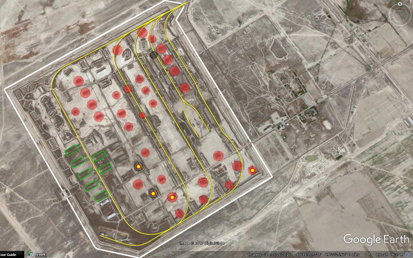
Source: Google Earth / Digital Globe
With such widespread damage, the clean-up operation and repairs to nearby villages that suffered damage will be costly. Indeed, the Azerbaijani MoD can use the incident as an opportunity to provide experience for its Explosive Ordnance Disposal Unit. Though the damage to the area was quite extensive, Azerbaijan got off relatively lightly considering the lack of mass fatalities when compared to other munitions explosions, such as the 2008 explosions at Gerdec, Albania, that resulted in 26 deaths. Finally, the full extent of the damage will be unknown until there are boots on the ground; in the meantime, the Bellingcat team will continue to monitor and update the situation with photos and imagery.
Satellite imagery from Planet Labs, Google Earth, and Bing maps, as well as images from the ground published by Azerbaijani photographer and journalist Səxavət Məmməd and the Ministry of Emergency situations of Azerbaijan were used for the analysis. The authors would like to acknowledge the collaborative efforts of Bellingcat and members of Razm.info, who provided additional photographs, image composites, and geolocations and for cross-checking imagery with Russian statistical information.