Viral Google Maps Images Shared Widely This Week Show Gaza Ruins. We Obtained More Recent Satellite Imagery
Earlier this week, several viral social media posts and news articles stated that Google had updated satellite imagery over Gaza.
The imagery shared in these posts and articles shows several areas, including the southern city of Rafah. Huge destruction is detailed in the images, including what appears to be entire neighbourhoods flattened
But the imagery wasn’t entirely new.
A Google spokesperson told Bellingcat that they regularly updated third-party satellite images and that the latest Gaza imagery had actually been available since June 2026.
Tomorrow's front page 📰
— The National (@ScotNational) September 28, 2026
New satellite pictures lay bare Israel's destruction of Gaza pic.twitter.com/E65GXUHwrG
Social media posts from earlier this year also detailed how Google Earth Pro users (a program that needs to be downloaded) had been analysing what appears to be the same imagery that was showcased this week by media outlets as early as May.
🧵Google Earth has updated its satellite imagery to 2026 for the central and south Gaza strip.
— Stinky (@Stinky915846091) May 22, 2026
In this thread, we will be going over some areas that I found interesting while I explored the update.
If you want a screenshot of a site, reply with the coordinates, and ill send. https://t.co/rPYzpKNRmW pic.twitter.com/iZpncz6bVH
Bellingcat has access to satellite imagery from commercial space company Planet Labs, which shows further destruction in Rafah after the June Google update.
The Planet Labs imagery also gives insight into destruction further north in Gaza as recently as September.
Demolitions and Destruction Continue
The Google imagery updated in June showed a satellite image captured by the Airbus satellite imagery provider several months prior, in February 2026.
When compared to a previous image of the same area that was published and visible on Google in June 2024, the difference is stark. Entire neighbourhoods have been razed while several school facilities near the Tal as Sultan area appear to be among the most prominent buildings still standing.
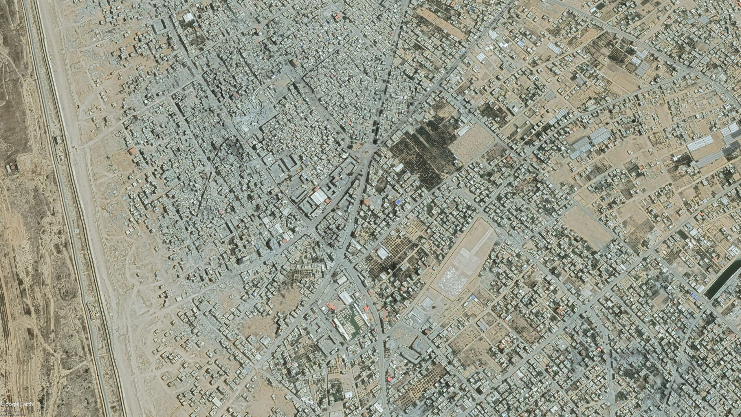
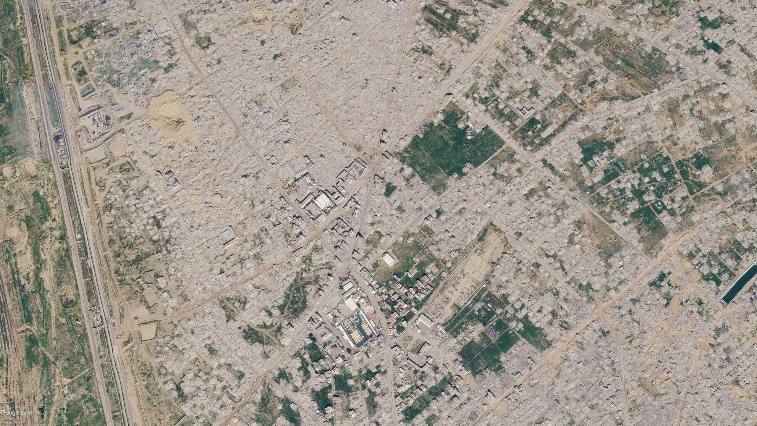
Satellite imagery shows visible changes across Rafah between June 2024 (left) and February 2026 (right). Image credit: Airbus via Google Earth.
Bellingcat previously reported on this destruction when it first started taking place in 2024. And the demolitions have continued since Google published its latest Airbus images in June.
The most recent high resolution imagery from Planet Labs, which uses its own constellation of satellites called SkySat, was taken in September. This was seven months after those now displayed on Google, and shows buildings near Rafah’s municipal stadium have now been demolished.
A number of schools and other buildings near the Tal as Sultan area previously still standing to the northwest of the stadium are also now shown to have been demolished in the September imagery.
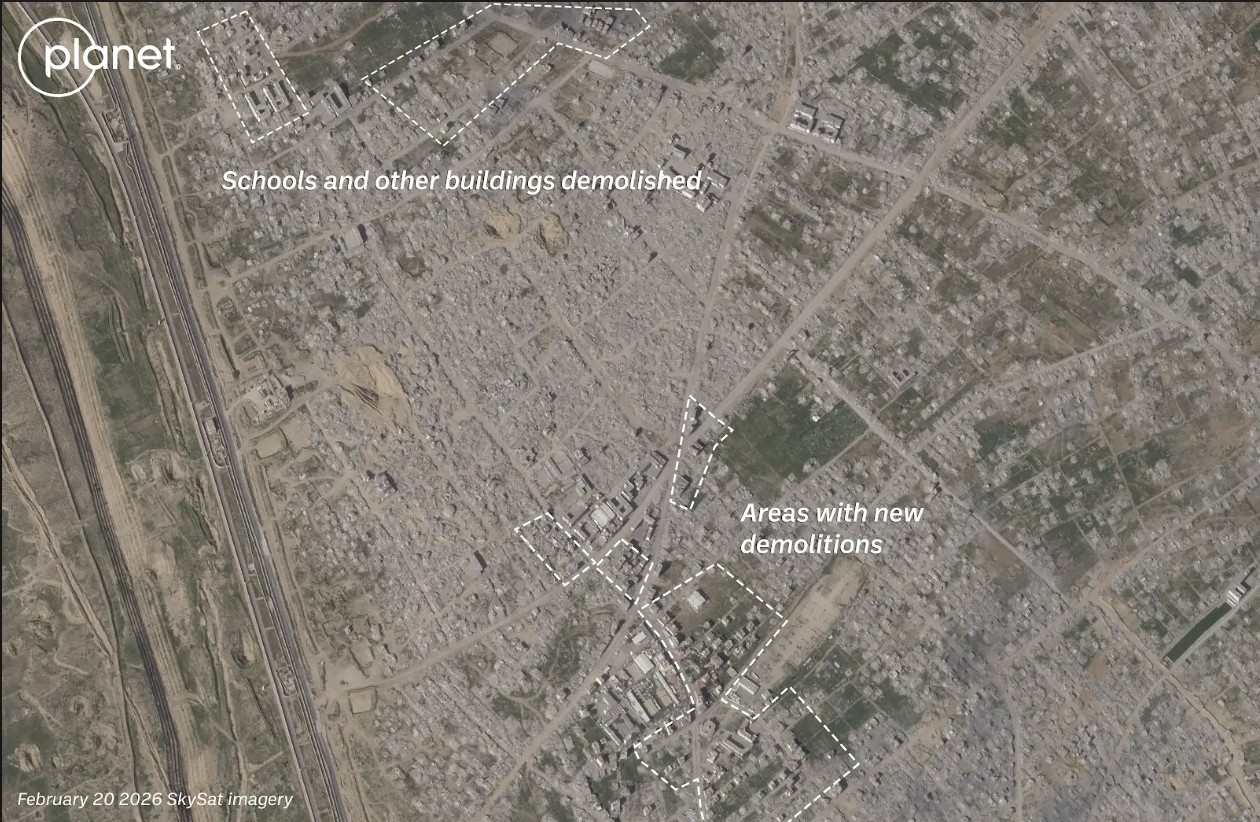
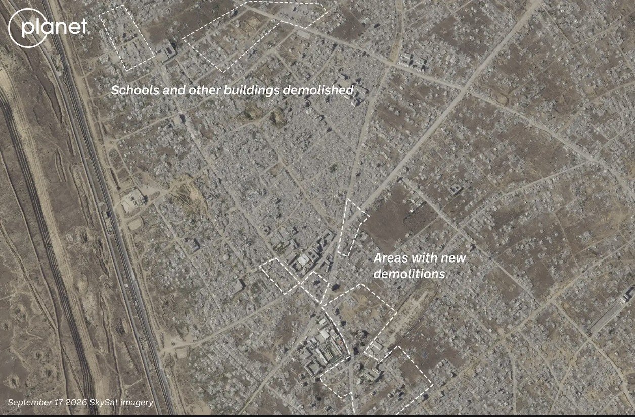
Satellite imagery shows visible changes across Rafah between February 2026 (left) and September 2026 (right). Image credit: Planet Labs PBC.
The centre of Bani Suheila, a town just to the east of Khan Yunis in southern Gaza, also looks drastically different from how it appears in the Google imagery.
While most of the buildings surrounding the centre of the town are visibly damaged or destroyed in the Airbus imagery, updated imagery from Planet shows that even more of the buildings have been reduced to rubble, with an IDF outpost now visible on top. A large earthen barrier is also visible, cutting through the town from north to south.
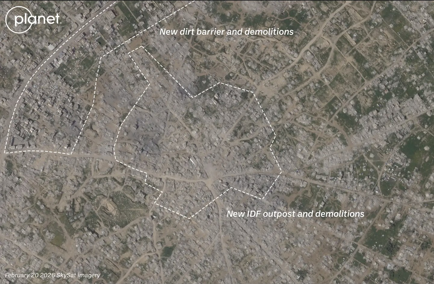
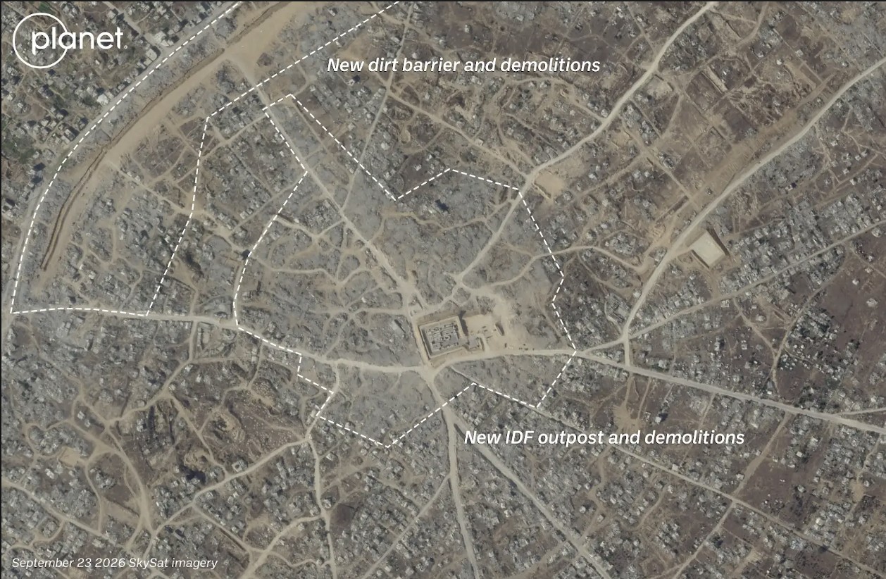
Satellite imagery shows visible changes in town of Bani Suheila between February 2026 (left) and September 2026 (right). Image credit: Planet Labs PBC.
Recent Planet Labs imagery also shows the level of destruction in northern Gaza, primarily in the eastern areas of the towns of Shujaiya and Jabaliya.
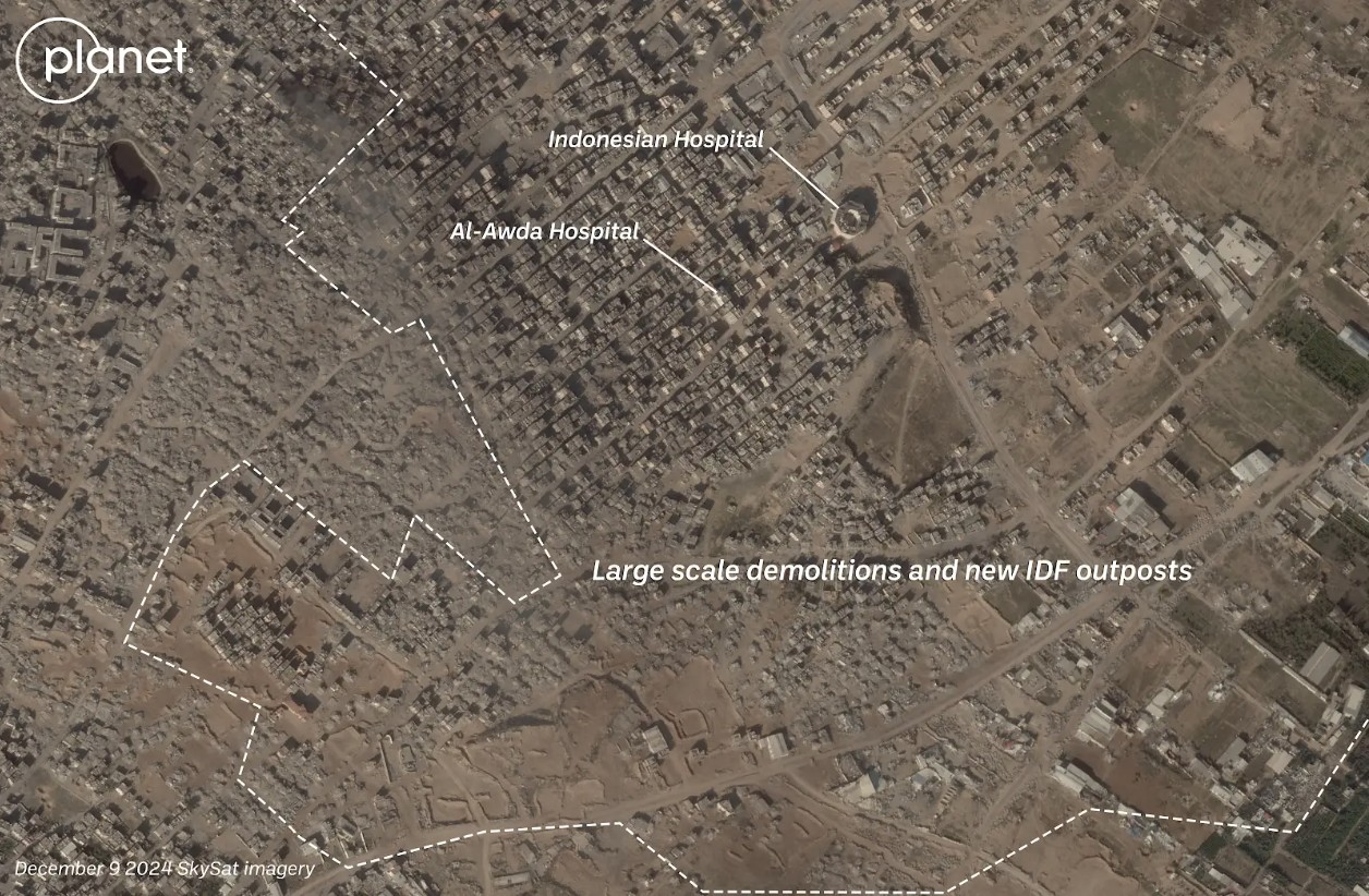
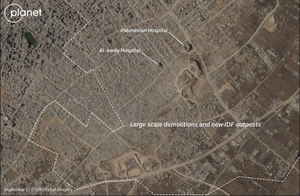
Satellite imagery shows visible changes in town of Jabaliya between December 2024 (left) and September 2026 (right). Image credit: Planet Labs PBC.
Both Shujaiya and Jabaliya were already heavily damaged before the most recent ceasefire. Satellite imagery shows that the IDF has continued razing large parts of both neighbourhoods while building outposts.
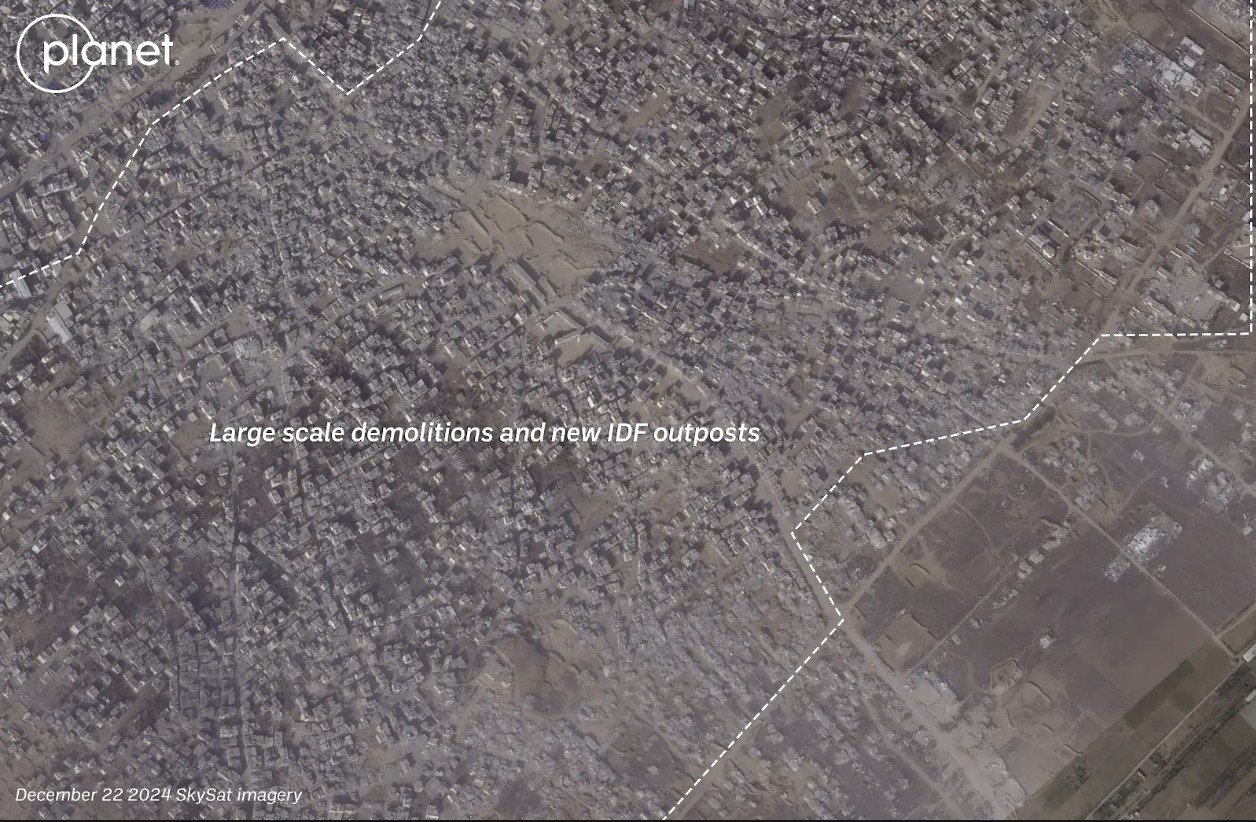
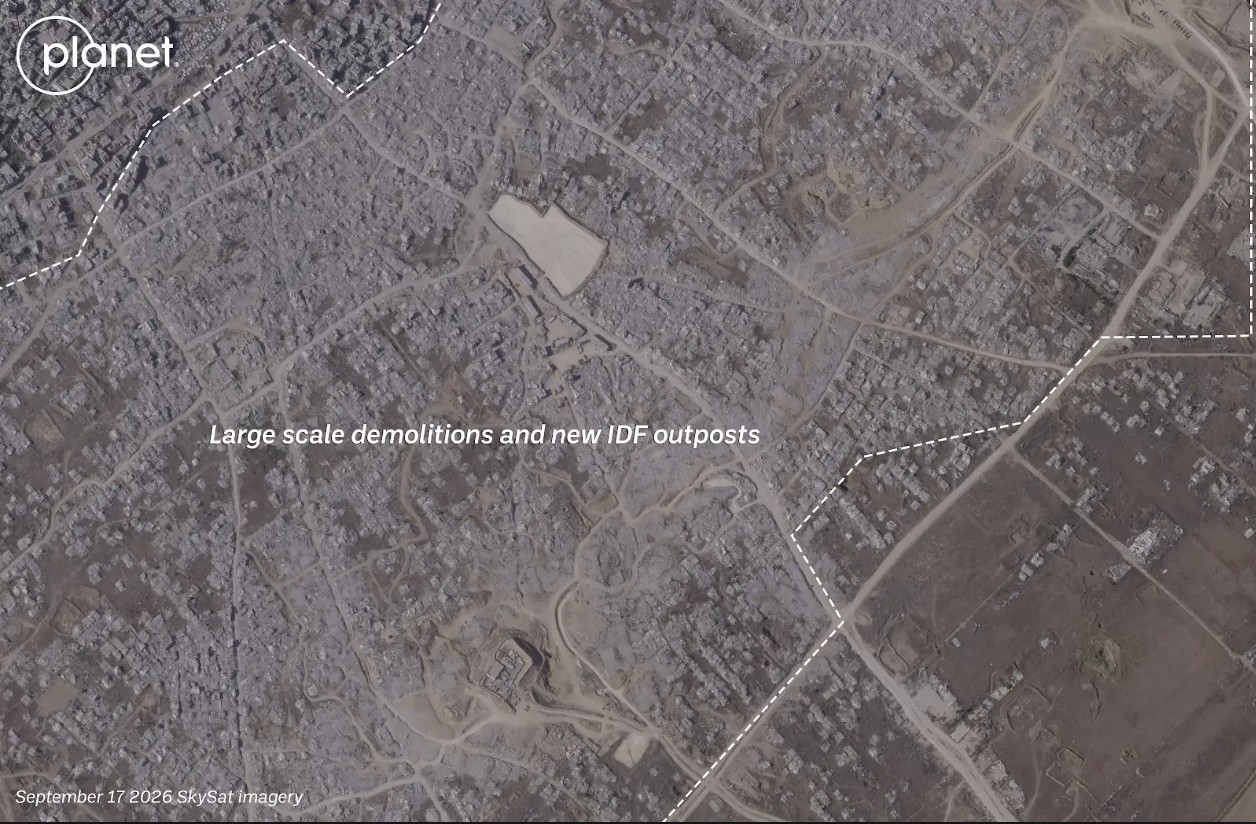
Satellite imagery shows visible changes in town of Shejiya between December 2024 (left) and September 2026 (right). Image credit: Planet Labs PBC.
Earlier this week, reports also surfaced that an Israeli satellite imagery provider had released images over northern Gaza before they were taken down.
Satellite images such as these appear to show that Israel has not stopped reducing buildings in Gaza to rubble despite the continuation of an official ceasefire.
Israel previously told media that the mass demolitions were part of an effort to “demilitarise” Gaza.
According to United Nations data, about 82 percent of the structures in Gaza are damaged, with two -thirds of them destroyed.
With international journalists still widely unable to enter Gaza freely, satellite imagery remains one of the only ways to assess the true scale of destruction and to understand what is happening on the ground.
Bellingcat is a non-profit and the ability to carry out our work is dependent on the kind support of individual donors. If you would like to support our work, you can do so here. You can also subscribe to our Newsletter and follow us on Bluesky here, Instagram here, Reddit here and YouTube here.