Geolocating Hamas-Led Attacks on Israeli Civilians
Explosions and gunshots are heard in the background as militants record their attack inside a kibbutz.
In one video a militant appears to see someone inside a home and shoots towards them. In another, they shoot the tyres of a parked ambulance. In yet another, they break into a house, where a mobile phone has been left on the kitchen table and is still ringing.
The videos have been circulating on social media and show part of recent surprise attacks in Israel carried out by Hamas and Palestinian Islamic Jihad.
Since the Hamas-led attacks on October 7 that killed hundreds of civilians, Telegram has been a key platform for the distribution of footage of the events. Many videos that emerged can provide insight into the massacres.
Bellingcat analysed footage from the sites of two attacks at kibbutzim — one at Kerem Shalom and one at Sufa — filmed by militants to verify the footage and details of the attack. We have done this in previous cases, including the recent Israeli raids in Jenin. Some of the footage linked in this article is graphic and readers are warned that they may find some of the details in this article disturbing.
As of Friday, Israeli authorities confirmed at least 1,400 deaths since the October 7 attacks, while the Palestinian Ministry of Health confirmed more than 3,400 deaths in Gaza. More than 200 Israelis were taken hostage in the attacks, Israel’s military has said. According to the Office of the United Nations High Commissioner for Human Rights, more than one million Palestinians have been displaced amid Israeli airstrikes carried out in advance of a planned ground invasion.
Common Features of the Videos
Both series of videos were posted on a pro-Israel Telegram channel called South First Responders (SFR). It should be noted that they are posted in short snippets on the channel and at least one of the videos contains a jump cut, which shows it was edited. Despite this, we were able to verify the events recorded in the footage. Both appear to have been filmed from wearable cameras, such as a GoPro, worn by militants involved in the October 7 attacks. Six videos were posted by SFR showing events in Kerem Shalom and 10 were posted by SFR showing events in Sufa.
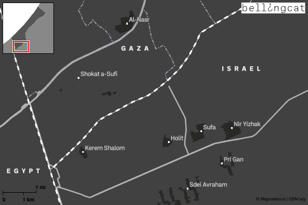
Other footage of these incidents may exist, but these two video series each appear to have been filmed by a single individual. Both video series were filmed on the morning of October 7. Solar calculation from the footage indicates both attacks occurred around the same time between approximately 7:00 and 8:30 am. Both kibbutzim, which are roughly five kilometres apart, are located less than three kilometres from the border with Gaza.
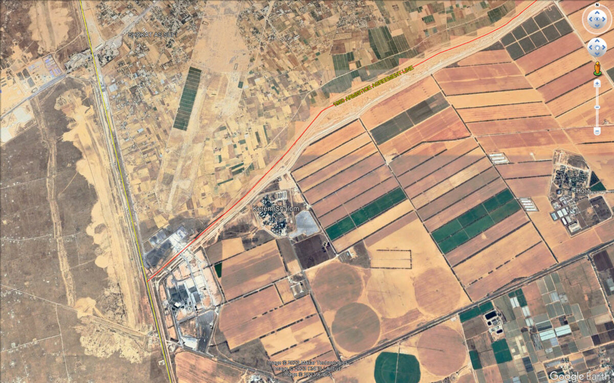
The Attack on Kerem Shalom
The SFR Telegram channel posted a series of six videos taken from the camera of a fighter who participated in an attack on Kibbutz Kerem Shalom on October 7. The kibbutz is located immediately adjacent to the border between Gaza and Israel, and approximately two kilometres from the border with Egypt.
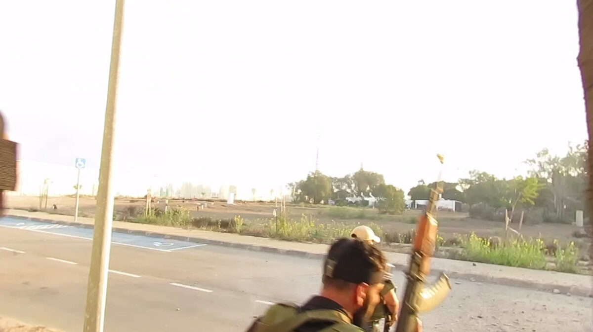
The six videos show fighters checking their weapons and driving from Gaza to Kerem Shalom. Some of the videos show fighters blowing holes in the fence separating Gaza from Israel in the vicinity of the kibbutz. Others show the fighters in the kibbutz, firing into homes and exchanging fire with people.
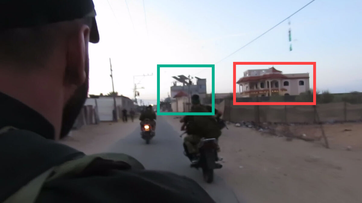
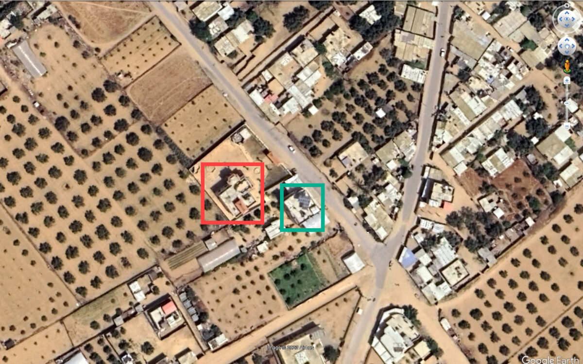
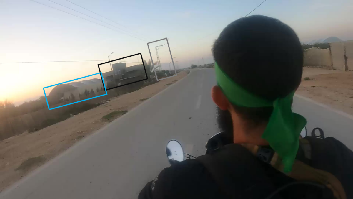
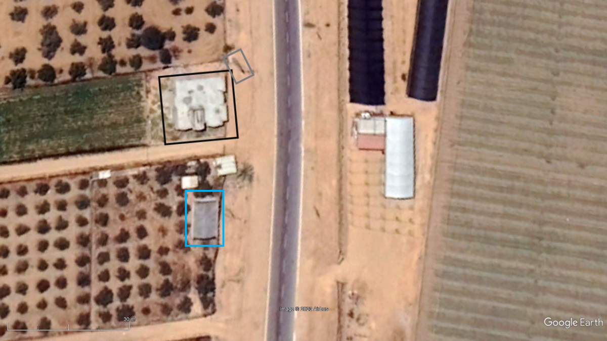
In the first video we see the militants set off on a motorbike as part of a convoy. At one point in the video, they pass two buildings that we geolocated here 31.2512347, 34.2679498. One of the buildings has solar panels on its roof that is visible in satellite imagery.
Two other videos show the fighters breaking through what appears to be the barrier wall separating Gaza and Israel, as well as the kibbutz’s perimeter wall. One of these videos indicates that the fighters broke through the kibbutz’s northwestern point, at approximately these coordinates: 31.22788, 34.2815.
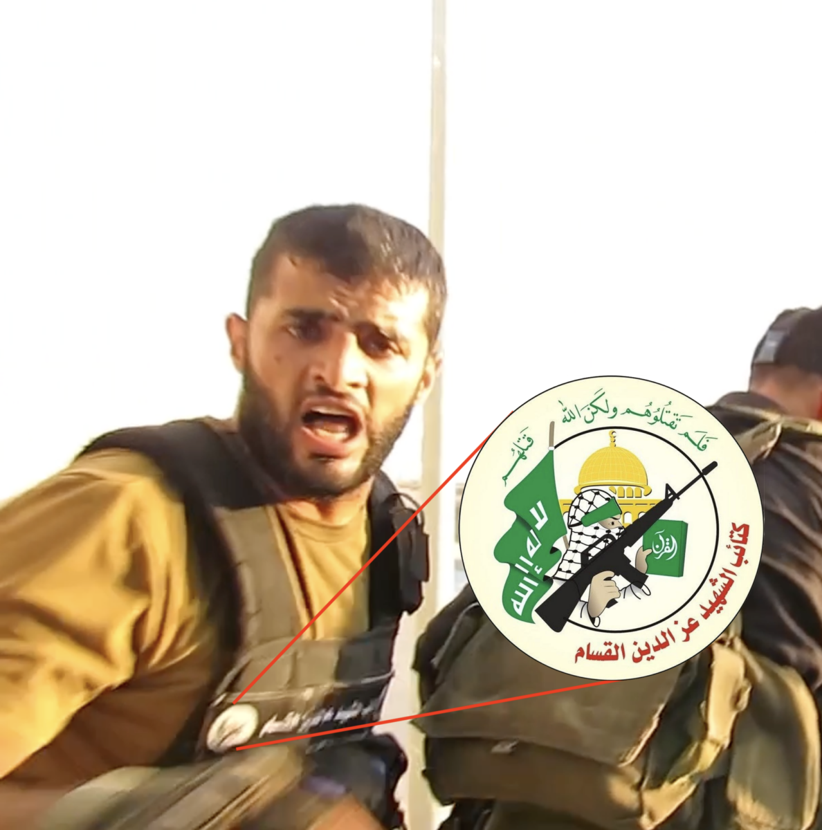
One of the fighters waving others through the perimeter wall has what appears to be an Al-Qassam Brigades patch on his combat vest (Al-Qassam is the military wing of Hamas).
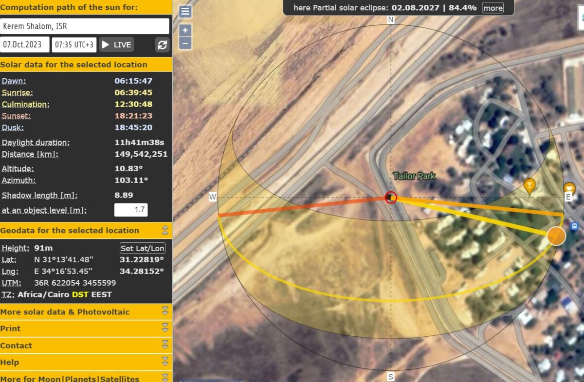
According to a solar calculation, the militants crossed into Kerem Shalom about 7:30am on October 7.
The sixth and final video in the series shows the fighters engaged in a firefight inside Kerem Shalom Kibbutz. We can not see in the footage who they exchange fire with but the fighter recording the video is eventually hit in the firefight, and presumably killed.
Bellingcat contributor Jake Godin geolocated the sixth video to the kibbutz’s northwestern edge, approximately 100 metres from the spot where the fighters breached the Kerem Shalom wall.
The Attack on Sufa
Benjamin den Braber, a Senior Investigator at the Centre for Information Resilience, geolocated a series of videos from Sufa on 15 October and shared them on X, formerly Twitter. We have independently verified and confirmed several of the geolocations and outlined them below, starting with the second video, when the militant puts on the camera and sets out towards Israel.
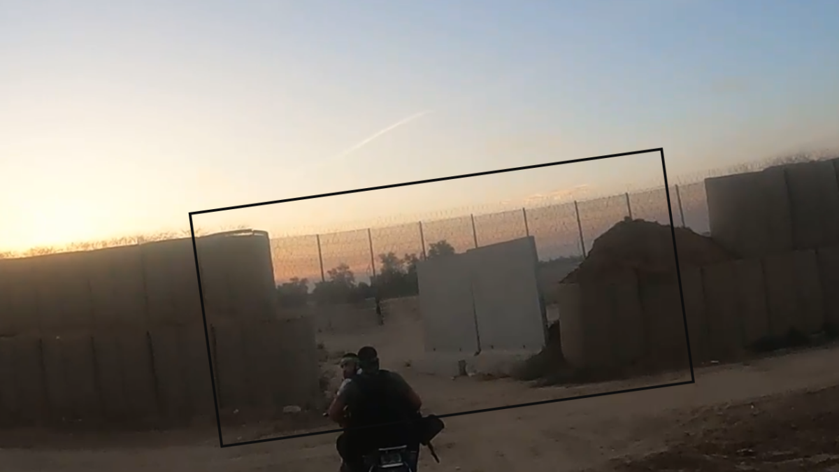
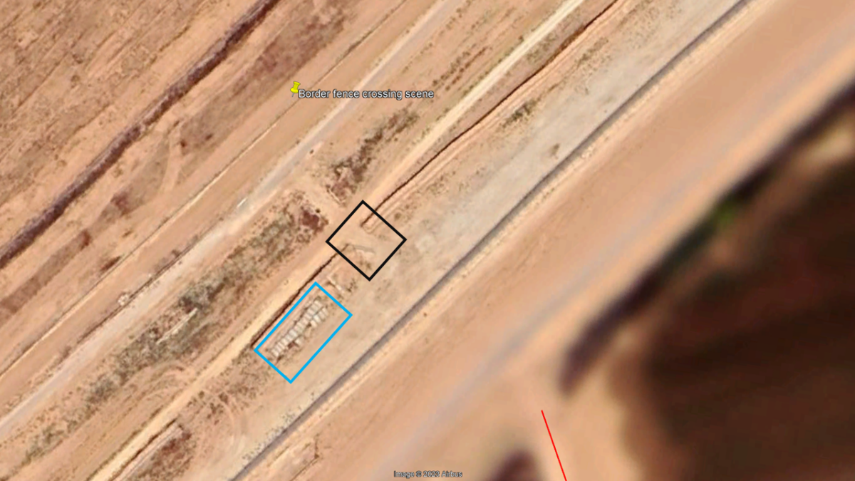
The second video in the series shows the militant donning a camera, and riding on the back of a motorcycle along a straight road, which leads towards the border. We geolocated the end of the clip to these coordinates 31.268085, 34.321625, just before the border.
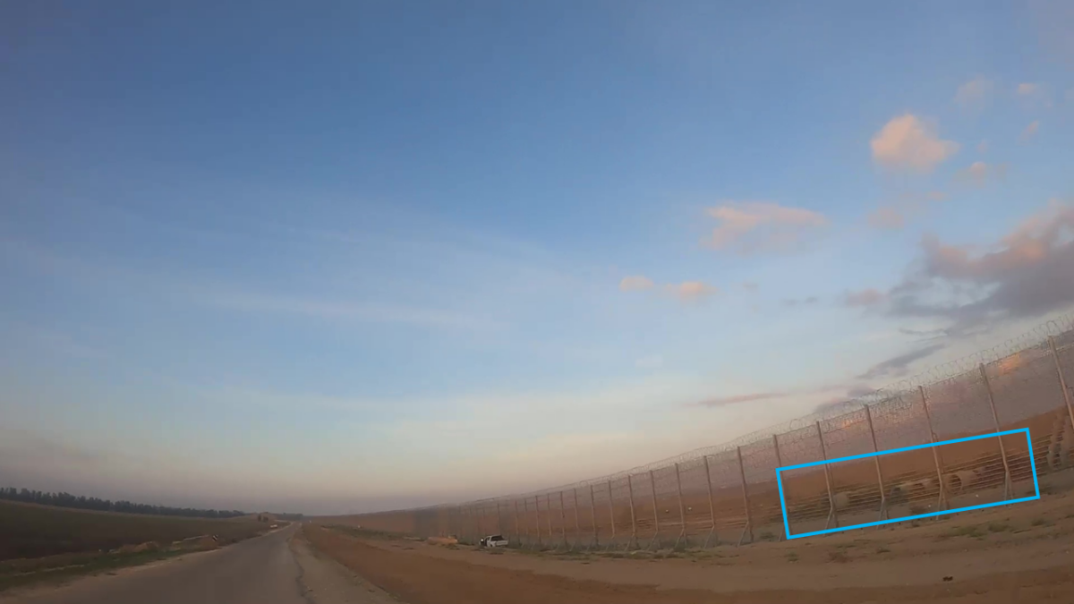
In the footage we can see the moment the motorbike struggles across a gap cut into a border fence between Gaza and Israel.
Using the footage from the militant, taken as he was crossing through this fence we calculated that he crossed the border approximately 7am on October 7, based on the sun azimuth.
Next the militants join another group of fighters on motorbikes and pass through a concrete barrier wall into Israel at 31.265254, 34.335050.
In the third video, the militants drive west down a road and we see them shooting into a fenced area, which we matched to the perimeter of Kibbutz Sufa.
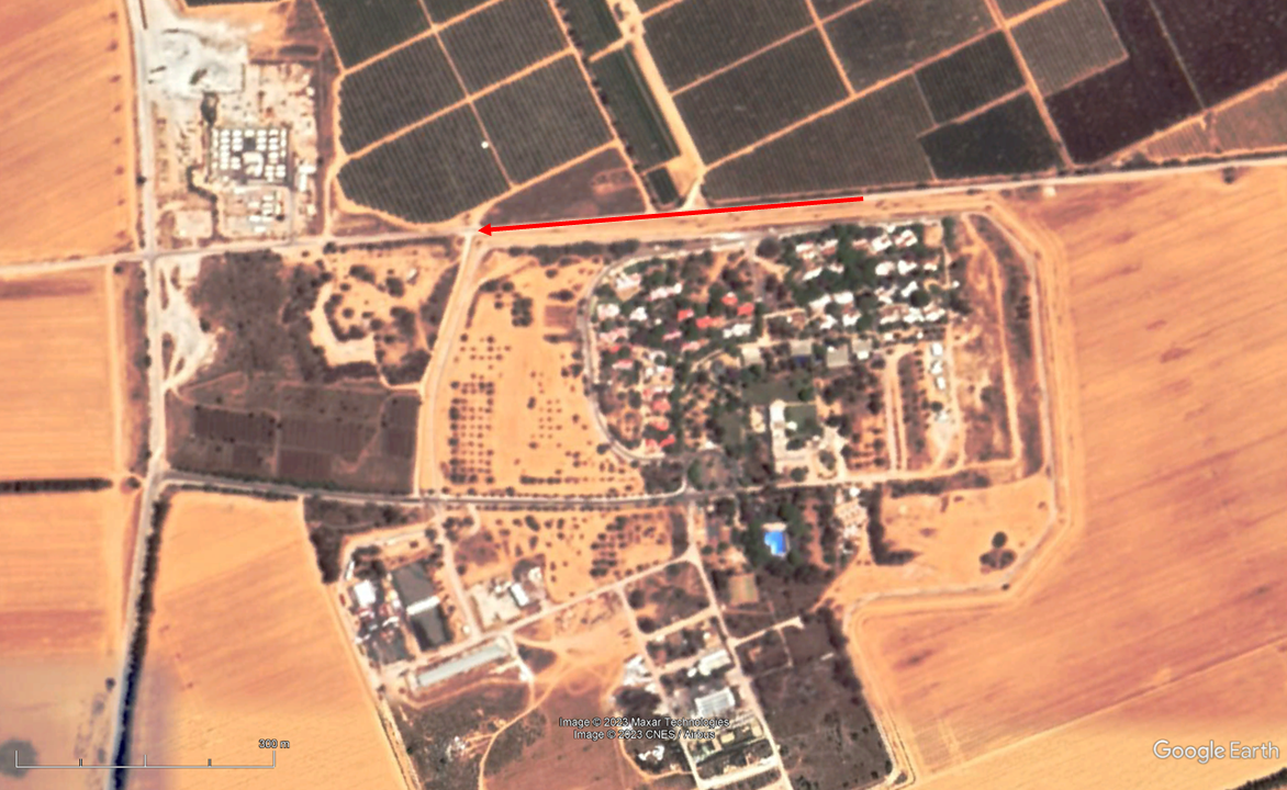
Before the militants arrive at the gate of the kibbutz they stop at a junction nearby what appears to be an Israeli military base. This can be seen in aerial imagery from Govmap.il located at 31.240231, 34.336213 a few hundred metres away from the kibbutz.
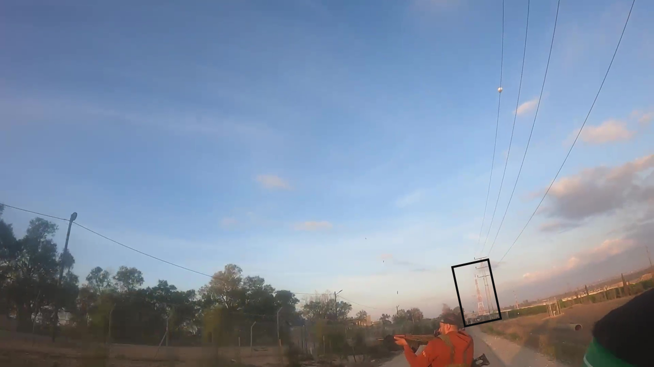
We counted at least 16 other fighters at the location.
The fighters shoot at a target further down the road, possibly IDF forces. One man fires a rocket-propelled grenade (RPG).
In the next videos, the fourth and fifth in the series, we see three men jump the gate of the kibbutz. As they approach the gate we see the sun is low on the horizon, beaming from beyond the gate straight into the camera. This suggests it was still early in the morning when they arrived at the entrance of the kibbutz.
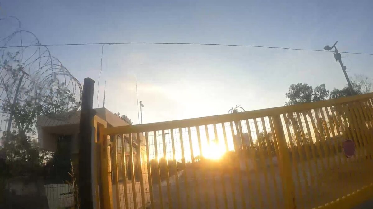
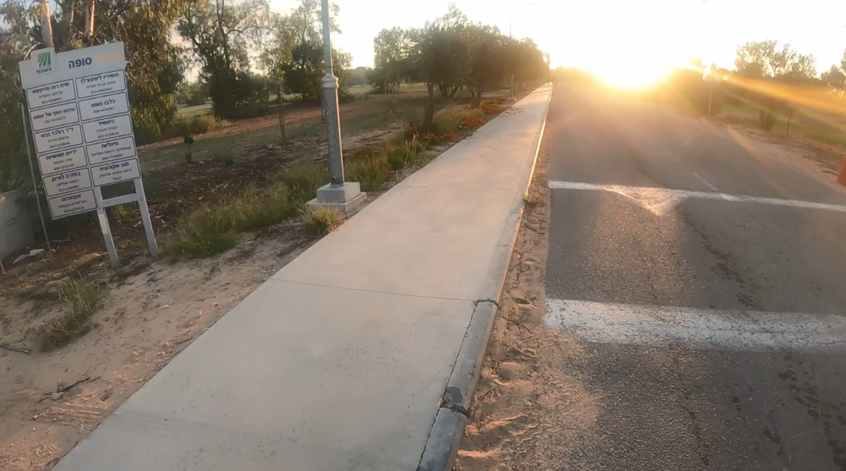
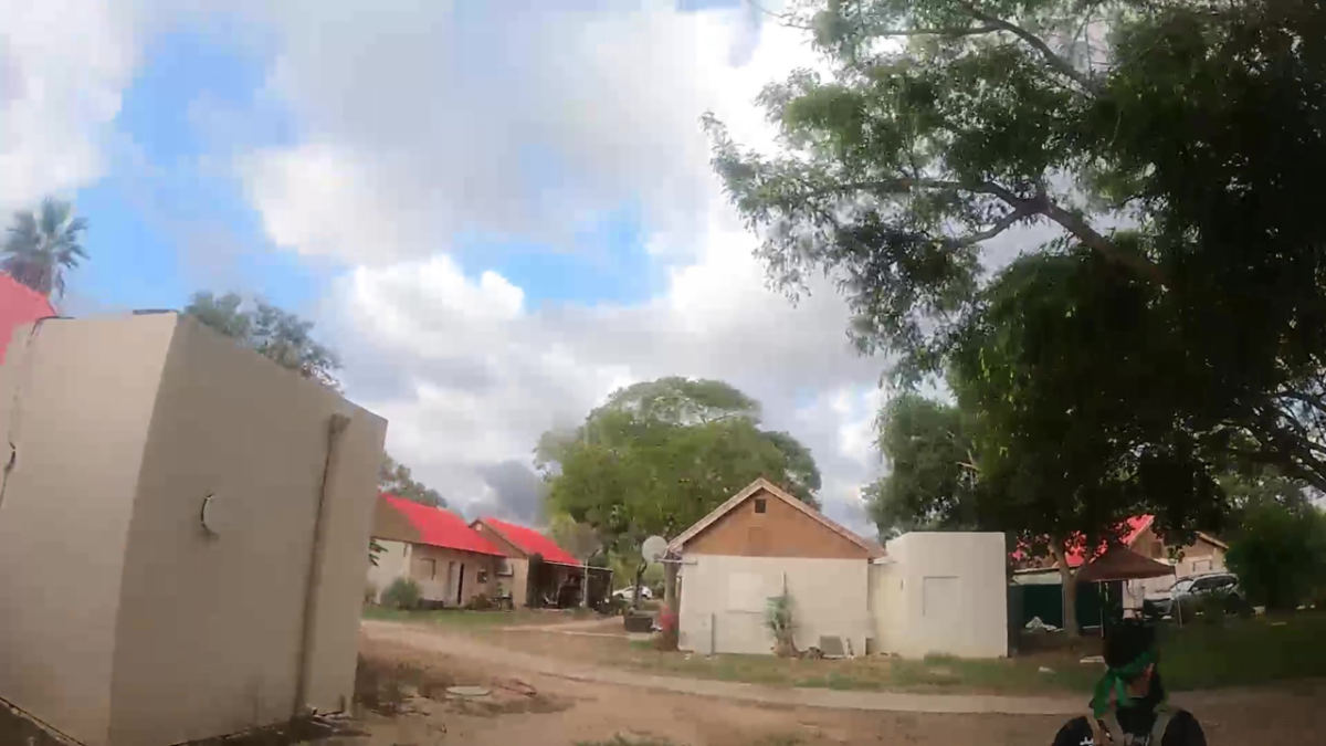
We see a militant jump over the yellow gate and hide behind the guard house, before walking into the kibbutz. We can see a sign with the name of the kibbutz in Hebrew (סופה).
Three other men enter the perimeter of the kibbutz and open the gate. As they enter, more gunshots can be heard. It is unclear who is shooting and where the shots are coming from.
At one point, a car approaches. The men open fire at it.
The next series of videos show the militants walking around the kibbutz. In the sixth video we see the person filming turn towards a house, which we geolocated but are not including the location here. He appears to spot a person inside the home and shoots into the house from the garden. In the audio it sounds like a wounded person inside the house cries out, but the militants appear to fire at least three more shots into the house.
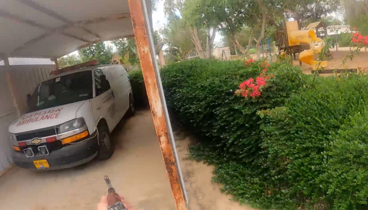
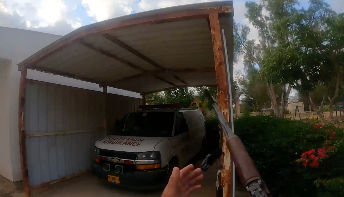
In video eight the militants spot an ambulance parked at (31.238632, 34.342698), shoot at its tyres and continue walking around the kibbutz. This video stops when the fighter is located at this location inside the kibbutz, approximately 450m from the gate (31.238658, 34.343007).
In video nine the militant shoots into another home and finally enters another residence, we geolocated both residences but are not including their location here. Once inside, they rummage through the belongings of the inhabitants and go from room to room. A mobile phone has been left on the kitchen table and is still ringing. A clock on the wall indicates it is 7:50 am local time. They fire one shot into the attic area.

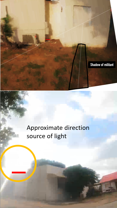
In the final video the militants walk outside again to an area we geolocated to 31.238266, 34.341226. A moment later the militant wearing the camera is shot and collapses at 31.238288, 34.340901. He appears to have been shot from the rear as he appears to have been caught off guard. The unknown shooter fires another four times before the sound in the area goes quiet.
According to our solar estimates, the militant was shot at some time between 8:00 and 8:30am. His shadow is visible on the ground as he falls. When the camera turns it also shows the approximate direction of the sun behind a house. We used these two reference points to estimate the time when he was shot.
On Wednesday, Human Rights Watch said it had verified four videos from the attacks in Israel- from the attacks on the Supernova music festival and Kibbutz Mefalsim. It said it is investigating these incidents, as well as others, as war crimes.
Bellingcat will continue to monitor the latest war in Israel-Palestine, including the IDF’s bombing of the Gaza Strip, with the aim of documenting civilian harm.
Youri van der Weide, Giancarlo Fiorella, Jake Godin, and Carlos Gonzales contributed research.
Bellingcat is a non-profit and the ability to carry out our work is dependent on the kind support of individual donors. If you would like to support our work, you can do so here. You can also subscribe to our Patreon channel here. Subscribe to our Newsletter and follow us on Twitter here and Mastodon here.