Solving World War II Photo Mysteries With Open Source Techniques
Open source investigative techniques can be used to uncover all sorts of interesting information about disinformation narratives, potential war crimes or even conspiracy communities. But these same practices can also be used to solve mysteries from the past.
For example, the ‘Finding the location WW1 & WW2’ Facebook group seeks to employ geolocation techniques to identify where unknown and undated images from the first and second World Wars were taken.
Recently, Bellingcat was able to uncover new information about a series of photos from the International Bomber Command Centre (IBCC) archives that were posted to this Facebook group. The techniques used to locate the photos are easily transferable to other scenarios.
What follows is a walk-through detailing exactly how we identified the images and solved the mystery of where they were taken.
One important note is that although Bellingcat located the following images independently, another member of the Finding the Location WW1 & WW2 Facebook group named Frank Schilder also did so before the IBCC pages were updated. He should therefore be duly credited for the geolocations as well.
For those interested, the IBCC Digital Archive contains more albums with mystery photos from the World War II era. Alongside the University of Lincoln in the UK, The IBCC Digital Archive focuses on the activities of the RAF Bomber Command during the 1939 to 1945 war period.
A Monarch and a Clue on eBay
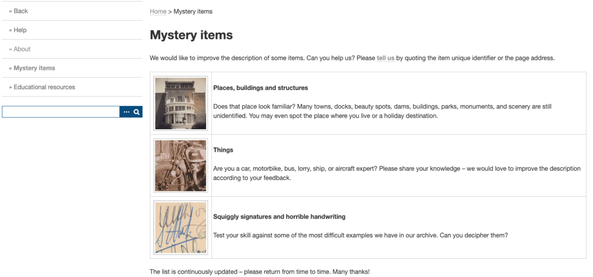
While browsing through the various IBCC collections, we applied the filter ‘pending identification, places’ to find the list of mystery items. You can also head to directly to mystery items page via this link.
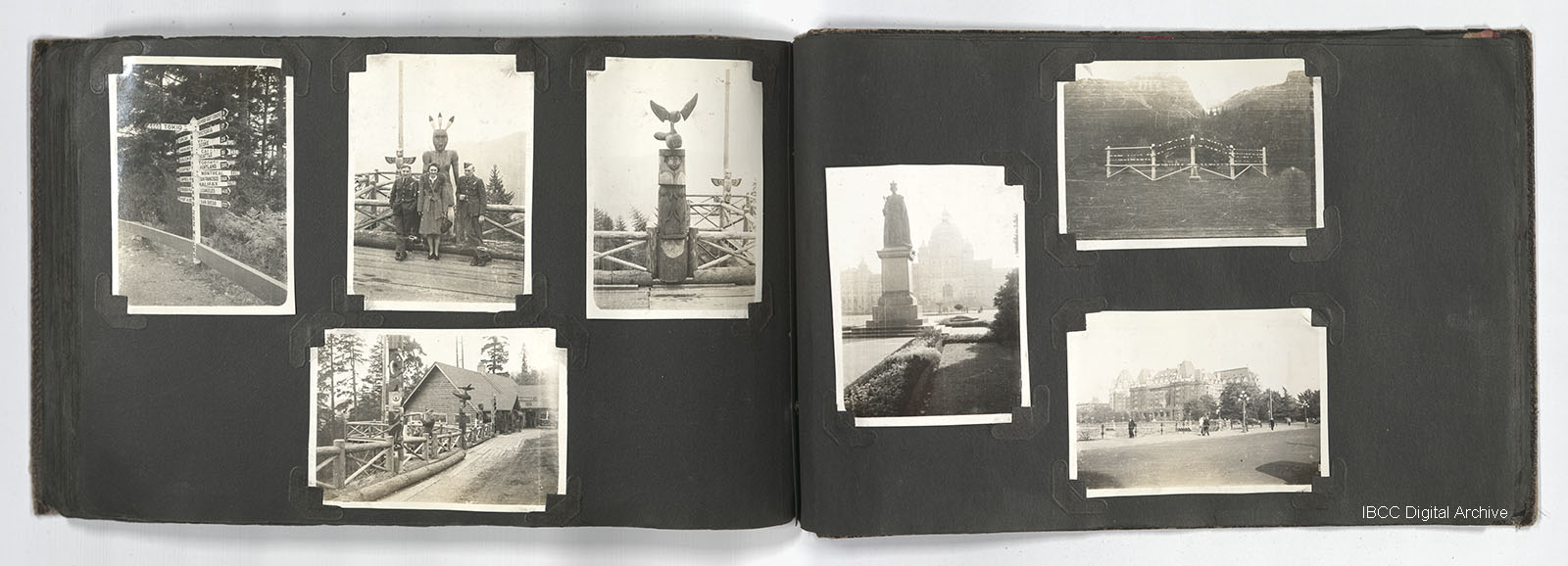
One of the albums we found was called ‘Urban scenes’ and showed several pictures, including one of a tall statue next to a hedge and some bushes in an urban setting (fourth photo from the left below).
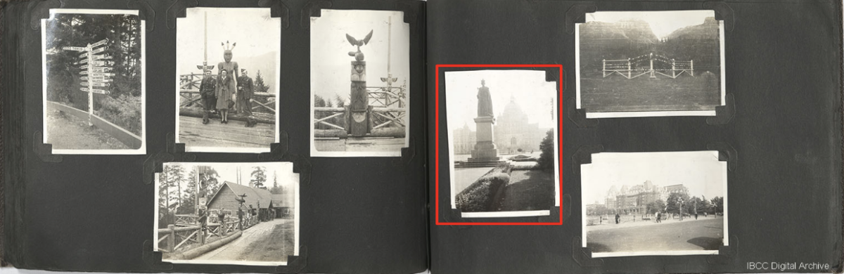
Here is an enlarged version of the image.
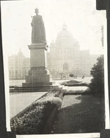
Upon closer inspection it appears to show a statue of a monarch, given a crown is visible on the head, with the outline of a building that has a dome in the background. A lawn and bush are visible in the foreground.
The first step in trying to find out where this image was taken involved undertaking a reverse image search, a simple technique that anyone with a computer and internet access can learn to do. Simply download the image in question or take a screenshot of it. After that, upload it on Google by going to Google.com and clicking the camera icon in the search area.
Google will perform a reverse image search on your picture using Google Lens, an image recognition technology it has developed.
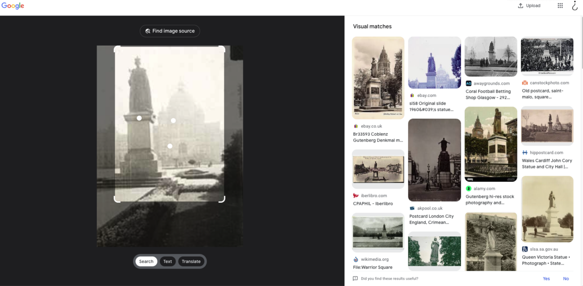
The results of a Google image search for a mystery picture from the IBCC Digital Archive.
As the results show, there are several statues suggested as potential matching candidates.
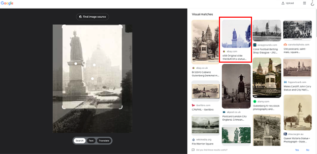
The second result sticks out because of the dome that can be seen in the background. The position the image has been taken from seems similar to our reference image. We can click on it to check it out.
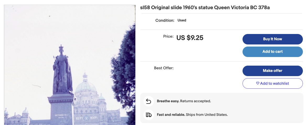
The result turns out to be a slide that somebody was selling on eBay. The item description is as follows: ‘Original slide 1960’s statue Queen Victoria BC 378a’. That gives us the next clue: the statue could very possibly be Queen Victoria.
But where is it?
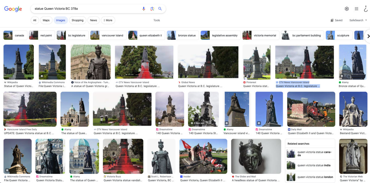
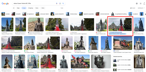
Using Google to search the text of the description “Statue Queen Victoria BC 378a” brings up a lot of results that show different statues of Queen Victoria (click on the image tab of Google search results to see all pictures). There are several results of a statue that was covered in paint, but most of them are close ups of the damage and do not include the background.
One of the results does show the background and a building where a dome can be seen as well, just like in the IBCC source image.
If you click on the image, it will show an expanded version of the picture. We can now see a news report about the statue.
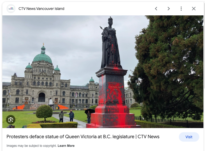
This report gives information about the location of the statue, which also shows that B.C stands for British Columbia, a province in western Canada. This small hint could have been picked up by people who are from Canada when looking at the eBay image, but which may have been missed by people from other parts of the world.
Let’s double check whether this indeed is the location of the image depicted in the IBCC archive.
We can use Google Maps and Google street view to help us.
If you search for ‘Queen Victoria, B.C legislature’ on Google Maps, you can see that there is indeed a Queen Victoria statue, right in front of the Legislative Assembly of British Columbia.
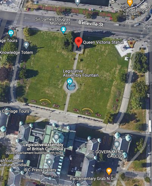
By switching to street view, we can get a ground level view from the street in front of the statue.
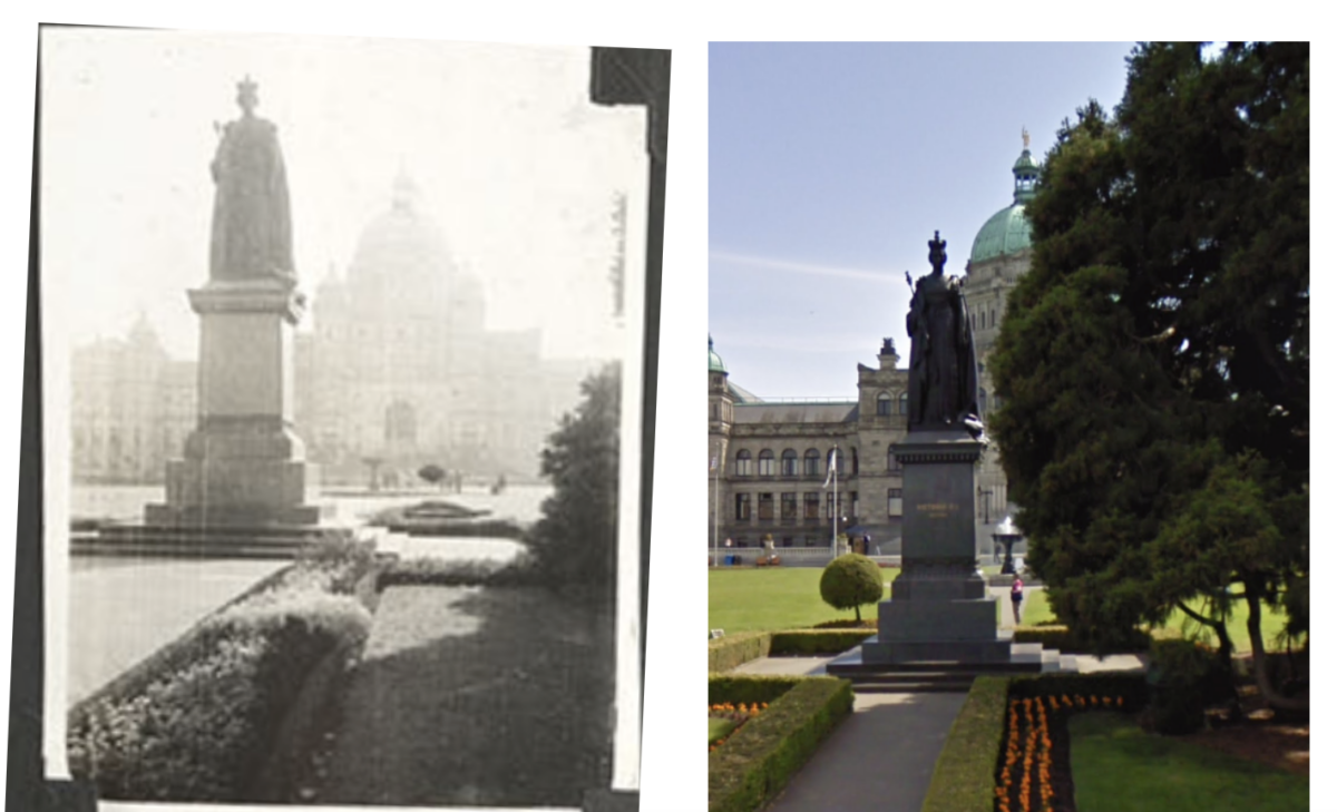
Because of the tree in the Street View image (right), it’s not possible to recreate the exact same perspective as our source picture. But through simple visual comparison we can verify that the statue we see is indeed Queen Victoria in front of the Legislative Assembly of British Columbia in the city of Victoria.
Mystery solved!
Using the exact same steps (reverse image search to uncover potential candidates, finding text that gives clues as to possible locations, then checking those locations on Google Maps), we were also able to identify several other pictures in the archive.
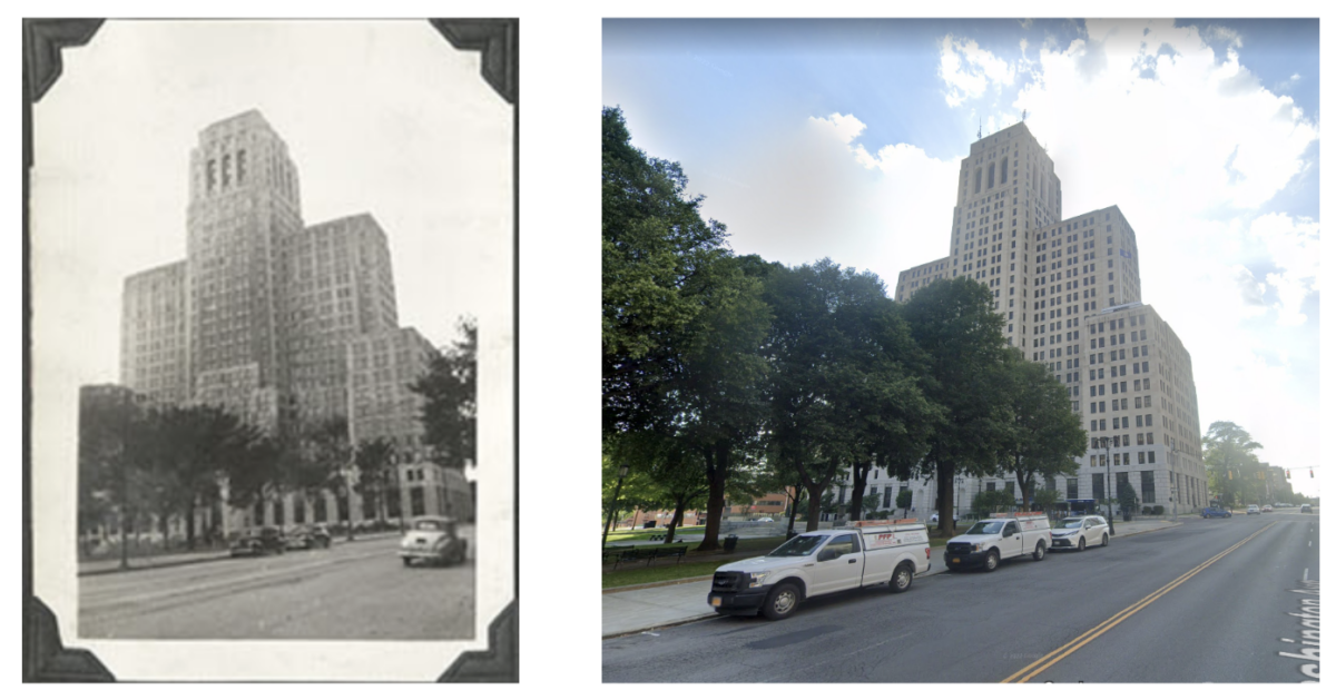
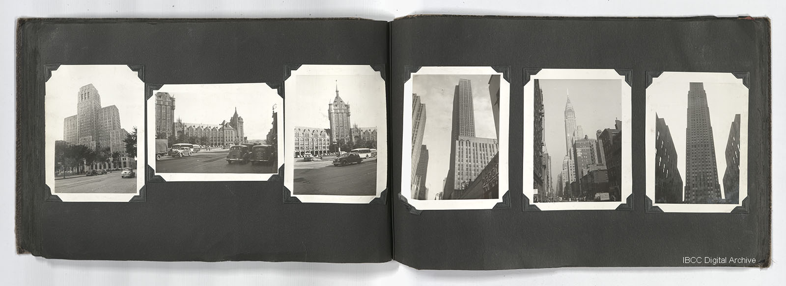
For example, the images below show the Alfred E. Smith Office building in Albany, New York, in the United States. The IBCC image (left) was included in another “Urban Scenes” album in the archive.
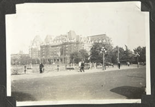
The below image was found to be the Fairmont Empress hotel in Victoria, British Columbia. For copyright reasons we have linked to this image taken from the Historic Hotels archive that shows the hotel from the same perspective.
Two Churches and a War Memorial
Another album in the IBCC archives called “Churches” showed several more pictures for which the location was not known. Unsurprisingly, the album depicted a lot of churches. But other, non-ecclesiastical images were included too.
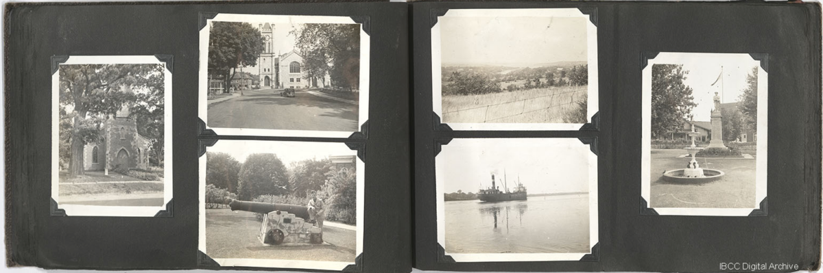
One of these pictures showed a statue in front of a flag pole and two buildings.
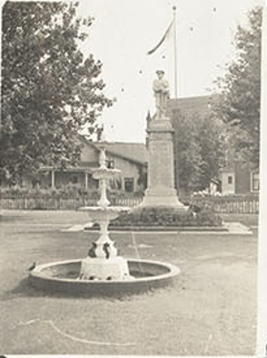
Although the first step of conducting a reverse image search (as we did for the first three images in the Urban Scenes album detailed above) was the same, there were a few other complicating factors to consider with this picture.
While Google Lens recognised that it was a statue, none of the results jumped out as being the one we were looking for.
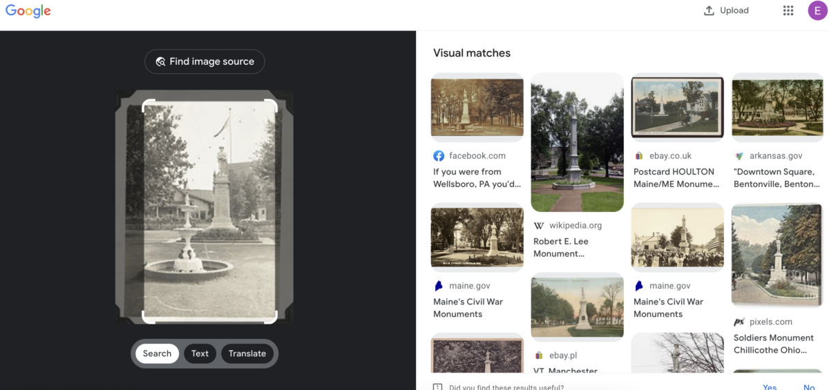
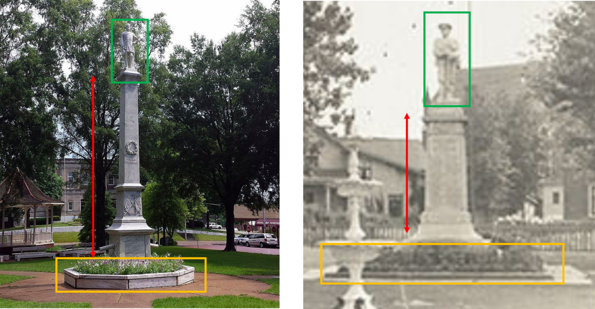
For example, the image on the left (below) depicted a statue and flower bed, just like our source image. But the base (yellow square), the shape and height of the plinth (red arrow) and the pose of the statue (green) did not match.
But scrolling through the results, there was one image that caught the eye. Even if a small part of the soldier is visible, the way he can be seen holding the rifle gives reason to have a closer look.
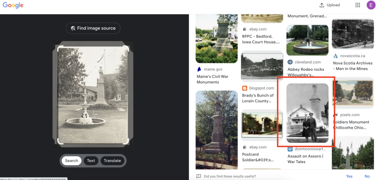
The website where this picture was posted, gives us a location of the memorial: Picton, Ontario, Canada.
We can again turn to Google Maps and Street View to check out the full memorial and see if it is indeed the same one as in our source material.
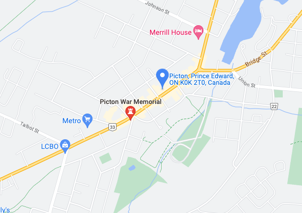
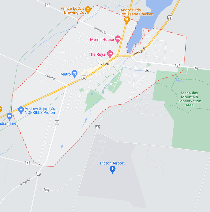
If we search for ‘Picton, Ontario, Canada’ in Google Maps it will lead you to the town, but not yet to the memorial. To widen our search, we can use the ‘nearby’ function that Google provides.
This option will give you an extra search option that you can use to search for businesses and landmarks near the destination entered into the search bar. The Picton War Memorial instantly jumps out.
Exploring this memorial on Google Street View shows that it is a strong candidate to be a match for our source image.
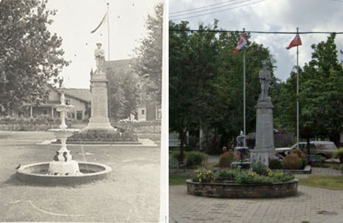
We can see that the fountain, position of the soldier as well as the detail of the statue and flower bed around it all match up.
However, a closer look shows that there is a small difference between the source material and the reference material.
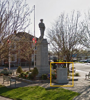
There is an extra memorial in front of the statue, but a quick Google search about the history of the memorial reveals an article on a website called ‘Traces of War’ that states the second memorial was added in 1950 for those who died in the Second World War.
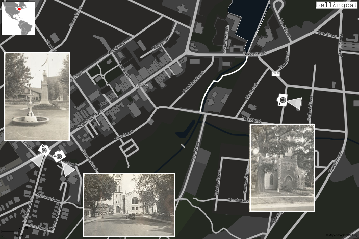
Confident we have identified the location of the IBCC source image we can now look at other images in the same album.
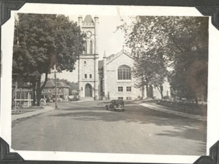
Another picture shows a church at the end of a quiet road. Because the previous picture was taken in Picton, we can make an educated guess that the church might also be in Picton.
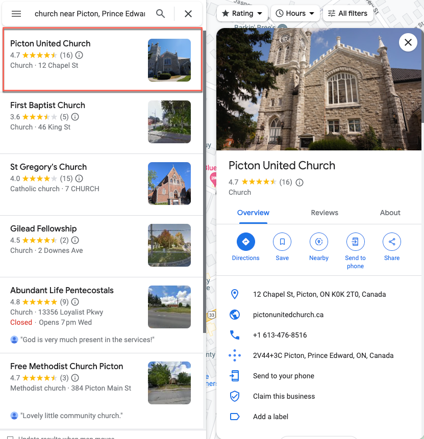
Using the ‘nearby’ function in Google again and typing in church to the search bar reveals that there are a several churches in Picton.
Because Google Maps provides you with small images (if available) of the locations on the left hand pane, you can do a quick scan for locations that look similar to the source material. Scrolling through the results shows what appears to be the same church as the one in our reference picture.
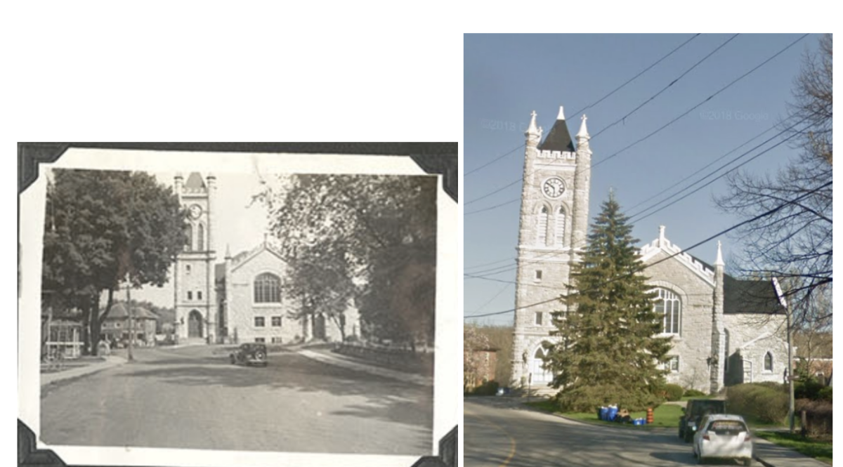
A look at Google Street View confirms that the church in the IBCC image is indeed the Picton United Church.
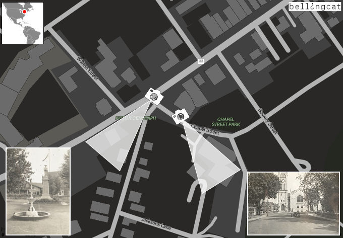
It turns out that the church is situated right around the corner from the war memorial.
Using this same tactic, another church in the album was also found in Picton.
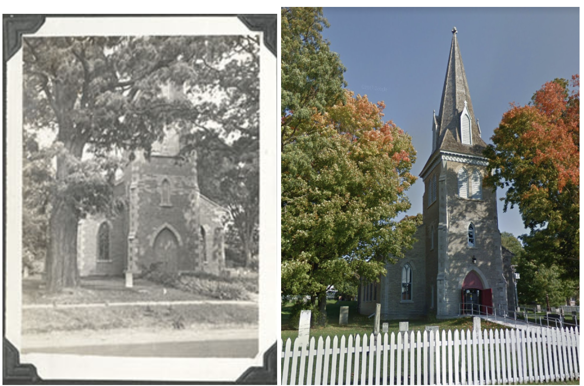
The site of the former Church of St Mary Magdalene (seen in the images above) is now part of Macaulay Heritage Park, according to a local tourism website. It is also situated a few streets away from the war memorial and Picton United Church.
Picton Airport
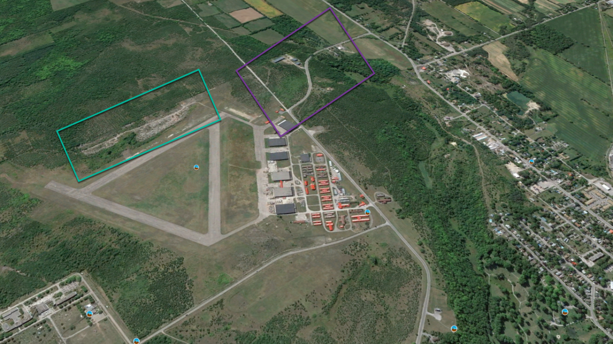
Sometimes finding the right location of an image can be a combination of common sense and luck.
Searching for the previous locations in Picton, we spent a fair amount of time on Google Maps analysing the town. While doing this, it was noticeable that there was a small airport close to the city.
When we went through the collection of aerial views in the IBCC archive, we saw an album for which there was no known location that even at a glance looked quite familiar.
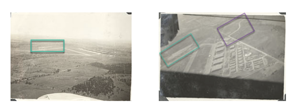
We compared some distinct features: the layout of the airport and the buildings, a road with a bend and a piece of land that seems to be filled with sand. As it turns out, we were able to use Google Maps to confirm that these images did indeed show the airport in Picton.
More Mystery Photos
As the identification and geolocation of these old war-time photos show, modern open source techniques can help answer questions and mysteries from the past.
However, this would not be possible without the efforts of the many people who digitise these old, analogue sources. In this way these memories, many of which would otherwise be forgotten, can continue to tell their stories.
There are still many more images in the IBCC archives whose dates and locations are unknown. They can be found here.
The ‘Finding the location WW1 & WW2’ group on Facebook, meanwhile includes many more unsolved mysteries that investigators or enthusiasts can help uncover. It can be found here.
If this article made you interested in doing open source research and you would like to get more information or help, please join our Discord server here!
Bellingcat is a non-profit and the ability to carry out our work is dependent on the kind support of individual donors. If you would like to support our work, you can do so here. You can also subscribe to our Patreon channel here. Subscribe to our Newsletter and follow us on Twitter here and Mastodon here.